File:2.Садиба Ахматової.jpg
Jump to navigation
Jump to search
Size of this preview: 391 × 599 pixels. Other resolutions: 157 × 240 pixels | 493 × 755 pixels.
Original file (493 × 755 pixels, file size: 320 KB, MIME type: image/jpeg)
Captions
Captions
Add a one-line explanation of what this file represents
Summary
[edit]
| Description |
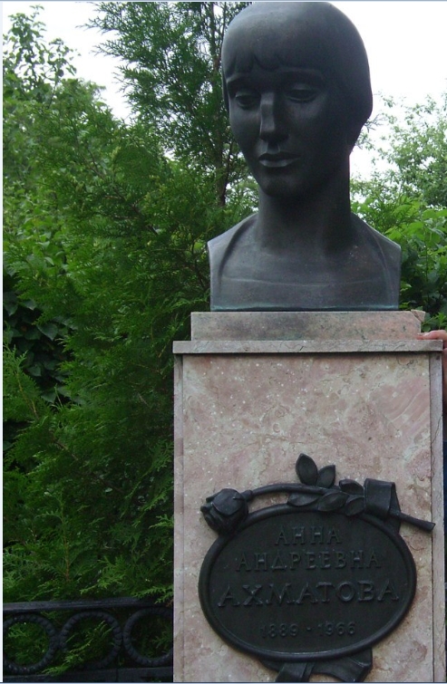
Українська: Шелехівський, Деражнянський район, с. Слобідка-Шелехівська, Музей Анни Ахматової
|
||
| Date | |||
| Source | Own work | ||
| Author | Руденко Володимир Володимирович |
| Camera location | | View this and other nearby images on: OpenStreetMap |
|---|
Licensing
[edit]
I, the copyright holder of this work, hereby publish it under the following license:
This file is licensed under the Creative Commons Attribution-Share Alike 4.0 International license.
- You are free:
- to share – to copy, distribute and transmit the work
- to remix – to adapt the work
- Under the following conditions:
- attribution – You must give appropriate credit, provide a link to the license, and indicate if changes were made. You may do so in any reasonable manner, but not in any way that suggests the licensor endorses you or your use.
- share alike – If you remix, transform, or build upon the material, you must distribute your contributions under the same or compatible license as the original.
This image was uploaded as part of Wiki Loves Earth 2020.
|
 |
File history
Click on a date/time to view the file as it appeared at that time.
| Date/Time | Thumbnail | Dimensions | User | Comment | |
|---|---|---|---|---|---|
| current | 13:47, 12 July 2020 | | 493 × 755 (320 KB) | Руденко Володимир Володимирович (talk | contribs) | Uploaded own work with UploadWizard |
You cannot overwrite this file.
File usage on Commons
The following 2 pages use this file:
File usage on other wikis
The following other wikis use this file:
- Usage on uk.wikipedia.org