File:1 Ólafsvík aerial pano 2017.jpg
Jump to navigation
Jump to search

Size of this preview: 800 × 307 pixels. Other resolutions: 320 × 123 pixels | 640 × 245 pixels | 1,024 × 392 pixels | 1,280 × 491 pixels | 2,560 × 981 pixels | 10,786 × 4,134 pixels.
Original file (10,786 × 4,134 pixels, file size: 26.4 MB, MIME type: image/jpeg)
Captions
Captions
Add a one-line explanation of what this file represents
Summary
[edit]
| Description |
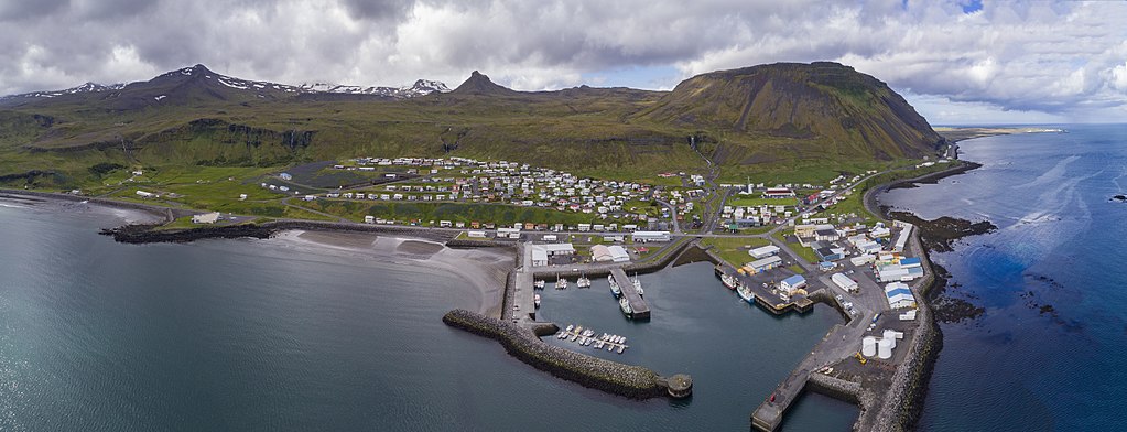
English: aerial panorama Ólafsvík iceland 2017 |
| Date | |
| Source | Own work |
| Author | Chensiyuan |
| Camera location | | View this and other nearby images on: OpenStreetMap |
|---|
Licensing
[edit]
I, the copyright holder of this work, hereby publish it under the following license:
This file is licensed under the Creative Commons Attribution-Share Alike 4.0 International license.
- You are free:
- to share – to copy, distribute and transmit the work
- to remix – to adapt the work
- Under the following conditions:
- attribution – You must give appropriate credit, provide a link to the license, and indicate if changes were made. You may do so in any reasonable manner, but not in any way that suggests the licensor endorses you or your use.
- share alike – If you remix, transform, or build upon the material, you must distribute your contributions under the same or compatible license as the original.
File history
Click on a date/time to view the file as it appeared at that time.
| Date/Time | Thumbnail | Dimensions | User | Comment | |
|---|---|---|---|---|---|
| current | 15:59, 23 September 2017 | 10,786 × 4,134 (26.4 MB) | Chensiyuan (talk | contribs) | User created page with UploadWizard |
You cannot overwrite this file.
File usage on Commons
The following 2 pages use this file:
File usage on other wikis
The following other wikis use this file:
- Usage on be.wikipedia.org
- Usage on ceb.wikipedia.org
- Usage on cs.wikipedia.org
- Usage on da.wikipedia.org
- Usage on de.wikivoyage.org
- Usage on en.wikipedia.org
- Usage on es.wikipedia.org
- Usage on eu.wikipedia.org
- Usage on gl.wikipedia.org
- Usage on is.wikipedia.org
- Usage on it.wikivoyage.org
- Usage on mdf.wikipedia.org
- Usage on mk.wikipedia.org
- Usage on nl.wikipedia.org
- Usage on os.wikipedia.org
- Usage on pt.wikipedia.org
- Usage on ru.wikipedia.org
- Usage on sv.wikipedia.org
- Usage on vo.wikipedia.org
- Usage on www.wikidata.org
- Usage on zh.wikipedia.org
Metadata
Categories:
- Ólafsvík
- Aerial photographs of Iceland
- Ólafsvík harbour
- Snæfellsjökull (volcanic system)
- Ólafsvíkurenni
- Aerial photographs of coasts of Snæfellsnes
- Ólafsvík in 2017
- Snæfellsjökull (volcanic system) in 2017
- Aerial photographs of cities and towns in Iceland
- Hrói
- Rjúpnaborgir
- Hrafnabjörg (Ólafsvík)
- Bæjarfoss (Ólafsvík)
- Snæfellsnes Volcanic Belt in 2017