File:19560314 Fukuhama S31 USA-M341-2-143 20220623.jpg
Jump to navigation
Jump to search
Size of this preview: 631 × 600 pixels. Other resolutions: 253 × 240 pixels | 505 × 480 pixels | 808 × 768 pixels | 1,078 × 1,024 pixels | 2,169 × 2,061 pixels.
Original file (2,169 × 2,061 pixels, file size: 1.19 MB, MIME type: image/jpeg)
Captions
Captions
Add a one-line explanation of what this file represents
Summary
[edit]
| Description |
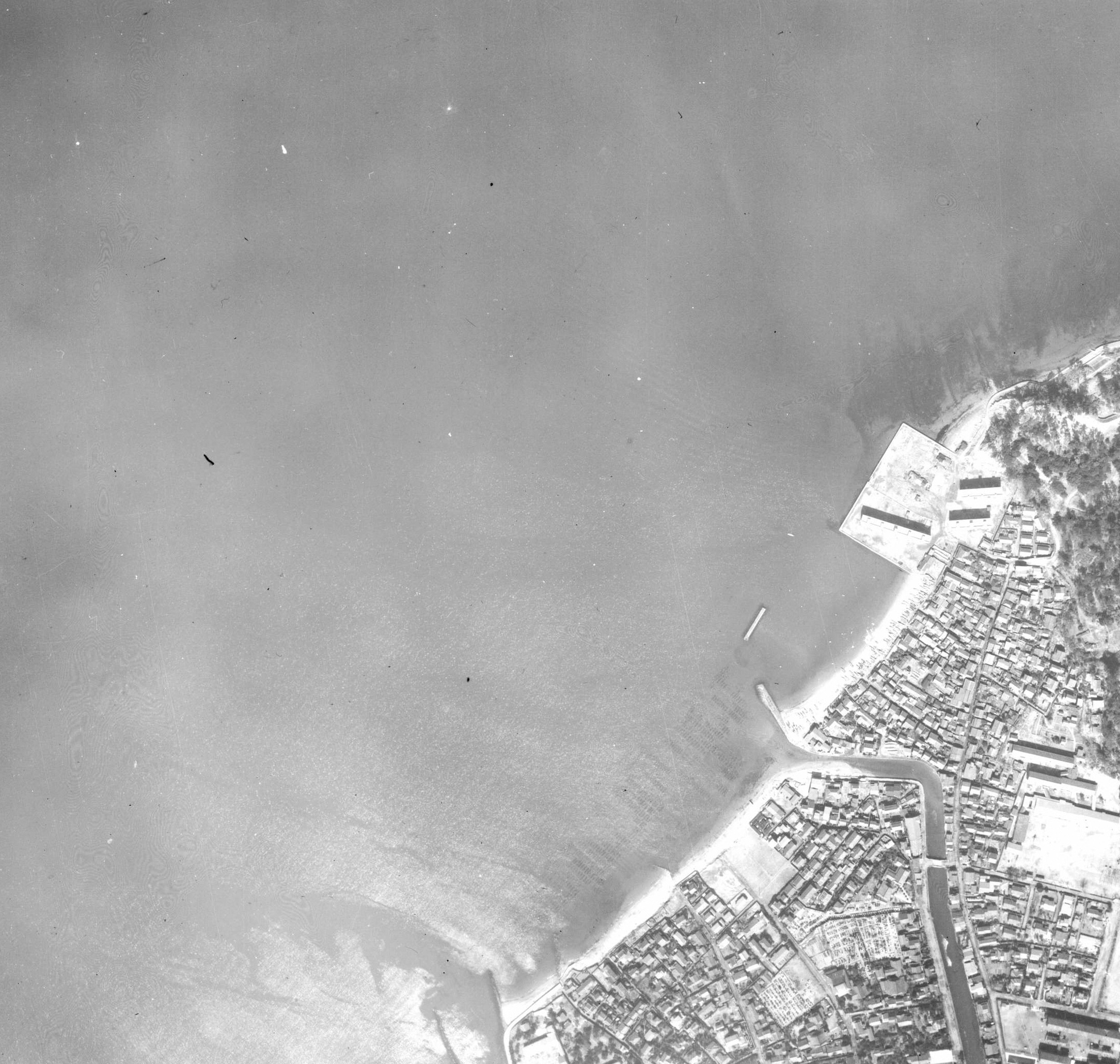
日本語: 1956年3月14日撮影の福浜地区(伊崎地先沖)の航空写真、国土地理院地図・空中写真閲覧サービス( https://mapps.gsi.go.jp/ )のUSA-M341-2-143を加工して作成 |
| Date | |
| Source | 国土地理院地図・空中写真閲覧サービス( https://mapps.gsi.go.jp/ )のUSA-M341-2-143を加工して作成 |
| Author | 国土交通省国土地理院 |
写真撮影当時は、福浜の埋立が行われる前で、黒門川が伊崎と唐人町との間より博多港(博多湾)に流れている。
Licensing
[edit]

|
The copyright holder of this file, the Ministry of Land, Infrastructure, Transport and Tourism of Japan, allows anyone to use it for any purpose, provided that the copyright holder is properly attributed. Redistribution, derivative work, commercial use, and all other use is permitted. |
Attribution:
Copyright © National Land Image Information (Color Aerial Photographs), Ministry of Land, Infrastructure, Transport and Tourism
|
 |
This image is copyrighted by the Ministry of Land, Infrastructure, Transport and Tourism of Japan. For terms of use, see the stipulation to use of National Land Information (in Japanese) and message from MLIT (in Japanese and English). When you display this image on an article, include the following phrase in the description: "Made based on National Land Image Information (Color Aerial Photographs), Ministry of Land, Infrastructure, Transport and Tourism".
|
国土地理院コンテンツ利用規約https://www.gsi.go.jp/kikakuchousei/kikakuchousei40182.html
File history
Click on a date/time to view the file as it appeared at that time.
| Date/Time | Thumbnail | Dimensions | User | Comment | |
|---|---|---|---|---|---|
| current | 06:26, 24 June 2022 | | 2,169 × 2,061 (1.19 MB) | Hirho (talk | contribs) | Uploaded a work by 国土交通省国土地理院 from 国土地理院地図・空中写真閲覧サービス(https://mapps.gsi.go.jp/)のUSA-M341-2-143を加工して作成 with UploadWizard |
You cannot overwrite this file.
File usage on Commons
There are no pages that use this file.