File:1927 Boston Elevated Railway system map.png
Jump to navigation
Jump to search
Size of this preview: 424 × 600 pixels. Other resolutions: 169 × 240 pixels | 339 × 480 pixels | 543 × 768 pixels | 724 × 1,024 pixels | 2,474 × 3,500 pixels.
Original file (2,474 × 3,500 pixels, file size: 12.54 MB, MIME type: image/png)
Captions
Captions
Add a one-line explanation of what this file represents
Summary
[edit]| Description |
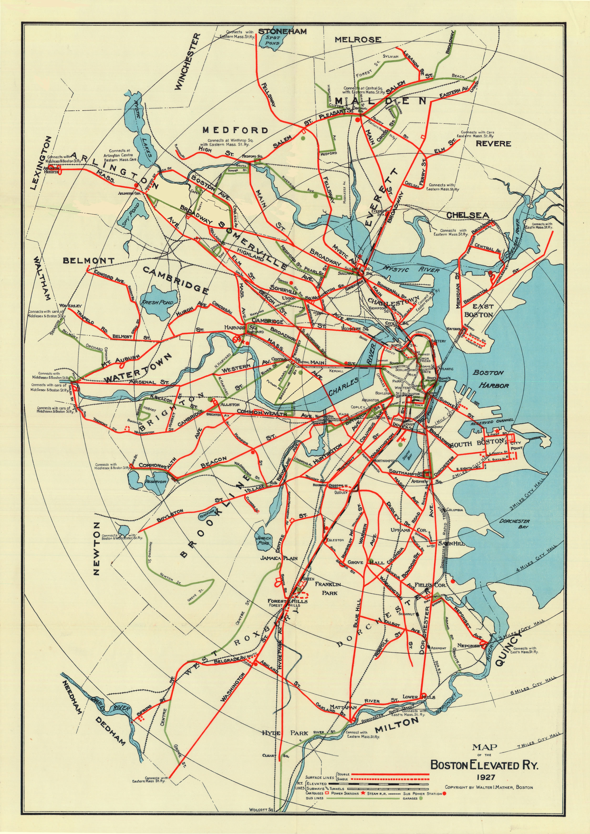
English: 1927 map of the Boston Elevated Railway |
|||
| Date | ||||
| Source | https://web.archive.org/web/20190607222409/http://www.wardmaps.com/viewasset.php?aid=22957 | |||
| Author | Walter Mather (restoration by Leo Sullivan) | |||
| Permission (Reusing this file) |
|

File history
Click on a date/time to view the file as it appeared at that time.
| Date/Time | Thumbnail | Dimensions | User | Comment | |
|---|---|---|---|---|---|
| current | 21:58, 7 June 2019 | | 2,474 × 3,500 (12.54 MB) | Pi.1415926535 (talk | contribs) | == {{int:filedesc}} == {{Information |Description ={{en|1=1927 map of the Boston Elevated Railway}} |Source =[https://www.wardmaps.com/viewasset.php?aid=22957 Ward Maps] |Author =Walter Mather (restoration by Leo Sullivan) |Date =1927 |Permission ={{PD-scan|PD-US-not renewed}} |other_versions = }} Category:1927 maps of the United States 1927 1927 [[Category:Other images uplo... |
You cannot overwrite this file.
File usage on Commons
The following 4 pages use this file: