File:1918-1939 circa Open GeoData Plan der Hauptstadt Hannover 1 zu 1000 (Historisch) Kachel nw 101b Angerstraße Sodenstraße Perlstraße Hallerstraße.jpg
Jump to navigation
Jump to search

Size of this preview: 800 × 526 pixels. Other resolutions: 320 × 210 pixels | 640 × 421 pixels | 1,024 × 673 pixels | 1,280 × 841 pixels | 1,940 × 1,275 pixels.
Original file (1,940 × 1,275 pixels, file size: 1,015 KB, MIME type: image/jpeg)
Captions
Captions
Add a one-line explanation of what this file represents
Summary
[edit]_Kachel_nw_101b_Angerstra%C3%9Fe_Sodenstra%C3%9Fe_Perlstra%C3%9Fe_Hallerstra%C3%9Fe.jpg&action=edit§ion=1)
| Description |
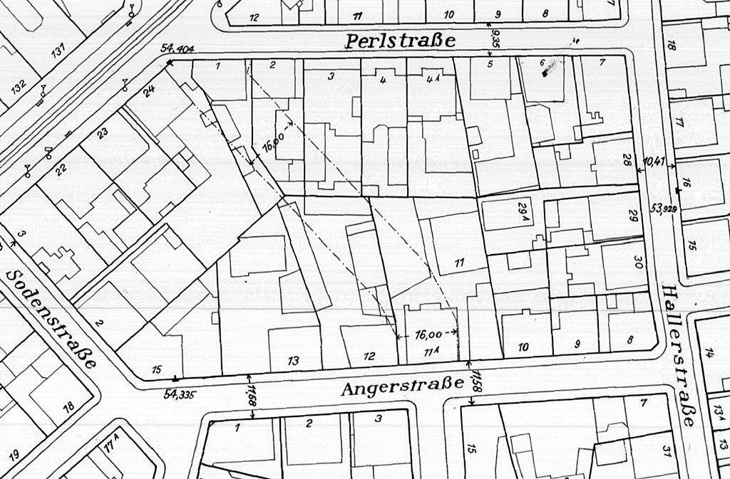
Deutsch: Ausschnitt aus dem vom Stadtbauamt Hannover 1934 zuletzt überarbeiteten Stadtplan mit den ehemaligen Gebäuden der Greiserwerke im Quarree Angerstraße, Sodenstraße, Perlstraße und Hallerstraße |
| Date | |
| Source |
Herausgeber: Landeshauptstadt Hannover, FB Planen und Stadtentwicklung, Bereich Geoinformation; Open GeoData; Plan der Hauptstadt Hannover 1:1000 (Historisch): https://www.hannover.de/Leben-in-der-Region-Hannover/Verwaltungen-Kommunen/Die-Verwaltung-der-Landeshauptstadt-Hannover/Dezernate-und-Fachbereiche-der-LHH/Stadtentwicklung-und-Bauen/Fachbereich-Planen-und-Stadtentwicklung/Geoinformation/Open-GeoData/Digitale-Stadtkarten/Plan-der-Hauptstadt-Hannover-1-1000-Historisch |
| Author | Stadtbauamt Hannover, Abteilung II |
Licensing
[edit]_Kachel_nw_101b_Angerstra%C3%9Fe_Sodenstra%C3%9Fe_Perlstra%C3%9Fe_Hallerstra%C3%9Fe.jpg&action=edit§ion=2)
This file is licensed under the Creative Commons Attribution 4.0 International license.
- You are free:
- to share – to copy, distribute and transmit the work
- to remix – to adapt the work
- Under the following conditions:
- attribution – You must give appropriate credit, provide a link to the license, and indicate if changes were made. You may do so in any reasonable manner, but not in any way that suggests the licensor endorses you or your use.
File history
Click on a date/time to view the file as it appeared at that time.
| Date/Time | Thumbnail | Dimensions | User | Comment | |
|---|---|---|---|---|---|
| current | 11:45, 19 November 2021 | | 1,940 × 1,275 (1,015 KB) | Bernd Schwabe in Hannover (talk | contribs) | Uploaded a work by Stadtbauamt Hannover, Abteilung II from Herausgeber: Landeshauptstadt Hannover, FB Planen und Stadtentwicklung, Bereich Geoinformation; Open GeoData; Plan der Hauptstadt Hannover 1:1000 (Historisch): https://www.hannover.de/Leben-in-der-Region-Hannover/Verwaltungen-Kommunen/Die-Verwaltung-der-Landeshauptstadt-Hannover/Dezernate-und-Fachbereiche-der-LHH/Stadtentwicklung-und-Bauen/Fachbereich-Planen-und-Stadtentwicklung/Geoinformation/Open-GeoData/Digitale-Stadtkarten/Plan-d... |
You cannot overwrite this file.
File usage on Commons
The following page uses this file:
_Kachel_Nw_101b.jpg)
File usage on other wikis
The following other wikis use this file:
- Usage on de.wikipedia.org
_Kachel_nw_101b_Angerstraße_Sodenstraße_Perlstraße_Hallerstraße.jpg&oldid=746644254)