File:1912 Presidential Election County Results Map.png
Jump to navigation
Jump to search
Size of this preview: 800 × 520 pixels. Other resolutions: 320 × 208 pixels | 640 × 416 pixels | 1,024 × 665 pixels | 1,513 × 983 pixels.
Original file (1,513 × 983 pixels, file size: 202 KB, MIME type: image/png)
Captions
Captions
Add a one-line explanation of what this file represents
Summary
[edit]
| Description |
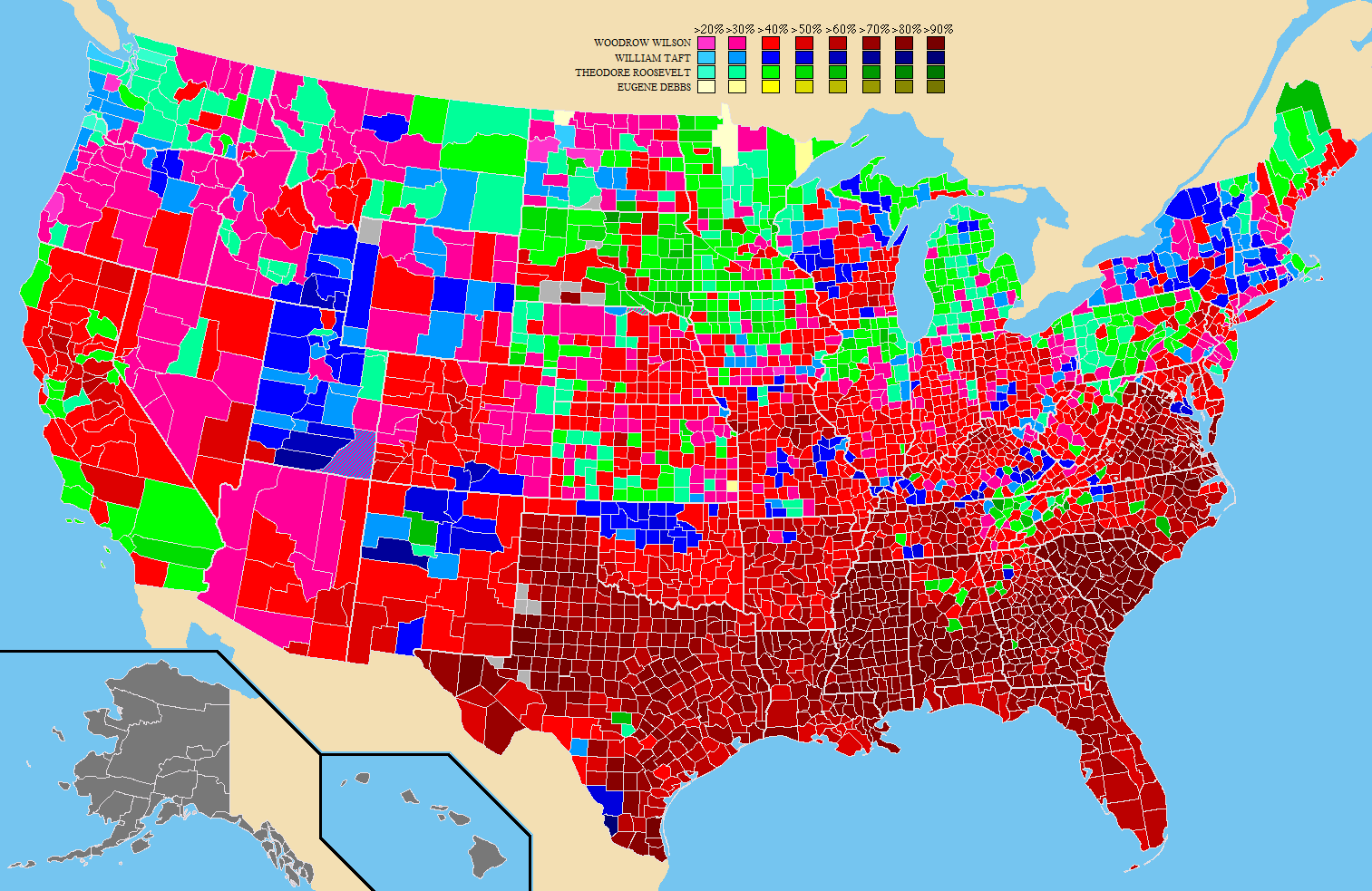
English: Map showing the results by county of the 1912 United States presidential election specifically identifying the percentage received by the winning candidate in each county. Counties with no information are in grey. |
| Date | |
| Source | Own work by uploader; data, coloring, and inspiration from http://uselectionatlas.org |
| Author | Rarohla |
Licensing
[edit]
| I, the copyright holder of this work, release this work into the public domain. This applies worldwide. In some countries this may not be legally possible; if so: I grant anyone the right to use this work for any purpose, without any conditions, unless such conditions are required by law. |
File history
Click on a date/time to view the file as it appeared at that time.
| Date/Time | Thumbnail | Dimensions | User | Comment | |
|---|---|---|---|---|---|
| current | 22:07, 12 October 2011 | | 1,513 × 983 (202 KB) | Magog the Ogre (talk | contribs) | Reverted to version as of 20:06, 27 April 2009 - newer version now at File:1912prescountymap.PNG |
| 14:09, 24 August 2011 |  | 800 × 520 (500 KB) | Rafael Kenneth (talk | contribs) | Inversão de cores de acordo com partidos; ajustes.http://en.wikipedia.org/wiki/File:1912prescountymap.PNG | |
| 20:06, 27 April 2009 |  | 1,513 × 983 (202 KB) | Rarohla~commonswiki (talk | contribs) | {{Information |Description={{en|1=Map showing the results by county of the 1924 United States presidential election specifically identifying the percentage recieved by the winning candidate in each county. Counties with no information are in grey.}} |Sour |
You cannot overwrite this file.
File usage on Commons
There are no pages that use this file.