File:1911 circa Stadtplan Hannover, Geographische Anstalt von Wagner & Debes, Leipzig, 02 Innere Stadt.jpg
Jump to navigation
Jump to search
Size of this preview: 406 × 600 pixels. Other resolutions: 162 × 240 pixels | 325 × 480 pixels | 520 × 768 pixels | 693 × 1,024 pixels | 1,386 × 2,048 pixels | 2,590 × 3,827 pixels.
Original file (2,590 × 3,827 pixels, file size: 15.36 MB, MIME type: image/jpeg)
Captions
Captions
Add a one-line explanation of what this file represents
Summary
[edit]
| Description |
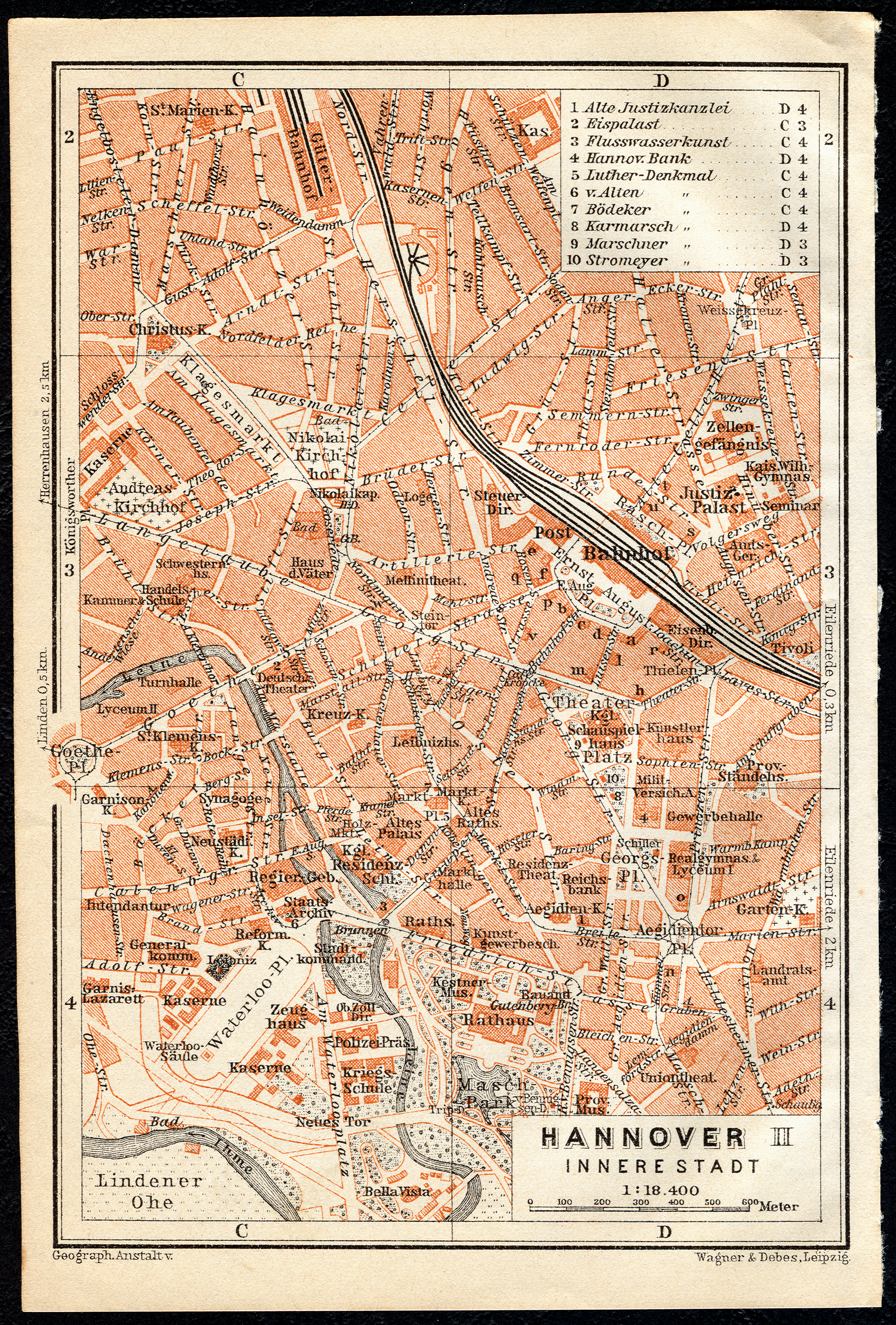
Deutsch: Stadtplan Hannover der Geographischen Anstalt von Wagner & Debes, Leipzig, um 1911, "Innere Stadt" mit seinerzeit aktuellen Sehenswürdigkeiten und mit Buchstaben markierten Hotels insbesondere im Bereich rund um den Ernst-August-Platz ... |
| Date | circa 1911 |
| Source | Scan vom Original: Bernd Schwabe in Hannover |
| Author | Wagner & Debes |
Licensing
[edit]
|
This work is in the public domain in its country of origin and other countries and areas where the copyright term is the author's life plus 70 years or fewer. | |
| This file has been identified as being free of known restrictions under copyright law, including all related and neighboring rights. | |
File history
Click on a date/time to view the file as it appeared at that time.
| Date/Time | Thumbnail | Dimensions | User | Comment | |
|---|---|---|---|---|---|
| current | 21:08, 8 April 2014 | | 2,590 × 3,827 (15.36 MB) | Bernd Schwabe in Hannover (talk | contribs) |
You cannot overwrite this file.
File usage on Commons
There are no pages that use this file.