File:1910 BERy system map (2).png
Jump to navigation
Jump to search
Size of this preview: 466 × 599 pixels. Other resolutions: 187 × 240 pixels | 373 × 480 pixels | 597 × 768 pixels | 796 × 1,024 pixels | 1,593 × 2,048 pixels | 2,722 × 3,500 pixels.
Original file (2,722 × 3,500 pixels, file size: 7.3 MB, MIME type: image/png)
Captions
Captions
Add a one-line explanation of what this file represents
Summary
[edit]| Description |
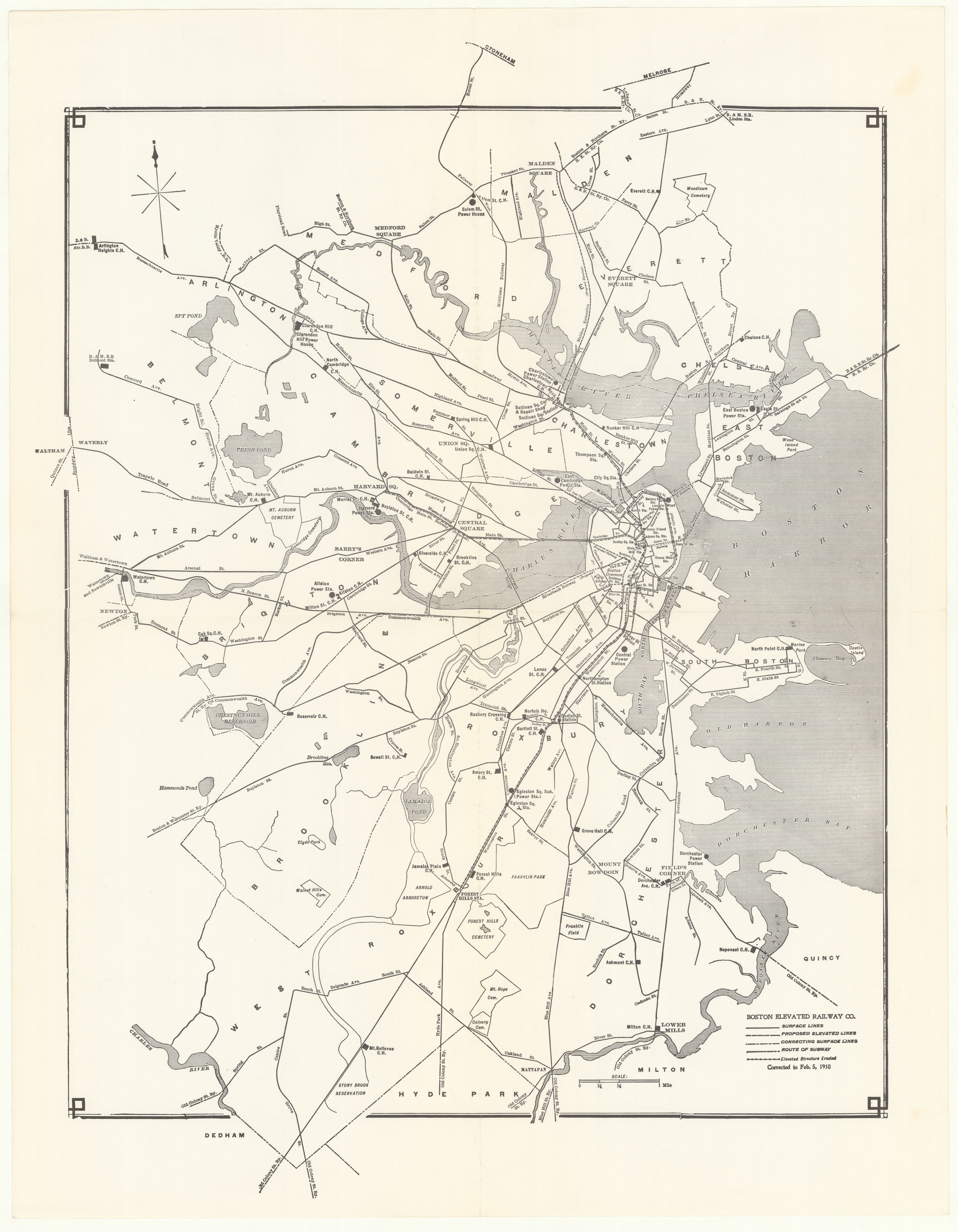
English: 1910 map of the Boston Elevated Railway system |
|||
| Date | ||||
| Source | Ward Maps | |||
| Author | Unknown author | |||
| Permission (Reusing this file) |
|

.png&action=edit§ion=1)
File history
Click on a date/time to view the file as it appeared at that time.
| Date/Time | Thumbnail | Dimensions | User | Comment | |
|---|---|---|---|---|---|
| current | 01:06, 12 June 2020 | | 2,722 × 3,500 (7.3 MB) | Pi.1415926535 (talk | contribs) | {{Information |description ={{en|1=1910 map of the Boston Elevated Railway system}} |date =1910-02-05 |source =[https://www.wardmaps.com/viewasset.php?aid=15866 Ward Maps]<!--only appears as a random map; downloaded using https://ophir.alwaysdata.net/dezoomify/dezoomify.html#https://www.wardmaps.com/viewmaps/transit/boston/bery-system-19100205//ImageProperties.xml--> |author ={{unknown|author}} |permission ={{PD-scan|PD-US-expired}} }} [[Category:1910 maps of Mass... |
You cannot overwrite this file.
File usage on Commons
The following 3 pages use this file:
.png&oldid=746546659)