File:1906FerndaleEarthquake-MainStreetToNorth.jpg
Jump to navigation
Jump to search
Size of this preview: 800 × 573 pixels. Other resolutions: 320 × 229 pixels | 640 × 459 pixels | 1,024 × 734 pixels | 1,280 × 917 pixels | 2,560 × 1,835 pixels | 3,222 × 2,309 pixels.
Original file (3,222 × 2,309 pixels, file size: 2.82 MB, MIME type: image/jpeg)
Captions
Captions
Add a one-line explanation of what this file represents
| Description |
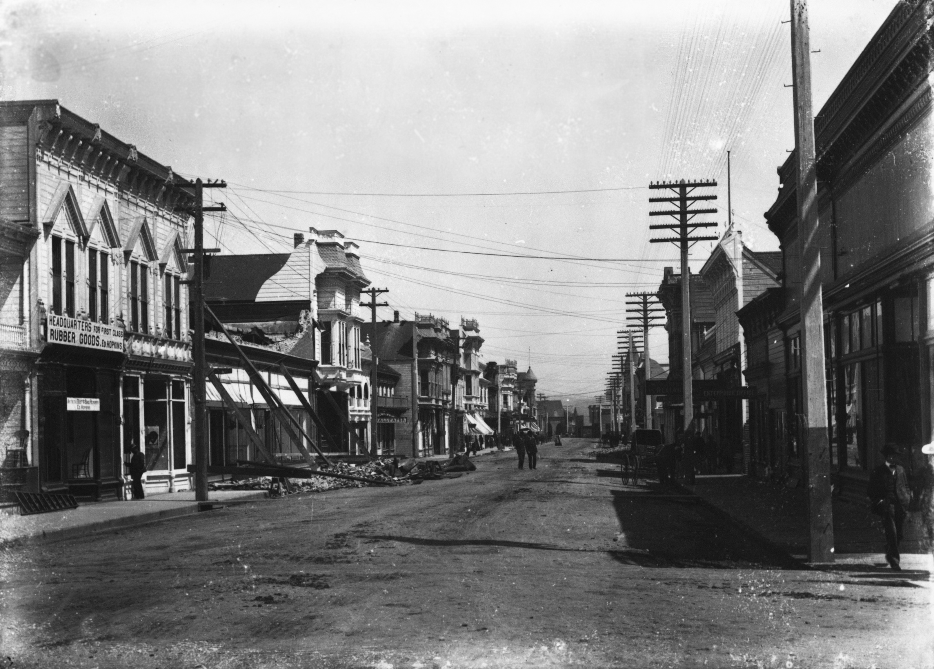
English: Black and white photograph taken shortly after the April 18, 1906 earthquake which devastated San Francisco and many other communities in Northern California. This view is looking north along Ferndale, California's Main Street. In this 1906 image notice the fallen front of the brand new brick Russ & Early Store (339 Main) as well as the Gilt Edge Hotel between the current day Candystick Gallery (361 Main) and the building with the clock in front (385-389 Main). The Gilt Edge Hotel had to be demolished due to damages sustained in this earthquake, the resultant empty lot has served for parking and the location of the theater in the movie The Majestic. Ferndale buildings suffered major damages in this earthquake, but had no fires. See File:Ferndale CA Main Street to North.jpg for modern view of same intersection. |
|||||||||||||||||||||||
| Date | ||||||||||||||||||||||||
| Source | Humboldt State University collection | |||||||||||||||||||||||
| Author |
|
|||||||||||||||||||||||
| Permission (Reusing this file) |
|
|||||||||||||||||||||||
.jpg)


| Object location | | View this and other nearby images on: OpenStreetMap |
|---|
File history
Click on a date/time to view the file as it appeared at that time.
| Date/Time | Thumbnail | Dimensions | User | Comment | |
|---|---|---|---|---|---|
| current | 02:31, 3 October 2014 | | 3,222 × 2,309 (2.82 MB) | Ellin Beltz (talk | contribs) | I uploaded one that was too bleached out and still had a "hypo-stain" in upper corner, both of which are fixed in this version. |
| 02:24, 3 October 2014 |  | 3,222 × 2,309 (2.56 MB) | Ellin Beltz (talk | contribs) | {{Information |Description ={{en|1={{en|Black and white photograph taken shortly after the April 18, 1906 earthquake which devastated San Francisco and many other communities in Northern California looking north along {{w|Ferndale, California}}'s Ma... |
You cannot overwrite this file.
File usage on Commons
There are no pages that use this file.
File usage on other wikis
The following other wikis use this file:
- Usage on fr.wikibooks.org