File:19-35-135-echota.jpg

Original file (4,204 × 2,836 pixels, file size: 1.93 MB, MIME type: image/jpeg)
Captions
Captions
Summary
[edit]
| Description |
English:
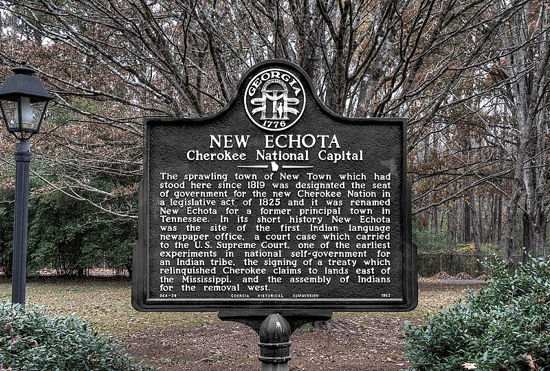
New Echota The sprawling town of New Town which had stood here since 1819 was designated the seat of government for the Cherokee Nation in a legislative act of 1825 and it was renamed New Echota for a former principal town in Tennessee. In its short history New Echota was the site of the first Indian language newspaper office, a court case which carried to the U.S. Supreme Court, one of the earliest experiments in national self-government for an Indian tribe, the signing of a treaty which relinquished Cherokee claims to lands east of the Mississippi, and the assembly of Indians for removal west. |
| Date | |
| Source | Own work |
| Author | Dsdugan |
| Camera location | | View this and other nearby images on: OpenStreetMap |
|---|
Licensing
[edit]
| This file is made available under the Creative Commons CC0 1.0 Universal Public Domain Dedication. | |
| The person who associated a work with this deed has dedicated the work to the public domain by waiving all of their rights to the work worldwide under copyright law, including all related and neighboring rights, to the extent allowed by law. You can copy, modify, distribute and perform the work, even for commercial purposes, all without asking permission.
|
File history
Click on a date/time to view the file as it appeared at that time.
| Date/Time | Thumbnail | Dimensions | User | Comment | |
|---|---|---|---|---|---|
| current | 16:28, 31 May 2022 | | 4,204 × 2,836 (1.93 MB) | Dsdugan (talk | contribs) | color image |
| 23:15, 6 December 2019 |  | 4,355 × 2,939 (1.97 MB) | Dsdugan (talk | contribs) | User created page with UploadWizard |
You cannot overwrite this file.
File usage on Commons
There are no pages that use this file.
File usage on other wikis
The following other wikis use this file:
- Usage on en.wikipedia.org