File:18th-century Maldives map by Pierre Mortier (cropped).jpg
Jump to navigation
Jump to search
Size of this preview: 800 × 513 pixels. Other resolutions: 320 × 205 pixels | 640 × 411 pixels | 971 × 623 pixels.
Original file (971 × 623 pixels, file size: 241 KB, MIME type: image/jpeg)
Captions
Captions
Add a one-line explanation of what this file represents
Summary
[edit]| Description |
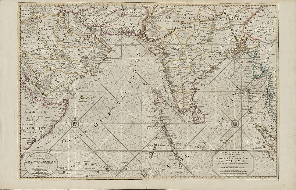
English: This detail from an 18th-century map by Pierre Mortier of The Netherlands names several dozen of the Maldive Islands off the southwestern coast of India. Map title: Carte particuliere d'une partie d'Asie ou sont les Isles d'Andemaon, Ceylan, les Maldives: dressé sur les memoires le plus nouveaux. |
| Date | circa 1700 |
| Source | http://catalogue.nla.gov.au/Record/3415503, which says "Probably from: Suite du Neptune François ou Atlas nouveau des cartes Marines / Pierre Mortier. Amsterdam : Chez Pierre Mortier, 1700." |
| Author | Pierre Mortier of The Netherlands |
| Other versions | http://www.saudiaramcoworld.com/issue/200504/the.seas.of.sindbad.htm |

.jpg&action=edit§ion=1)
Licensing
[edit].jpg&action=edit§ion=2)
|
This is a faithful photographic reproduction of a two-dimensional, public domain work of art. The work of art itself is in the public domain for the following reason:
The official position taken by the Wikimedia Foundation is that "faithful reproductions of two-dimensional public domain works of art are public domain".
This photographic reproduction is therefore also considered to be in the public domain in the United States. In other jurisdictions, re-use of this content may be restricted; see Reuse of PD-Art photographs for details. | ||||
File history
Click on a date/time to view the file as it appeared at that time.
| Date/Time | Thumbnail | Dimensions | User | Comment | |
|---|---|---|---|---|---|
| current | 15:56, 14 August 2022 | | 971 × 623 (241 KB) | Pelikana (talk | contribs) | File:18th-century Maldives map by Pierre Mortier.jpg cropped 3 % horizontally, 5 % vertically using CropTool with lossless mode. |
You cannot overwrite this file.
File usage on Commons
There are no pages that use this file.
.jpg&oldid=746375838)