File:1889 Chicago map by Blanchard.jpg
Jump to navigation
Jump to search

Size of this preview: 403 × 599 pixels. Other resolutions: 161 × 240 pixels | 323 × 480 pixels | 516 × 768 pixels | 688 × 1,024 pixels | 1,377 × 2,048 pixels | 7,257 × 10,792 pixels.
Original file (7,257 × 10,792 pixels, file size: 11.55 MB, MIME type: image/jpeg)
Captions
Captions
Add a one-line explanation of what this file represents
| Title |
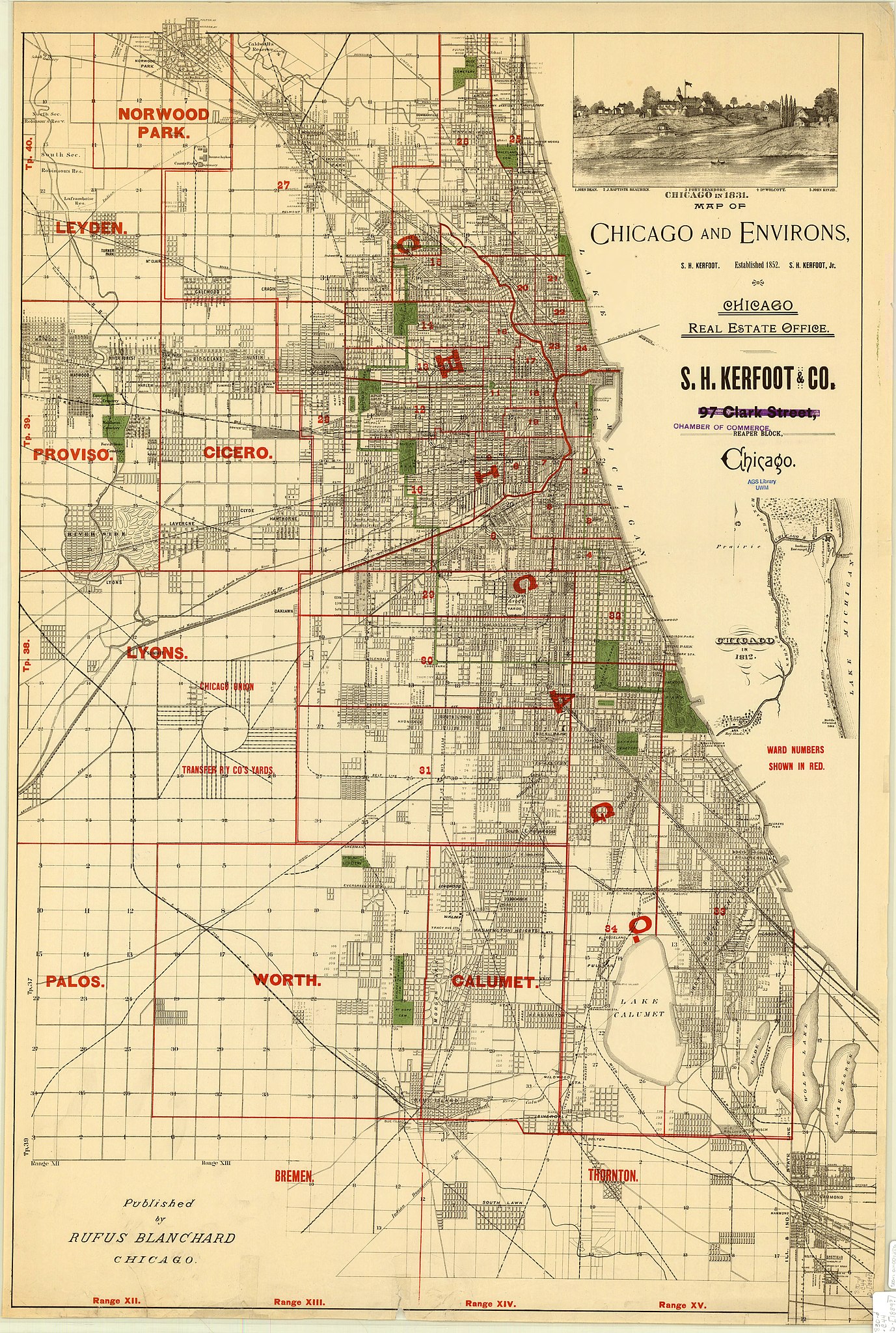
English: Map of Chicago and environs |
||||
| Description |
Includes advertising for S.H. Kerfoot & Co. Date of publication determined from location of Chicago city limits. Insets: Chicago in 1831 : [view] -- Chicago in 1812. |
||||
| Date | |||||
| Source | [1] | ||||
| Creator |
Blanchard, Rufus, 1821-1904 |
||||
| Permission (Reusing this file) |
|
||||
| Geotemporal data | |||||
| Date depicted | |||||
| Map location | Chicago | ||||
| Scale | 1:51,000 | ||||
| Georeferencing | If inappropriate please set warp_status = skip to hide. | ||||
| Bibliographic data | |||||
| Publisher |
Blanchard, Rufus, 1821-1904 |
||||
File history
Click on a date/time to view the file as it appeared at that time.
| Date/Time | Thumbnail | Dimensions | User | Comment | |
|---|---|---|---|---|---|
| current | 17:21, 11 August 2016 | | 7,257 × 10,792 (11.55 MB) | Scewing (talk | contribs) | {{Map |title ={{en|Map of Chicago and environs}} |description =Includes advertising for S.H. Kerfoot & Co. Date of publication determined from location of Chicago city limits. Insets: Chicago in 1831 : [view] -- Chicago in 1812. |leg... |
You cannot overwrite this file.
File usage on Commons
There are no pages that use this file.
File usage on other wikis
The following other wikis use this file:
- Usage on de.wikipedia.org