File:1877 Mitchell's map of Chicago.jpg
Jump to navigation
Jump to search

Size of this preview: 485 × 599 pixels. Other resolutions: 194 × 240 pixels | 388 × 480 pixels | 622 × 768 pixels | 829 × 1,024 pixels | 1,658 × 2,048 pixels | 3,453 × 4,266 pixels.
Original file (3,453 × 4,266 pixels, file size: 8.01 MB, MIME type: image/jpeg)
Captions
Captions
Add a one-line explanation of what this file represents
| Title |
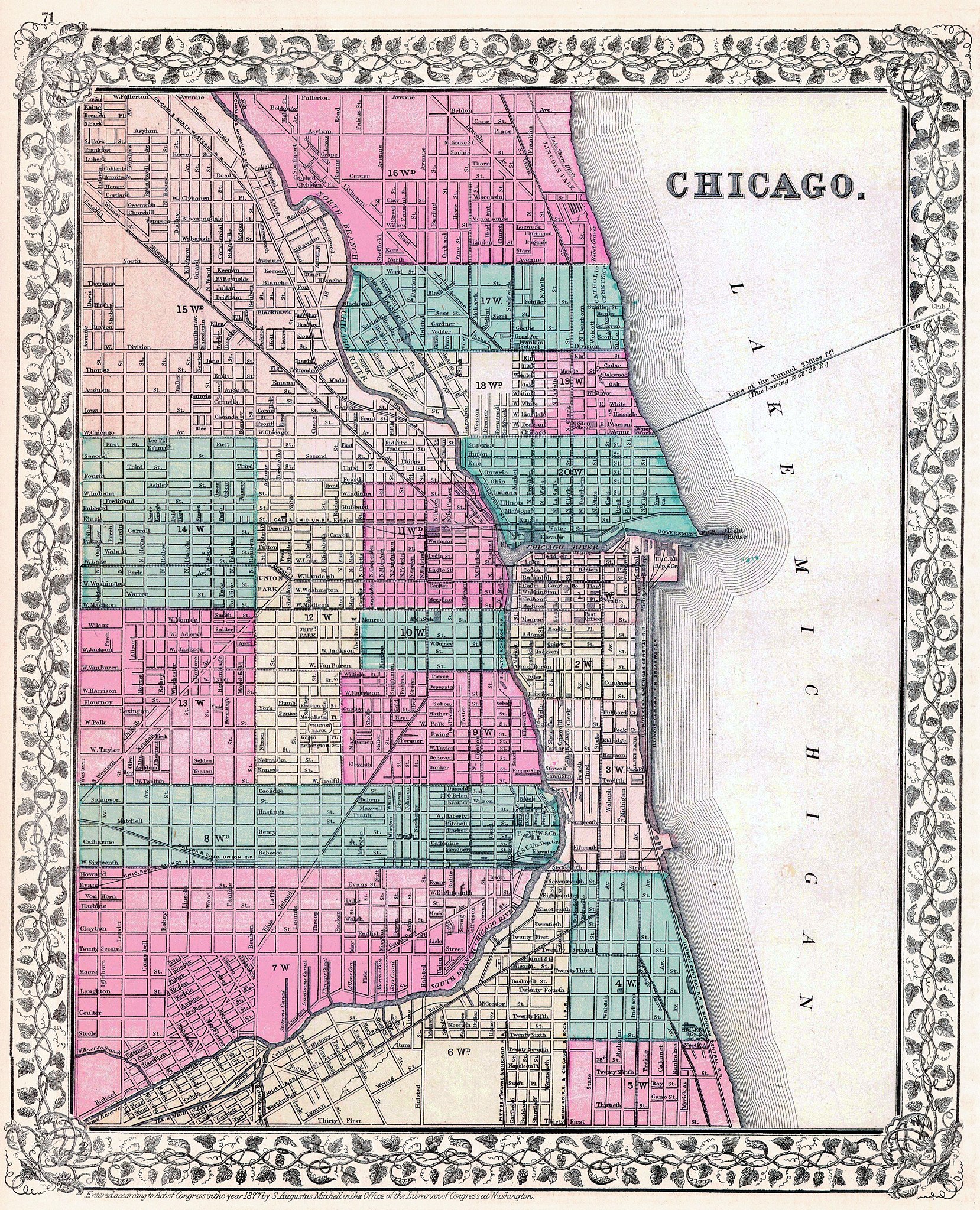
Mitchell's plan of the city of Chicago, Illinois. |
||||
| Date | |||||
| Source | [1] | ||||
| Creator |
Mitchell, S. Augustus (Samuel Augustus), 1792-1868 |
||||
| Permission (Reusing this file) |
|
||||
| Geotemporal data | |||||
| Date depicted | |||||
| Map location | Chicago | ||||
| Scale | 1:31680 | ||||
| Georeferencing | If inappropriate please set warp_status = skip to hide. | ||||
| Bibliographic data | |||||
| Publisher |
Mitchell, S. Augustus (Samuel Augustus), 1792-1868 |
||||
| Archival data | |||||
| Dimensions | 21.3 × 14.2 in (54.1 × 36.1 cm) | ||||
File history
Click on a date/time to view the file as it appeared at that time.
| Date/Time | Thumbnail | Dimensions | User | Comment | |
|---|---|---|---|---|---|
| current | 22:53, 20 August 2016 | | 3,453 × 4,266 (8.01 MB) | Scewing (talk | contribs) | {{Map |title =Mitchell's plan of the city of Chicago, Illinois. |description = |legend = |author =Mitchell, S. Augustus (Samuel Augustus), 1792-1868 |date =1877 |source =[http://www.antiqu... |
You cannot overwrite this file.
File usage on Commons
The following page uses this file: