File:1870 Johnson Map of Sweden, Norway and Denmark - Geographicus - SwedenDenmark-johnson-1870.jpg
Jump to navigation
Jump to search
Size of this preview: 800 × 574 pixels. Other resolutions: 320 × 230 pixels | 640 × 459 pixels | 1,024 × 735 pixels | 1,280 × 919 pixels | 2,560 × 1,838 pixels | 5,000 × 3,589 pixels.
Original file (5,000 × 3,589 pixels, file size: 6.39 MB, MIME type: image/jpeg)
Captions
Captions
Add a one-line explanation of what this file represents
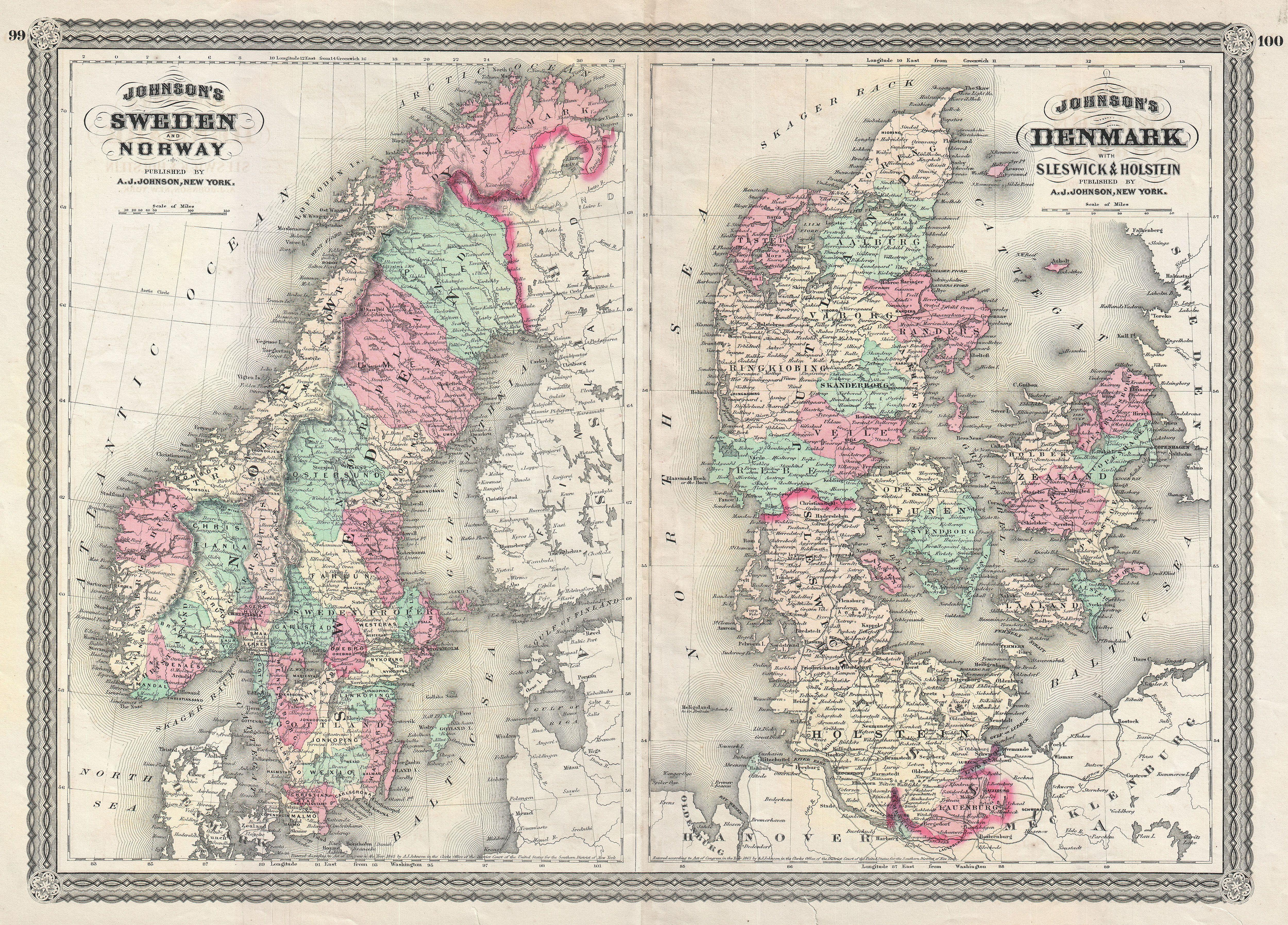
| Alvin Jewett Johnson: Johnson's Sweden and Norway. - Johnson's Denmark with Sleswick & Holstein.
( |
|||||||||||||||||||||||
|---|---|---|---|---|---|---|---|---|---|---|---|---|---|---|---|---|---|---|---|---|---|---|---|
| Artist |
|
||||||||||||||||||||||
| Title |
Johnson's Sweden and Norway. - Johnson's Denmark with Sleswick & Holstein. |
||||||||||||||||||||||
| Description |
English: This is A. J. Johnson 1870 map of Sweden, Norway and Denmark. This is actually a composite on a single folio sheet of two maps formerly issued on separate sheets. Depicts the area in considerable detail with color coding according to both country and district. The left hand map depicts Norway and Sweden. The right hand map details Denmark, Sleswick and Holstein. Features the spirograph style border common to Johnson’s atlas work in 1870. Steel plate engraving prepared by A. J. Johnson for publication as page nos. 99 - 100 in the rare 1870 edition of his New Illustrated Atlas… Dated and copyrighted, “Entered according to Act of Congress in the Year of 1865, by A. J. Johnson in the Clerks Office of the District Court of the United States for the Southern District of New York. |
||||||||||||||||||||||
| Date | 1865 (dated) | ||||||||||||||||||||||
| Dimensions | height: 15.5 in (39.3 cm); width: 22.2 in (56.5 cm) | ||||||||||||||||||||||
| Accession number |
Geographicus link: SwedenDenmark-johnson-1870 |
||||||||||||||||||||||
| Source/Photographer |
Johnson, A. J., Johnson's New Illustrated Family Atlas. (1870 A. J. Johnson edition)
|
||||||||||||||||||||||
| Permission (Reusing this file) |
|
||||||||||||||||||||||
File history
Click on a date/time to view the file as it appeared at that time.
| Date/Time | Thumbnail | Dimensions | User | Comment | |
|---|---|---|---|---|---|
| current | 08:29, 22 March 2011 | | 5,000 × 3,589 (6.39 MB) | BotMultichill (talk | contribs) | {{subst:User:Multichill/Geographicus |link=http://www.geographicus.com/P/AntiqueMap/SwedenDenmark-johnson-1870 |product_name=1870 Johnson Map of Sweden, Norway and Denmark |map_title=Johnson's Sweden and Norway. - Johnson's Denmark with Sleswick & Holstei |
You cannot overwrite this file.
File usage on Commons
The following page uses this file: