File:1862 Johnson Map of New York State - Geographicus - NY-johnson-1862.jpg
Jump to navigation
Jump to search
Size of this preview: 800 × 555 pixels. Other resolutions: 320 × 222 pixels | 640 × 444 pixels | 1,024 × 711 pixels | 1,280 × 888 pixels | 2,560 × 1,777 pixels | 5,000 × 3,470 pixels.
Original file (5,000 × 3,470 pixels, file size: 6.84 MB, MIME type: image/jpeg)
Captions
Captions
Add a one-line explanation of what this file represents
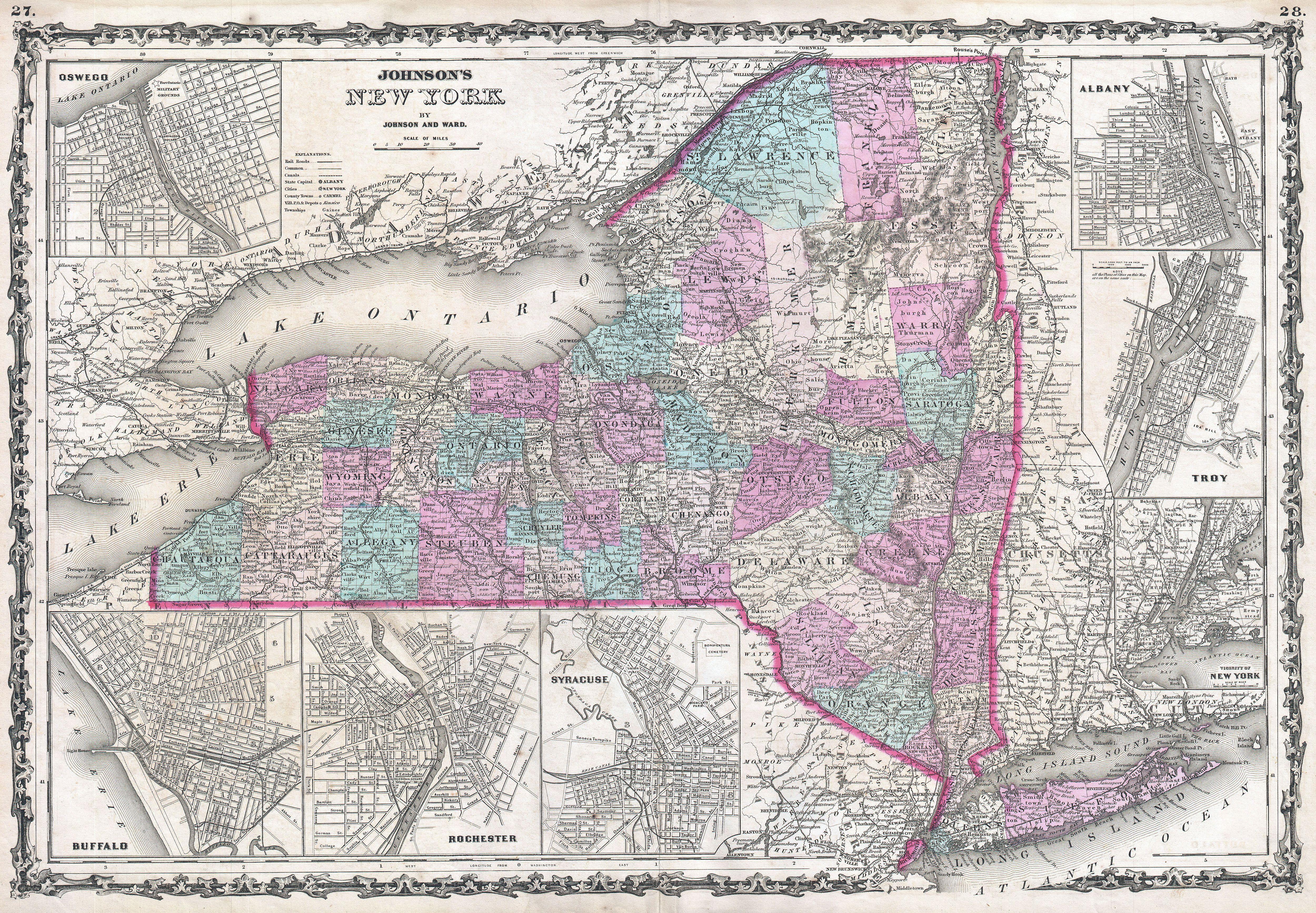
| Alvin Jewett Johnson: Johnson's New York.
( |
|||||||||||||||||||||||
|---|---|---|---|---|---|---|---|---|---|---|---|---|---|---|---|---|---|---|---|---|---|---|---|
| Artist |
|
||||||||||||||||||||||
| Title |
Johnson's New York. |
||||||||||||||||||||||
| Description |
English: This is Johnson and Ward’s 1862 map of New York State. This rare map offers a fascinating snapshot of New York shortly following the outbreak of the American Civil War. Map New York in full with bold and dramatic color coding according to county, also details transportation routes, especially roads, railroads, and canals. Includes seven inset city plans detailing Oswego, Buffalo, Rochester, Syracuse, the environs of New York, Troy and Albany. Features the strapwork style border common to Johnson’s atlas work from 1860 to 1863. Steel plate engraving prepared by A. J. Johnson for publication as plates no. 27 and 28 in the 1862 edition of his New Illustrated Atlas… This is the first edition of the Johnson’s Atlas to bear the Johnson & Ward imprint. |
||||||||||||||||||||||
| Date | 1862 (undated) | ||||||||||||||||||||||
| Dimensions | height: 17.5 in (44.4 cm); width: 24.5 in (62.2 cm) | ||||||||||||||||||||||
| Accession number |
Geographicus link: NY-johnson-1862 |
||||||||||||||||||||||
| Source/Photographer |
Johnson, A. J., Johnson's New Illustrated (Steel Plate) Family Atlas with Descriptions, Geographical, Statistical, and Historical. (1862 A. J. Johnson & Ward edition)
|
||||||||||||||||||||||
| Permission (Reusing this file) |
|
||||||||||||||||||||||
File history
Click on a date/time to view the file as it appeared at that time.
| Date/Time | Thumbnail | Dimensions | User | Comment | |
|---|---|---|---|---|---|
| current | 20:30, 22 March 2011 | | 5,000 × 3,470 (6.84 MB) | BotMultichillT (talk | contribs) | {{subst:User:Multichill/Geographicus |link=http://www.geographicus.com/P/AntiqueMap/NY-johnson-1862 |product_name=1862 Johnson Map of New York State |map_title=Johnson's New York. |description=This is Johnson and Ward’s 1862 map of New York State. This |
You cannot overwrite this file.
File usage on Commons
The following page uses this file: