File:1861 map of Huntsville, Alabama.jpg
Jump to navigation
Jump to search

Size of this preview: 471 × 599 pixels. Other resolutions: 189 × 240 pixels | 377 × 480 pixels | 604 × 768 pixels | 805 × 1,024 pixels | 1,610 × 2,048 pixels | 3,301 × 4,200 pixels.
Original file (3,301 × 4,200 pixels, file size: 1.5 MB, MIME type: image/jpeg)
Captions
Captions
Add a one-line explanation of what this file represents
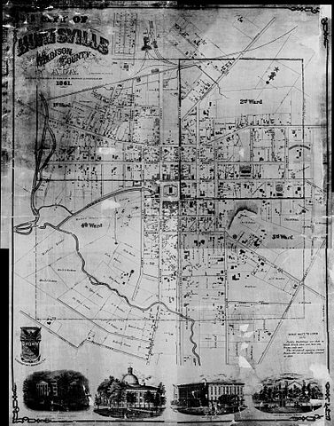
| Description | Map of Huntsville, Alabama | ||||
| Date | |||||
| Source | Historical Maps of Alabama collection, University of Alabama Department of Geography | ||||
| Author | Hartley and Drayton, Louisville, Ky. | ||||
| Permission (Reusing this file) |
|
||||
File history
Click on a date/time to view the file as it appeared at that time.
| Date/Time | Thumbnail | Dimensions | User | Comment | |
|---|---|---|---|---|---|
| current | 23:26, 17 December 2009 | | 3,301 × 4,200 (1.5 MB) | Spyder Monkey (talk | contribs) | {{Information |Description=Map of {{w|Huntsville, Alabama}} |Source=[http://alabamamaps.ua.edu/historicalmaps/counties/madison/madison.html Historical Maps of Alabama collection], University of Alabama Department of Geography |Date=1861 |Author=Hartley an |
You cannot overwrite this file.
File usage on Commons
There are no pages that use this file.