File:1855 Perthes Map of Asia at the end of the 17th Century - Geographicus - Asia17th-perthes-1855.jpg
Jump to navigation
Jump to search
Size of this preview: 738 × 600 pixels. Other resolutions: 295 × 240 pixels | 591 × 480 pixels | 945 × 768 pixels | 1,260 × 1,024 pixels | 2,520 × 2,048 pixels | 3,000 × 2,438 pixels.
Original file (3,000 × 2,438 pixels, file size: 2.19 MB, MIME type: image/jpeg)
Captions
Captions
Add a one-line explanation of what this file represents
| Justus Perthes: Asien am Ausgange des 17th Jahrhunderts.
( |
||||||||||||||||||||||||
|---|---|---|---|---|---|---|---|---|---|---|---|---|---|---|---|---|---|---|---|---|---|---|---|---|
| Artist |
|
|||||||||||||||||||||||
| Title |
Asien am Ausgange des 17th Jahrhunderts. |
|||||||||||||||||||||||
| Description |
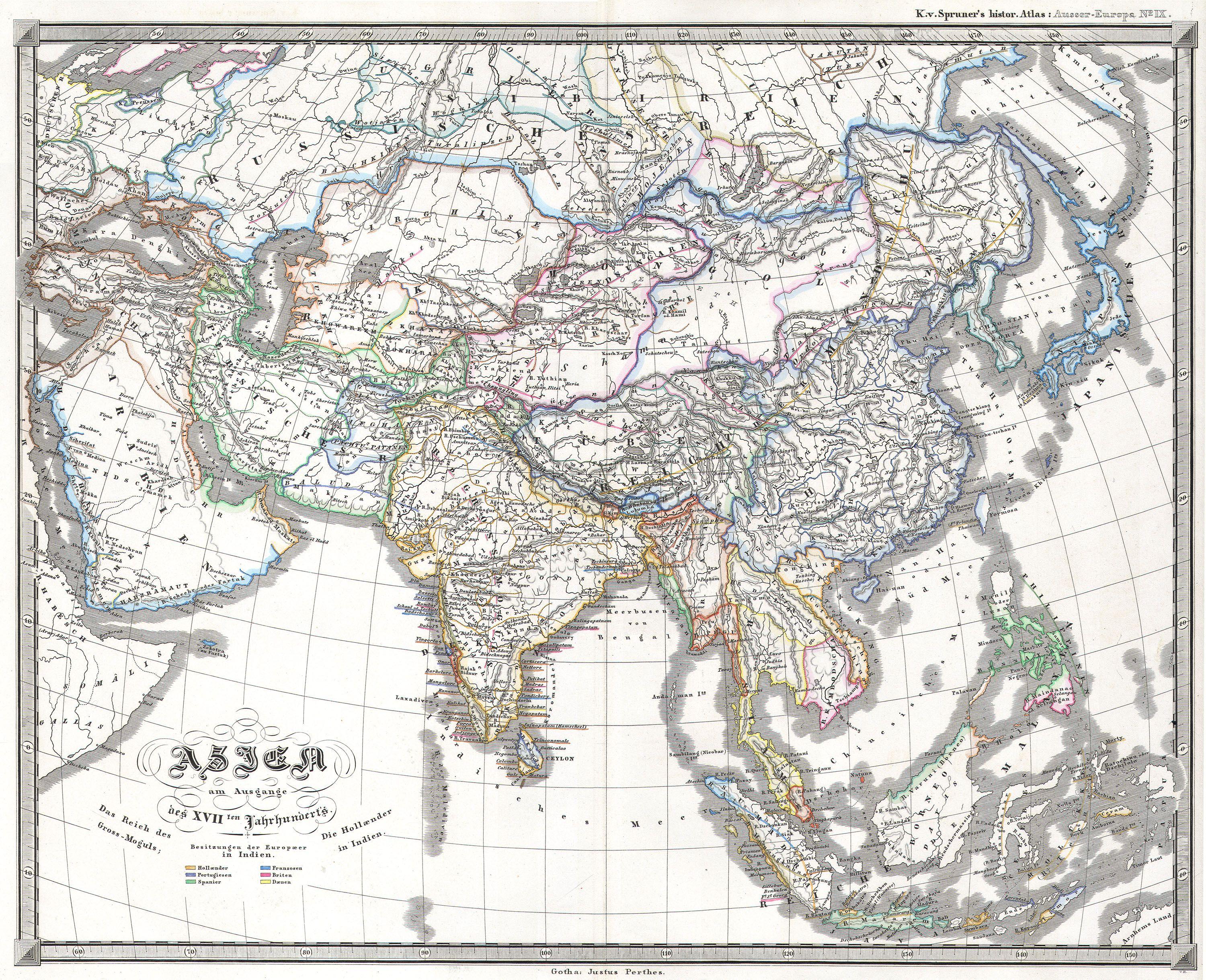
English: This fascinating hand colored map depicts Asia at the end of the 17th century. The Dutch had established themselves in India and the Chinese Empire was under Mogul control. Also depicts Southeast Asia in good detail with early versions of Vietnam (Anam & Tonkin), Cambodia (Kambodscha) and Thailand. Singapore is labeled as Singapura. Published as part of Karl von Spruner’s Historical Atlas of 1855. |
|||||||||||||||||||||||
| Date | 1855 | |||||||||||||||||||||||
| Dimensions | height: 14 in (35.5 cm); width: 17 in (43.1 cm) | |||||||||||||||||||||||
| Accession number |
Geographicus link: Asia17th-perthes-1855 |
|||||||||||||||||||||||
| Source/Photographer |
|
|||||||||||||||||||||||
| Permission (Reusing this file) |
|
|||||||||||||||||||||||

File history
Click on a date/time to view the file as it appeared at that time.
| Date/Time | Thumbnail | Dimensions | User | Comment | |
|---|---|---|---|---|---|
| current | 09:39, 16 March 2011 | | 3,000 × 2,438 (2.19 MB) | BotMultichill (talk | contribs) | {{subst:User:Multichill/Geographicus |link=http://www.geographicus.com/P/AntiqueMap/Asia17th-perthes-1855 |product_name=1855 Perthes Map of Asia at the end of the 17th Century |map_title=Asien am Ausgange des 17th Jahrhunderts. |description=This fascina |
You cannot overwrite this file.
File usage on Commons
The following page uses this file:
File usage on other wikis
The following other wikis use this file:
- Usage on fr.wikipedia.org