File:1854 U.S. Coast Survey Chart or Map of the Savannah River ans Savannah, Georgia - Geographicus - SavannahE2-uscs-1854.jpg
Original file (2,000 × 1,971 pixels, file size: 609 KB, MIME type: image/jpeg)
Captions
Captions
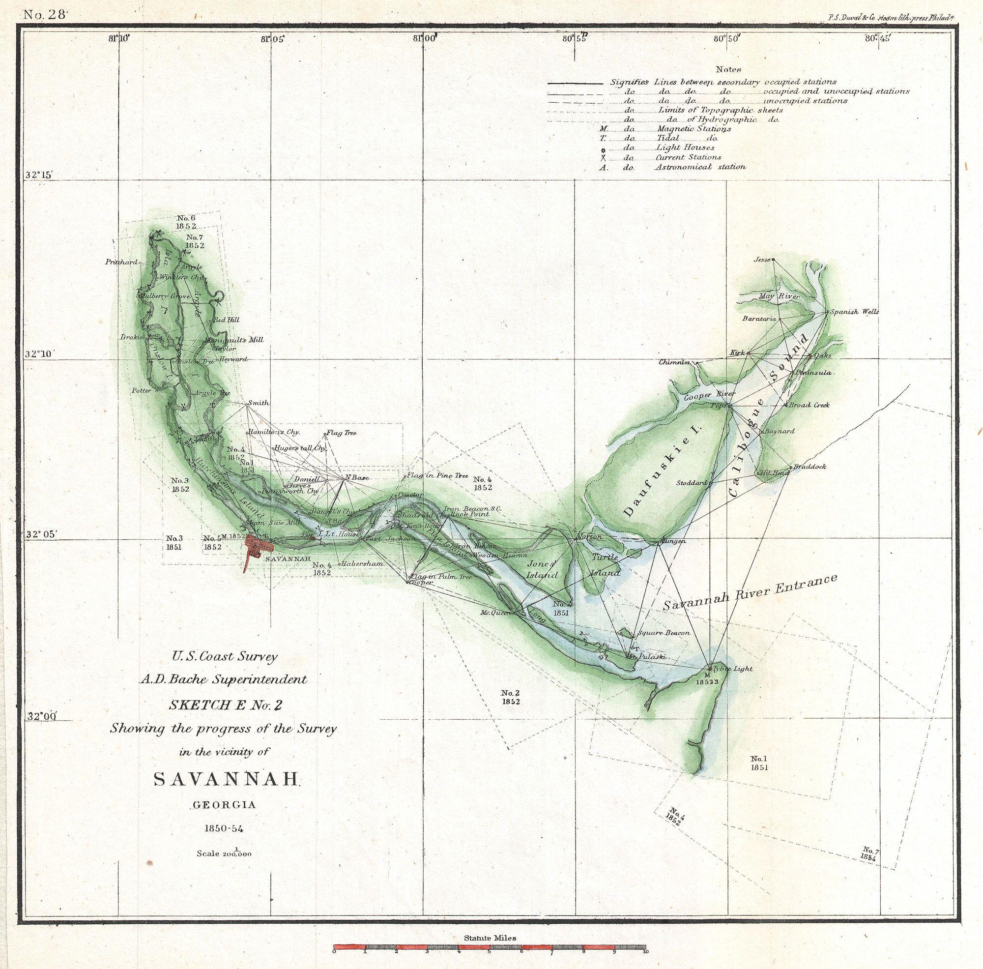
| Sketch E No. 2 Showing the progress of the Survey in the vicinity of Savannah Georgia 1850–52. | ||||||
|---|---|---|---|---|---|---|
| Artist | ||||||
| Title |
Sketch E No. 2 Showing the progress of the Survey in the vicinity of Savannah Georgia 1850–52. |
|||||
| Description |
English: An attractive hand colored 1854 U.S. Coast Survey triangulation chart or map of Savannah Georgia and the Savannah River. Shows the progress of the survey work in this area by date annotated sections. Shows navigation marks such as Fort Jackson, Tybee Lighthouse, Manigault’s Mill and even the Steam Saw Mill. Details the grid layout of Savannah city. The hand color work on this beautiful map is exceptionally well done. This map was compiled under the direction of A. D. Bache, Superintendent of the Survey of the Coast of the United States and one of the most influential American cartographers of the 19th century. |
|||||
| Date | 1854 (dated) | |||||
| Dimensions | height: 9.5 in (24.1 cm); width: 9.5 in (24.1 cm) | |||||
| Accession number |
Geographicus link: SavannahE2-uscs-1854 |
|||||
| Source/Photographer |
Report of the Superintendant of the U.S. Coast Survey, (1854 edition).
|
|||||
| Permission (Reusing this file) |
|
|||||
| Object location | | View this and other nearby images on: OpenStreetMap |
|---|
File history
Click on a date/time to view the file as it appeared at that time.
| Date/Time | Thumbnail | Dimensions | User | Comment | |
|---|---|---|---|---|---|
| current | 09:48, 23 March 2011 | | 2,000 × 1,971 (609 KB) | BotMultichillT (talk | contribs) | {{subst:User:Multichill/Geographicus |link=http://www.geographicus.com/P/AntiqueMap/SavannahE2-uscs-1854 |product_name=1854 U.S. Coast Survey Chart or Map of the Savannah River ans Savannah, Georgia |map_title=Sketch E No. 2 Showing the progress of the S |
You cannot overwrite this file.
File usage on Commons
The following page uses this file: