File:1854 Ansei Tokai earthquake intensity.png
Jump to navigation
Jump to search
No higher resolution available.
1854_Ansei_Tokai_earthquake_intensity.png (512 × 512 pixels, file size: 49 KB, MIME type: image/png)
Captions
Captions
Add a one-line explanation of what this file represents
Summary
[edit]
| Description |
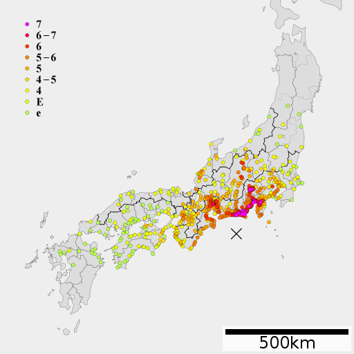
English: 1854 Ansei Tokai earthquake intensity
日本語: 安政東海地震の震度分布 |
| Date | |
| Source | http://www.bousai.go.jp/jishin/chubou/nankai/16/sankousiryou2_2.pdf 宇佐美 歴史地震の震度分布, Lincun(2010)ファイル:地図 令制国 和泉国.svg |
| Author | As6022014 |
Licensing
[edit]
I, the copyright holder of this work, hereby publish it under the following license:
This file is licensed under the Creative Commons Attribution-Share Alike 3.0 Unported license.
- You are free:
- to share – to copy, distribute and transmit the work
- to remix – to adapt the work
- Under the following conditions:
- attribution – You must give appropriate credit, provide a link to the license, and indicate if changes were made. You may do so in any reasonable manner, but not in any way that suggests the licensor endorses you or your use.
- share alike – If you remix, transform, or build upon the material, you must distribute your contributions under the same or compatible license as the original.
File history
Click on a date/time to view the file as it appeared at that time.
| Date/Time | Thumbnail | Dimensions | User | Comment | |
|---|---|---|---|---|---|
| current | 03:34, 18 December 2012 | | 512 × 512 (49 KB) | As6022014 (talk | contribs) | {{Information |Description=安政東海地震の震度分布 |Source=Usami(2007)http://www.bousai.go.jp/jishin/chubou/nankai/16/sankousiryou2_2.pdf,宇佐美龍夫:わが国の歴史地震の震度分布・等震度線図 , Lincun(2010)ファイル:地... |
| 06:43, 22 February 2012 |  | 512 × 512 (48 KB) | As6022014 (talk | contribs) | {{Information |Description=安政東海地震の震度分布 |Source=Usami(2007)http://www.bousai.go.jp/jishin/chubou/nankai/16/sankousiryou2_2.pdf, Lincun(2010)ファイル:地図 令制国 和泉国.svg |Date=2012-02-22 |Author=As6022014 |Permission={{s | |
| 03:14, 20 January 2012 |  | 512 × 512 (37 KB) | As6022014 (talk | contribs) | {{Information |Description=安政東海地震の震度分布 |Source=Usami(2007)http://www.bousai.go.jp/jishin/chubou/nankai/16/sankousiryou2_2.pdf, Lincun(2010)ファイル:地図 令制国 和泉国.svg |Date=2011-01-20 |Author=As6022014 |Permission={{s | |
| 04:27, 16 November 2011 |  | 512 × 512 (41 KB) | As6022014 (talk | contribs) | {{Information |Description ={{en|1=1854 Ansei Tokai earthquake intensity}} {{ja|1=安政東海地震震度分布}} |Source =http://www.bousai.go.jp/jishin/chubou/nankai/16/sankousiryou2_2.pdf 宇佐美 歴史地震の震度分布, Lincun(2010) |
You cannot overwrite this file.
File usage on Commons
There are no pages that use this file.
File usage on other wikis
The following other wikis use this file:
- Usage on de.wikipedia.org
- Usage on es.wikipedia.org
- Usage on ja.wikipedia.org
- Usage on ko.wikipedia.org
- Usage on uk.wikipedia.org
- Usage on www.wikidata.org
- Usage on zh.wikipedia.org