File:1853 Erie.jpg
Jump to navigation
Jump to search

Size of this preview: 800 × 477 pixels. Other resolutions: 320 × 191 pixels | 640 × 381 pixels | 1,024 × 610 pixels | 1,280 × 763 pixels | 2,560 × 1,526 pixels | 14,176 × 8,448 pixels.
Original file (14,176 × 8,448 pixels, file size: 18.4 MB, MIME type: image/jpeg)
Captions
Captions
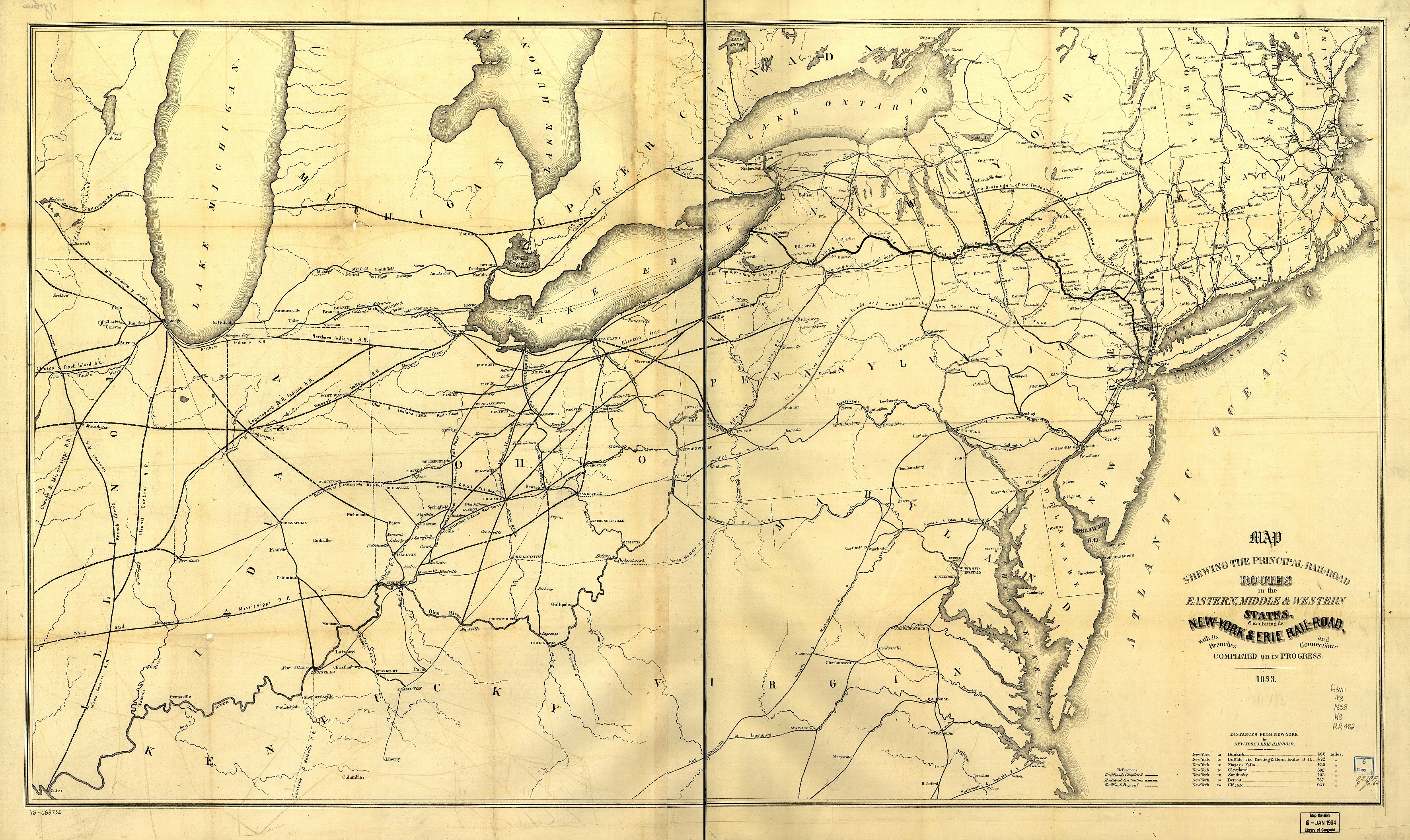
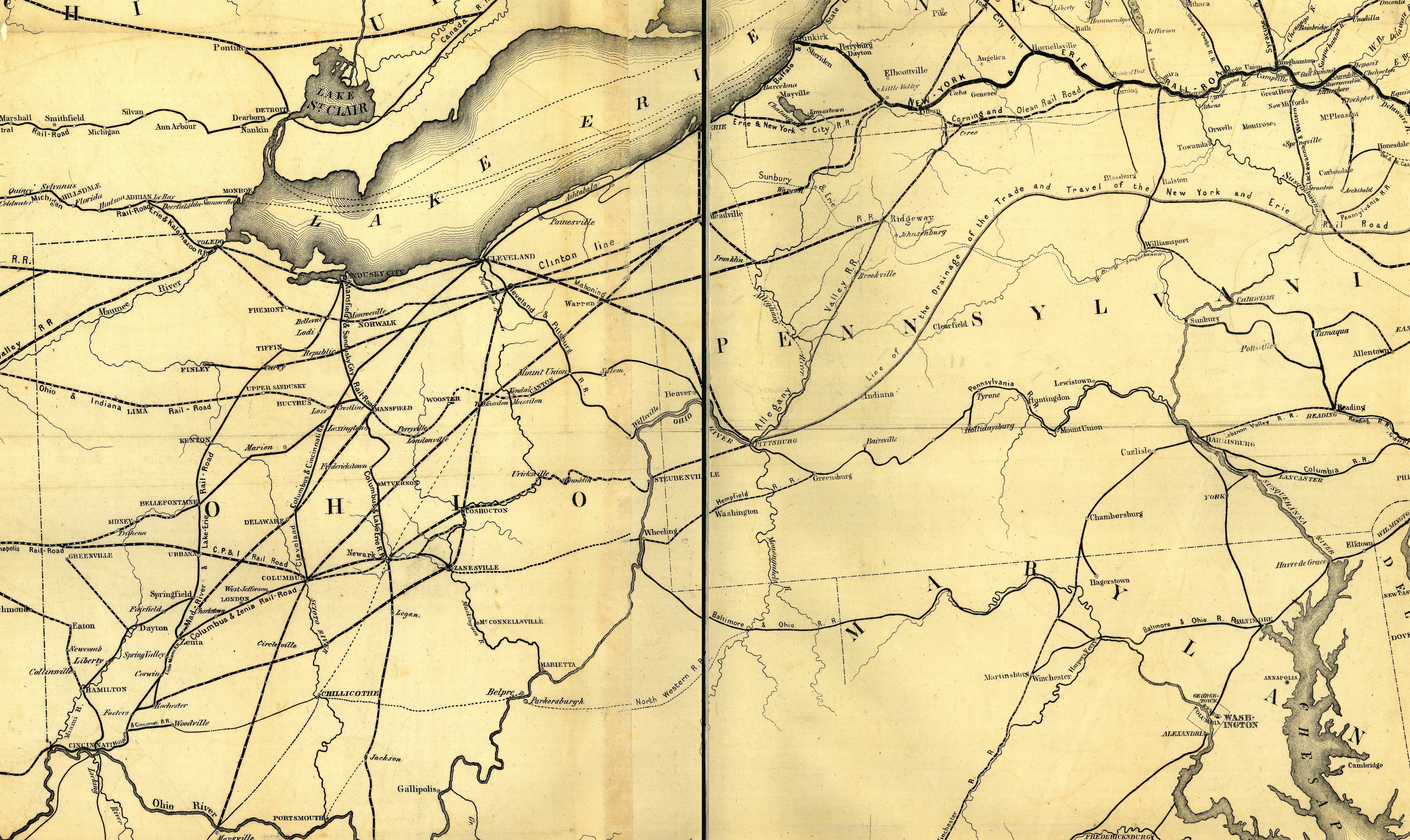
A territory map of the New York & Erie Rail Road from 1853
| Warning | The original file is very high-resolution. It might not load properly or could cause your browser to freeze when opened at full size. |
|---|
Summary
[edit]
| Description |
English: 1853 map showing the principal rail-road routes in the eastern, middle & western states, & exhibiting the New-York & Erie Rail-Road, with its branches and connections, completed or in progress. |
| Date | |
| Source | Library of Congress Geography and Map Division |
| Author | New York and Erie Railroad Company |

|
This map is available from the United States Library of Congress's Geography & Map Division
under the digital ID g3711p.rr004820. This tag does not indicate the copyright status of the attached work. A normal copyright tag is still required. See Commons:Licensing.
|
Licensing
[edit]
|
This work is in the public domain in its country of origin and other countries and areas where the copyright term is the author's life plus 70 years or fewer. | |
| This file has been identified as being free of known restrictions under copyright law, including all related and neighboring rights. | |
File history
Click on a date/time to view the file as it appeared at that time.
| Date/Time | Thumbnail | Dimensions | User | Comment | |
|---|---|---|---|---|---|
| current | 17:37, 14 July 2005 | | 14,176 × 8,448 (18.4 MB) | SPUI~commonswiki (talk | contribs) | {{PD}} 1853 map of the New York and Erie Rail Road from [http://memory.loc.gov/cgi-bin/query/r?ammem/gmd:@field(NUMBER+@band(g3711p+rr004820))]. See 1853 Erie 25% and 1853Erie 50% for smaller images. category:Erie Railroad [[category:Railroad |
You cannot overwrite this file.
File usage on Commons
There are no pages that use this file.