File:1851 Sikhim map to illustrate Hooker's paper.jpg

Original file (2,792 × 2,460 pixels, file size: 728 KB, MIME type: image/jpeg)
Captions
Captions
Summary
[edit]
| Description |
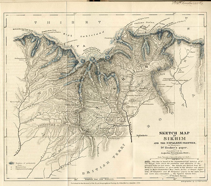
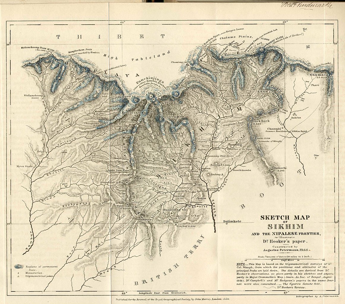
English: 1851 Sikkim map to illustrate w:Joseph Dalton Hooker's paper
Title: Sketch Map of Sikhim and the Nipalese Frontier to illustrate Dr. Hooker's paper. Authorship: Constructed by Augustus Petermann, F.R.G.S. Scale: 1/890,000 of Nature (14 miles to 1 inch.) Note: This Map is based on the trigonometrical surveys or Lt. Col. Waugh, from which the positions and altitudes of the principal Peaks are laid down. The details are derived from Dr. Hooker's observations, as given partly in his sketches and papers partly in Major Crommelin's Map (Journ. As. Soc. of Bengal, August 1849) Dr. Campbell's and Mr. Hodgson's papers in the same Journal were also consulted. The figures denote feet. Dotted lines indicate Dr. Hooker's Routes. |
| Date | |
| Source | https://pahar.in |
| Author | w:Survey of India |
Licensing
[edit]
|
This work is in the public domain in its country of origin and other countries and areas where the copyright term is the author's life plus 70 years or fewer. This work is in the public domain in the United States because it was published (or registered with the U.S. Copyright Office) before January 1, 1929. | |
| This file has been identified as being free of known restrictions under copyright law, including all related and neighboring rights. | |
File history
Click on a date/time to view the file as it appeared at that time.
| Date/Time | Thumbnail | Dimensions | User | Comment | |
|---|---|---|---|---|---|
| current | 14:43, 1 November 2021 | | 2,792 × 2,460 (728 KB) | Kautilya3 (talk | contribs) | Uploaded a work by w:Survey of India from https://pahar.in with UploadWizard |
You cannot overwrite this file.
File usage on Commons
The following page uses this file:
.jpg)