File:1842TreatyOfLaPointe.jpg
Jump to navigation
Jump to search
Size of this preview: 800 × 582 pixels. Other resolutions: 320 × 233 pixels | 640 × 465 pixels | 1,024 × 745 pixels | 1,280 × 931 pixels | 1,650 × 1,200 pixels.
Original file (1,650 × 1,200 pixels, file size: 1.2 MB, MIME type: image/jpeg)
Captions
Captions
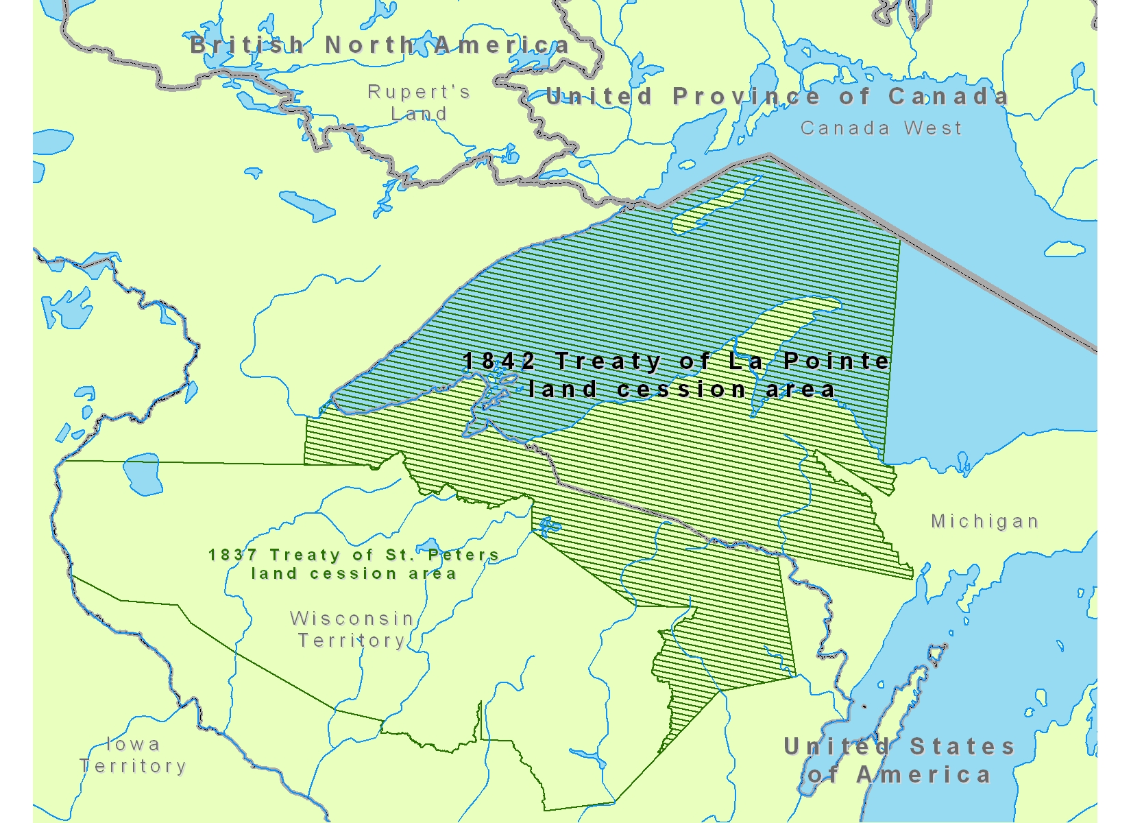
Map is incorrect. East boundary is straight line from Big Island at Mouth of Eacanaba River to Head Water of Chocolay. Not as described in 1836 Treaty.
Summary
[edit]
| Description |
English: Map of Lake Superior region showing the 1842 Treaty of La Pointe land cession area of Native American tribal territories.
|
| Date | |
| Source | Own work |
| Author | CJLippert |
Licensing
[edit]
| I, the copyright holder of this work, release this work into the public domain. This applies worldwide. In some countries this may not be legally possible; if so: I grant anyone the right to use this work for any purpose, without any conditions, unless such conditions are required by law. |
File history
Click on a date/time to view the file as it appeared at that time.
| Date/Time | Thumbnail | Dimensions | User | Comment | |
|---|---|---|---|---|---|
| current | 18:36, 22 August 2008 | | 1,650 × 1,200 (1.2 MB) | CJLippert (talk | contribs) | {{Information |Description={{en|1=Map of Lake Superior region showing the 1842 Treaty of La Pointe land cession area in reference to Rupert's Land, Canada West, [[w:Michig |
You cannot overwrite this file.
File usage on Commons
There are no pages that use this file.
File usage on other wikis
The following other wikis use this file:
- Usage on en.wikipedia.org
- Usage on fr.wikipedia.org
- Usage on fy.wikipedia.org
- Usage on ro.wikipedia.org
- Usage on ru.wikipedia.org