File:1840s Grand Junction Railroad map.jpg
Jump to navigation
Jump to search
Size of this preview: 706 × 600 pixels. Other resolutions: 283 × 240 pixels | 565 × 480 pixels | 904 × 768 pixels | 1,206 × 1,024 pixels | 2,412 × 2,048 pixels | 4,436 × 3,767 pixels.
Original file (4,436 × 3,767 pixels, file size: 7.96 MB, MIME type: image/jpeg)
Captions
Captions
Add a one-line explanation of what this file represents
| Description |
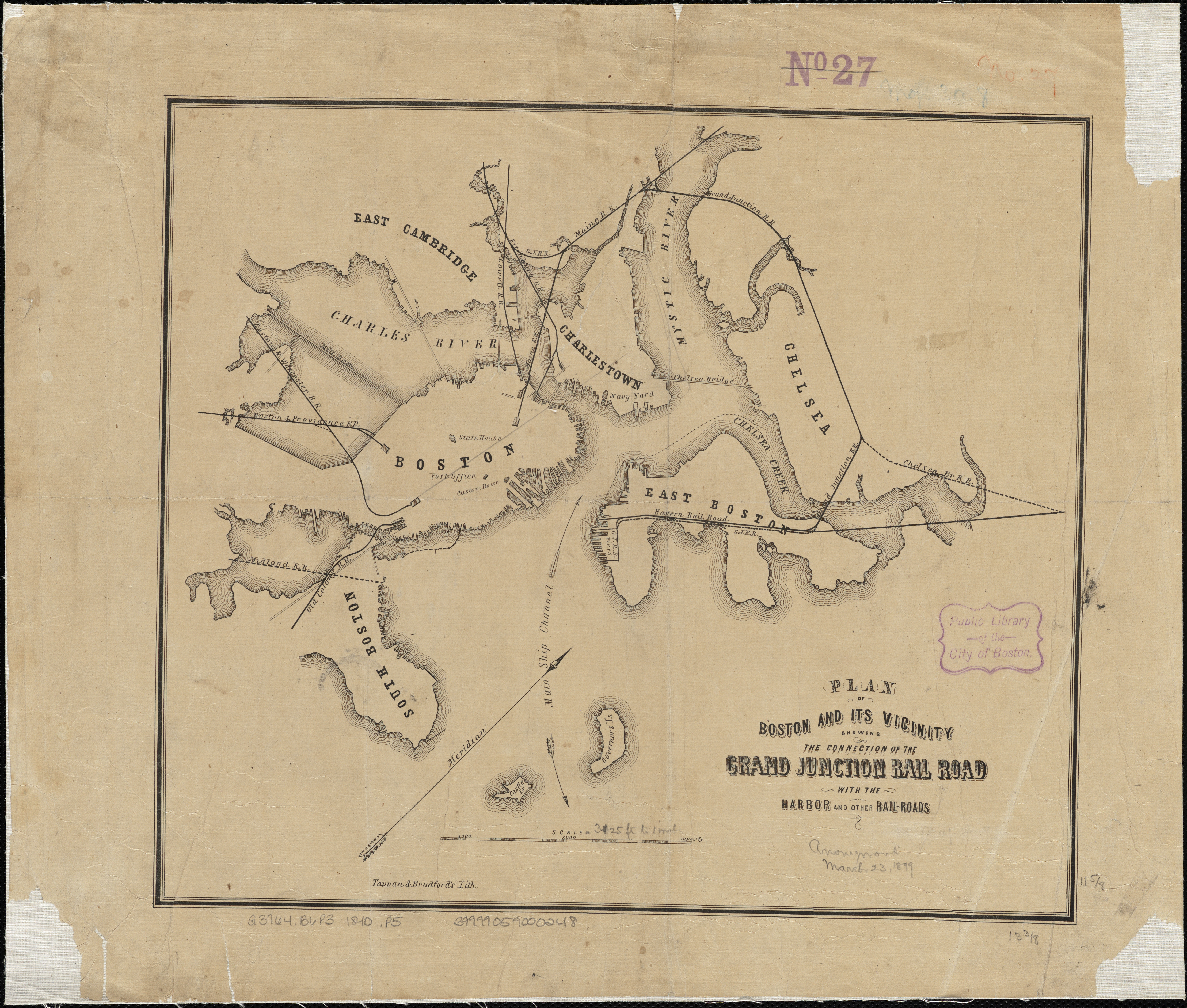
English: 1840s map of the Grand Junction Railroad, showing how it connected the four major northside railroads |
||
| Date | between 1840 and 1849 | ||
| Source | Plan of Boston and its vicinity showing the connection of the Grand Junction Rail Road with the Harbor and other Rail-roads via Norman B. Leventhal Map Ceenter | ||
| Author | Tappan & Bradford | ||
| Permission (Reusing this file) |
|
File history
Click on a date/time to view the file as it appeared at that time.
| Date/Time | Thumbnail | Dimensions | User | Comment | |
|---|---|---|---|---|---|
| current | 20:11, 8 September 2015 | | 4,436 × 3,767 (7.96 MB) | Pi.1415926535 (talk | contribs) | {{Information |Description ={{en|1=1840s map of the Grand Junction Railroad, showing how it connected the four major northside railroads}} |Source =[http://maps.bpl.org/id/10936 Plan of Boston and its vicinity showing the connection of the G... |
You cannot overwrite this file.
File usage on Commons
The following 2 pages use this file: