File:1840 flood level sign in Tournus.jpg
Jump to navigation
Jump to search
Size of this preview: 450 × 600 pixels. Other resolutions: 180 × 240 pixels | 360 × 480 pixels | 576 × 768 pixels | 768 × 1,024 pixels | 2,112 × 2,816 pixels.
Original file (2,112 × 2,816 pixels, file size: 1.49 MB, MIME type: image/jpeg)
Captions
Captions
Add a one-line explanation of what this file represents
Summary
[edit]
| Description |
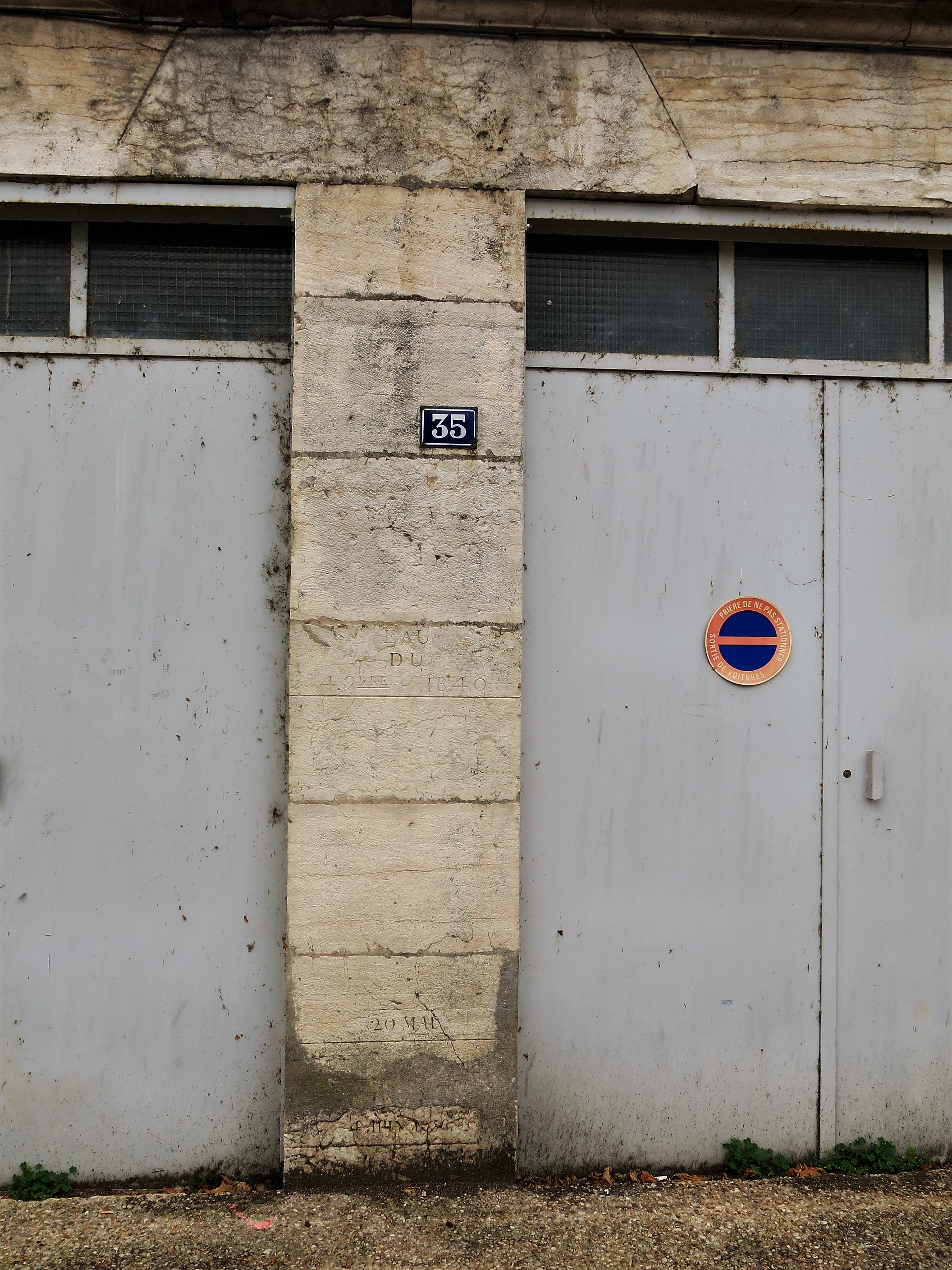
English: 1840 flood level sign (4th of september) in Tournus (Saône-et-Loire, France).
Français : Marque de l'inondation de 1840 (4 septembre), 35 quai du midi à Tournus, Saône-et-Loire. |
| Date | |
| Source | Self-photographed |
| Author | Tangopaso |
| Camera location | | View this and other nearby images on: OpenStreetMap |
|---|
Licensing
[edit]
| I, the copyright holder of this work, release this work into the public domain. This applies worldwide. In some countries this may not be legally possible; if so: I grant anyone the right to use this work for any purpose, without any conditions, unless such conditions are required by law. |
| Annotations | This image is annotated: View the annotations at Commons |
File history
Click on a date/time to view the file as it appeared at that time.
| Date/Time | Thumbnail | Dimensions | User | Comment | |
|---|---|---|---|---|---|
| current | 08:14, 22 August 2017 | | 2,112 × 2,816 (1.49 MB) | Tangopaso (talk | contribs) | =={{int:filedesc}}== {{Information |description= {{en|1=1840 flood level sign (4th of september) in Tournus (Saône-et-Loire, France).}} {{fr|1=Marque de l'inondation de 1840 (4 septembre), 35 quai du midi à Tournus, Saône-et-Loire.}} |source={{sf}}... |
You cannot overwrite this file.
File usage on Commons
There are no pages that use this file.