File:1840 Lizars Map of Scandinavia ( Norway, Sweden, Finland, Denmark, Iceland ) - Geographicus - Scandinavia-lizar-1840.jpg
Jump to navigation
Jump to search

Size of this preview: 480 × 600 pixels. Other resolutions: 192 × 240 pixels | 384 × 480 pixels | 614 × 768 pixels | 819 × 1,024 pixels | 1,638 × 2,048 pixels | 4,000 × 5,000 pixels.
Original file (4,000 × 5,000 pixels, file size: 4.31 MB, MIME type: image/jpeg)
Captions
Captions
Add a one-line explanation of what this file represents
| Title |
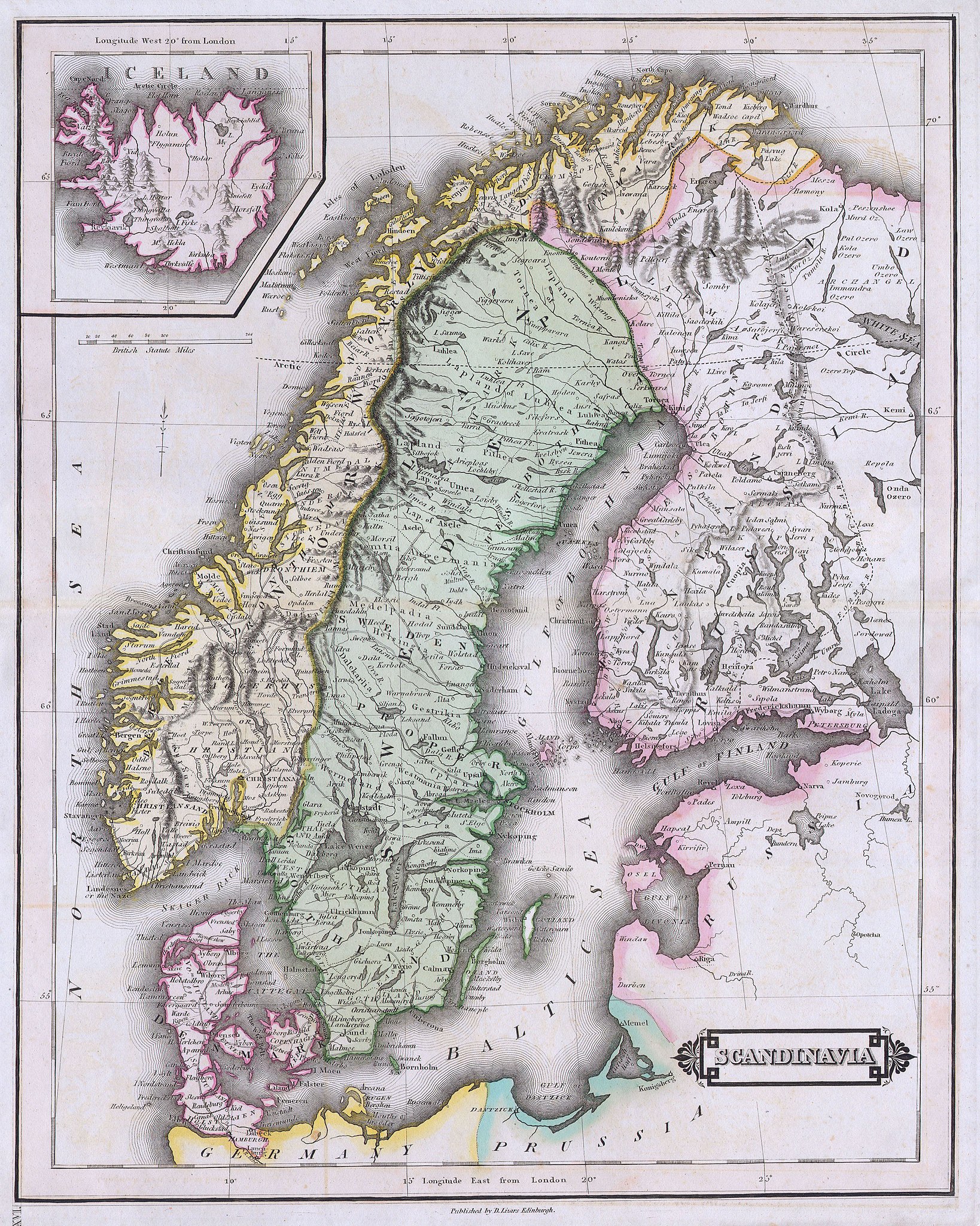
Scandinavia. |
|||||
| Description |
English: This beautiful hand colored map of Scandinavia was produced by Daniel Lizars in 1840. Depicts the whole of Scandinavia including Norway, Sweden, Finland and Denmark. Inset of Iceland in the upper left corner. One of the finest maps of Scandinavia to appear in the mid 19th century. Undated. |
|||||
| Date | ||||||
| Source |
|
|||||
| Permission (Reusing this file) |
|
|||||
| Georeferencing | If inappropriate please set warp_status = skip to hide. | |||||
| Archival data | ||||||
| Accession number |
Geographicus link: Scandinavia-lizar-1840 |
|||||
| Dimensions | height: 15 in (38.1 cm); width: 19 in (48.2 cm) | |||||
- Error in {{Map}} template: unknown parameter "artist".
File history
Click on a date/time to view the file as it appeared at that time.
| Date/Time | Thumbnail | Dimensions | User | Comment | |
|---|---|---|---|---|---|
| current | 23:02, 24 March 2011 | | 4,000 × 5,000 (4.31 MB) | BotMultichillT (talk | contribs) | {{subst:User:Multichill/Geographicus |link=http://www.geographicus.com/P/AntiqueMap/Scandinavia-lizar-1840 |product_name=1840 Lizars Map of Scandinavia ( Norway, Sweden, Finland, Denmark, Iceland ) |map_title=Scandinavia. |description=This beautiful han |
You cannot overwrite this file.
File usage on Commons
There are no pages that use this file.
_-_Geographicus_-_Scandinavia-lizar-1840.jpg&oldid=744969580)