File:1824-Charlottenburg-Kataster-Gundlach-Beilage-XVII-Ausschnitt-WartenbergschesGS.png

Original file (4,103 × 2,942 pixels, file size: 6.28 MB, MIME type: image/png)
Captions
Captions
Summary
[edit]
| Description |
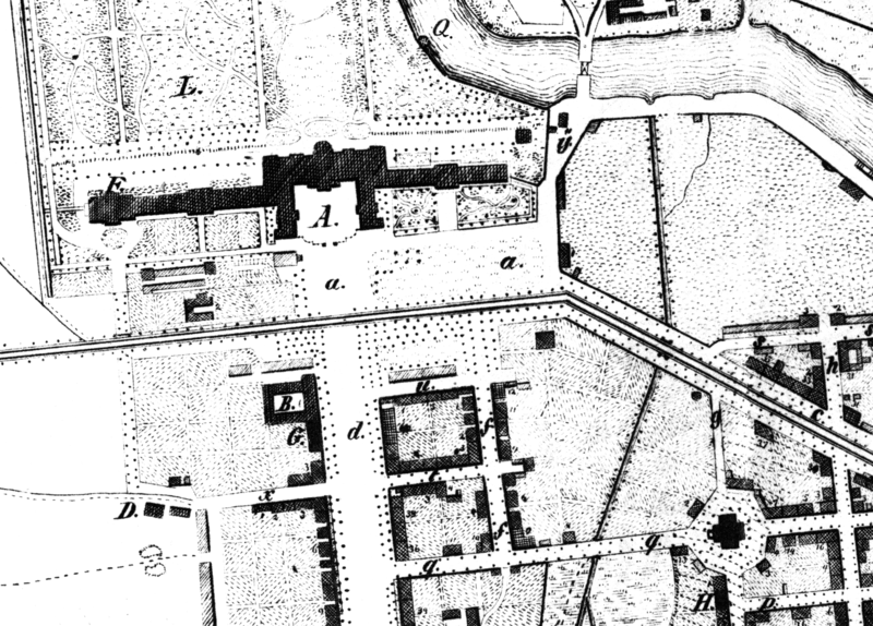
English: Map of Charlottenburg, extract from Schloss Charlottenburg til Luisenkirche, drawn around 1824. Showing Landhaus Behrend (southeast of Luisenplatz) and the property of the former Royal Kitchengarden (laying between Luisenkirche and Luisenplatz)
Deutsch: Situationsplan von Charlottenburg, Ausschnitt Schloss Charlottenburg bis Luisenkirche von 1824 mit dem Landhaus Behrend (südöstlich vom Luisenplatz) und dem Grundstück des ehemaligen Königlichen Küchengartens (zwischen Luisenkirche und Luisenplatz) |
| Date | |
| Source | Wilhelm Gundlach: Geschichte der Stadt Charlottenburg. Springer-Verlag, 1905 |
| Author | Unknown author |
Licensing
[edit]
|
This work is in the public domain in its country of origin and other countries and areas where the copyright term is the author's life plus 70 years or fewer.
| |
| This file has been identified as being free of known restrictions under copyright law, including all related and neighboring rights. | |
File history
Click on a date/time to view the file as it appeared at that time.
| Date/Time | Thumbnail | Dimensions | User | Comment | |
|---|---|---|---|---|---|
| current | 18:16, 15 May 2020 | | 4,103 × 2,942 (6.28 MB) | GillianTL (talk | contribs) | {{Information |description ={{en|1=Map of Charlottenburg, extract from Schloss Charlottenburg til Luisenkirche, drawn around 1824. Showing Landhaus Behrend (southeast of Luisenplatz) and the property of the former Royal Kitchengarden (laying between Luisenkirche and Luisenplatz)}} {{de|1=Situationsplan von Charlottenburg, Ausschnitt Schloss Charlottenburg bis Luisenkirche von 1824 mit dem Landhaus Behrend (südöstlich vom Luisenplatz) und dem Grundstück des ehemaligen Königlichen Küchengarte... |
You cannot overwrite this file.
File usage on Commons
There are no pages that use this file.
File usage on other wikis
The following other wikis use this file:
- Usage on de.wikipedia.org