File:1814 Thomson Map of Bavaria, Germany - Geographicus - Bavaria-t-1814.jpg
Jump to navigation
Jump to search
Size of this preview: 703 × 599 pixels. Other resolutions: 282 × 240 pixels | 563 × 480 pixels | 901 × 768 pixels | 1,201 × 1,024 pixels | 2,500 × 2,131 pixels.
Original file (2,500 × 2,131 pixels, file size: 1.34 MB, MIME type: image/jpeg)
Captions
Captions
Add a one-line explanation of what this file represents
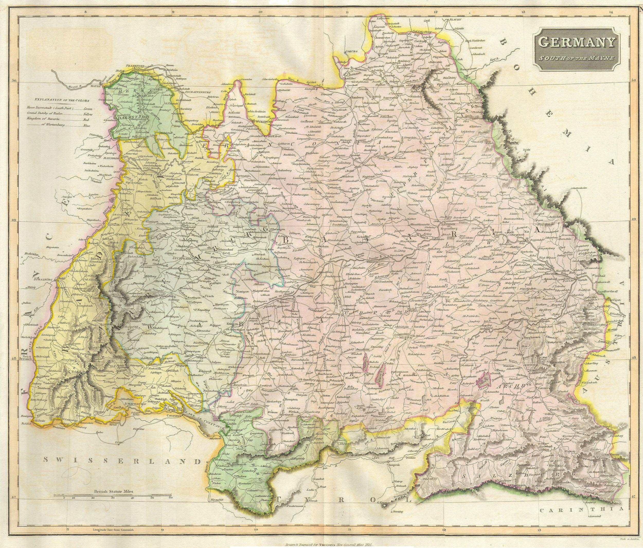
| John Thomson: Bavaria, Germany
( |
||||||||||||||
|---|---|---|---|---|---|---|---|---|---|---|---|---|---|---|
| Artist |
|
|||||||||||||
| Title |
Bavaria, Germany |
|||||||||||||
| Description |
English: This hand colored map is a steel plate engraving, dating to 1814 by the important English mapmaker John Thomson. It depicts the Bavaria and Southern Germany in stupendous detail. Thomson maps are known for their stunning color, awe inspiring size, and magnificent detail. Thomson’s work, including this map, represents some of the finest cartographic art of the 19th century. |
|||||||||||||
| Date | 1814 | |||||||||||||
| Dimensions | height: 20 in (50.8 cm); width: 24 in (60.9 cm) | |||||||||||||
| Accession number |
Geographicus link: Bavaria-t-1814 |
|||||||||||||
| Source/Photographer |
|
|||||||||||||
| Permission (Reusing this file) |
|
|||||||||||||
File history
Click on a date/time to view the file as it appeared at that time.
| Date/Time | Thumbnail | Dimensions | User | Comment | |
|---|---|---|---|---|---|
| current | 23:29, 24 March 2011 | | 2,500 × 2,131 (1.34 MB) | BotMultichillT (talk | contribs) | {{subst:User:Multichill/Geographicus |link=http://www.geographicus.com/P/AntiqueMap/Bavaria-t-1814 |product_name=1814 Thomson Map of Bavaria, Germany |map_title=Bavaria, Germany |description=This hand colored map is a steel plate engraving, dating to 1814 |
You cannot overwrite this file.
File usage on Commons
The following page uses this file:
File usage on other wikis
The following other wikis use this file:
- Usage on de.wikipedia.org