File:1757 Celi.jpg
Jump to navigation
Jump to search

Size of this preview: 800 × 518 pixels. Other resolutions: 320 × 207 pixels | 640 × 414 pixels | 1,024 × 663 pixels | 1,280 × 828 pixels | 2,560 × 1,656 pixels | 6,800 × 4,400 pixels.
Original file (6,800 × 4,400 pixels, file size: 3.71 MB, MIME type: image/jpeg)
Captions
Captions
Add a one-line explanation of what this file represents
Summary
[edit]
| Description |
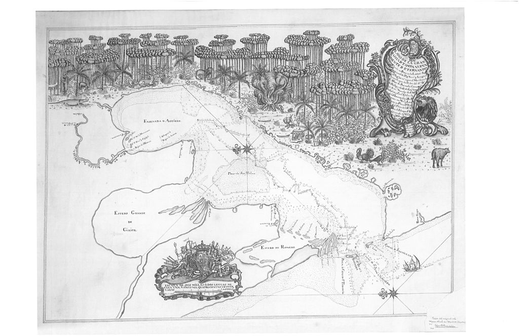
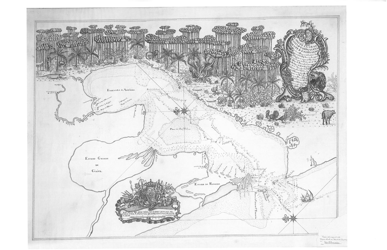
English: The earliest known map of the Tampa Bay area. It is by Spanish explorer Don Francisco Maria Celi of the Spanish Royal Fleet, 1757. This copy is from the South Florida History Museum, the original is in the Museo Naval de Madrid, Spain.
The river on the upper left of the map is the Hillsborough, the area designated as "El Pinal de la Cruz de Santa Teresa" is today in Temple Terrace. "El Salto" are the rapids at Hillsborough River State Park, where the journey ended. The map is oriented so that east is to the top. |
| Date | |
| Source | Public domain |
| Author | Unknown author |
| Permission (Reusing this file) |
Public domain |
Licensing
[edit]
This media file is in the public domain in the United States. This applies to U.S. works where the copyright has expired, often because its first publication occurred prior to January 1, 1929, and if not then due to lack of notice or renewal. See this page for further explanation.
|
 | |
 |
File history
Click on a date/time to view the file as it appeared at that time.
| Date/Time | Thumbnail | Dimensions | User | Comment | |
|---|---|---|---|---|---|
| current | 17:40, 6 February 2009 | | 6,800 × 4,400 (3.71 MB) | Toltec (talk | contribs) | {{Information |Description={{en|1= The earliest known map of the Tampa Bay area. It is by Spanish explorer Don Francisco Maria Celi of the Spanish Royal Fleet, 1757. This copy is from the South Florida History Museum, the original is in the Museo Naval |
You cannot overwrite this file.
File usage on Commons
There are no pages that use this file.
File usage on other wikis
The following other wikis use this file:
- Usage on azb.wikipedia.org
- Usage on en.wikipedia.org
- Usage on ig.wikipedia.org