File:1745 Seale Map or Chart of the Mediterranean Sea - Geographicus - Mediterranean-seale-1845.jpg
Jump to navigation
Jump to search

Size of this preview: 800 × 390 pixels. Other resolutions: 320 × 156 pixels | 640 × 312 pixels | 1,024 × 500 pixels | 1,280 × 625 pixels | 4,000 × 1,952 pixels.
Original file (4,000 × 1,952 pixels, file size: 1.44 MB, MIME type: image/jpeg)
Captions
Captions
Add a one-line explanation of what this file represents
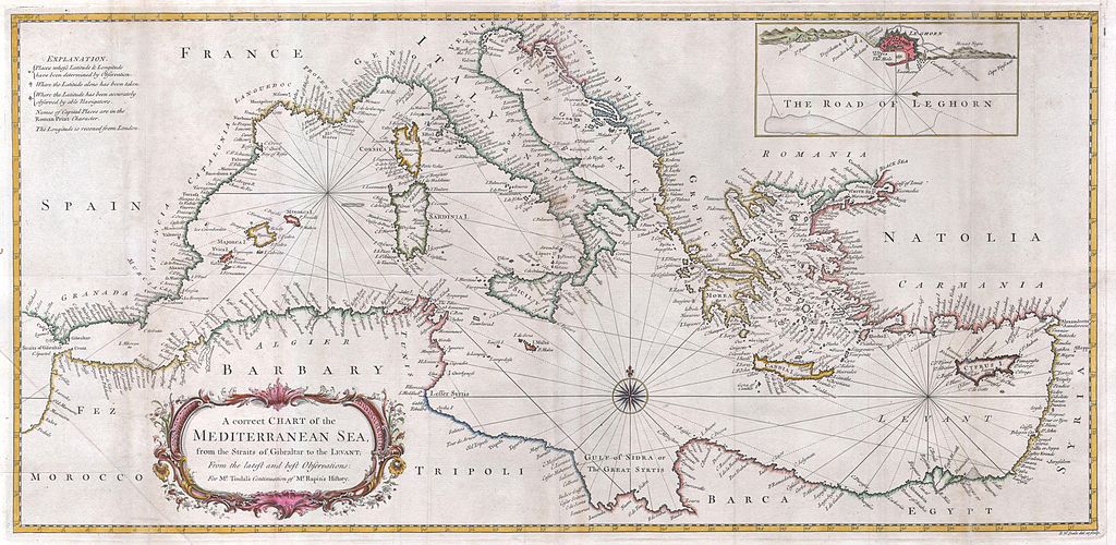
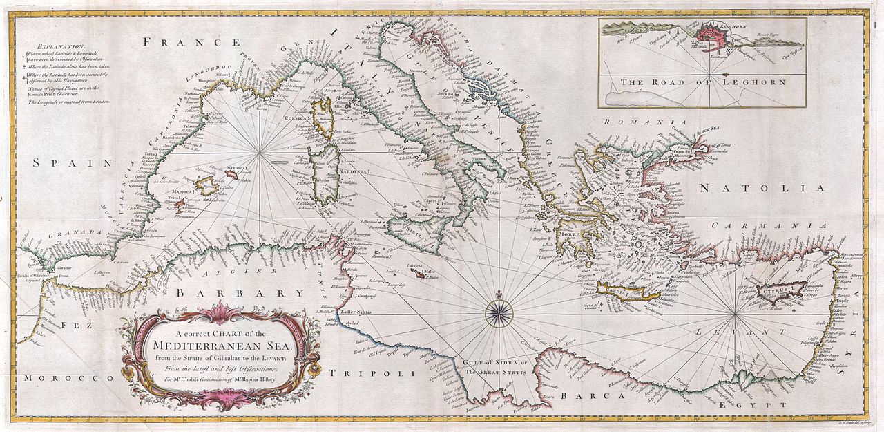
| Richard William Seale: A correct Chart of the Mediterranean Sea, from the Straits of Gibraltar to the Levant; From the latest and best Observations: for Mr. Tindal’s Continuation of Mr. Rapin’s History..
( |
||||||||||||||||||||
|---|---|---|---|---|---|---|---|---|---|---|---|---|---|---|---|---|---|---|---|---|
| Artist |
|
|||||||||||||||||||
| Title |
A correct Chart of the Mediterranean Sea, from the Straits of Gibraltar to the Levant; From the latest and best Observations: for Mr. Tindal’s Continuation of Mr. Rapin’s History.. |
|||||||||||||||||||
| Description |
English: A large and attractive hand colored 1745 sea chart of the entire Mediterranean region. Drawn in considerable detail with most ports clearly labeled. Large title cartouche in the lower left quadrant. Rumb lines throughout with a decorative compass rose at center. An inset depicts “The Road to Leghorn” or Livorno harbor. |
|||||||||||||||||||
| Date | 1745 | |||||||||||||||||||
| Dimensions | height: 14 in (35.5 cm); width: 28.5 in (72.3 cm) | |||||||||||||||||||
| Accession number |
Geographicus link: Mediterranean-seale-1845 |
|||||||||||||||||||
| Source/Photographer |
|
|||||||||||||||||||
| Permission (Reusing this file) |
|
|||||||||||||||||||
File history
Click on a date/time to view the file as it appeared at that time.
| Date/Time | Thumbnail | Dimensions | User | Comment | |
|---|---|---|---|---|---|
| current | 11:34, 24 March 2011 | | 4,000 × 1,952 (1.44 MB) | BotMultichillT (talk | contribs) | {{subst:User:Multichill/Geographicus |link=http://www.geographicus.com/P/AntiqueMap/Mediterranean-seale-1845 |product_name=1745 Seale Map or Chart of the Mediterranean Sea |map_title=A correct Chart of the Mediterranean Sea, from the Straits of Gibraltar |
You cannot overwrite this file.
File usage on Commons
The following page uses this file:
File usage on other wikis
The following other wikis use this file:
- Usage on es.wikipedia.org