File:1738 Ratelband Map of the Balkans ( Bosnia, Serbia, Bulgaria, Rumania ) - Geographicus - Balkans-lafeuille-1738.jpg
Jump to navigation
Jump to search
Size of this preview: 800 × 345 pixels. Other resolutions: 320 × 138 pixels | 640 × 276 pixels | 1,024 × 441 pixels | 1,280 × 552 pixels | 2,560 × 1,104 pixels | 4,997 × 2,154 pixels.
Original file (4,997 × 2,154 pixels, file size: 1.99 MB, MIME type: image/jpeg)
Captions
Captions
Add a one-line explanation of what this file represents
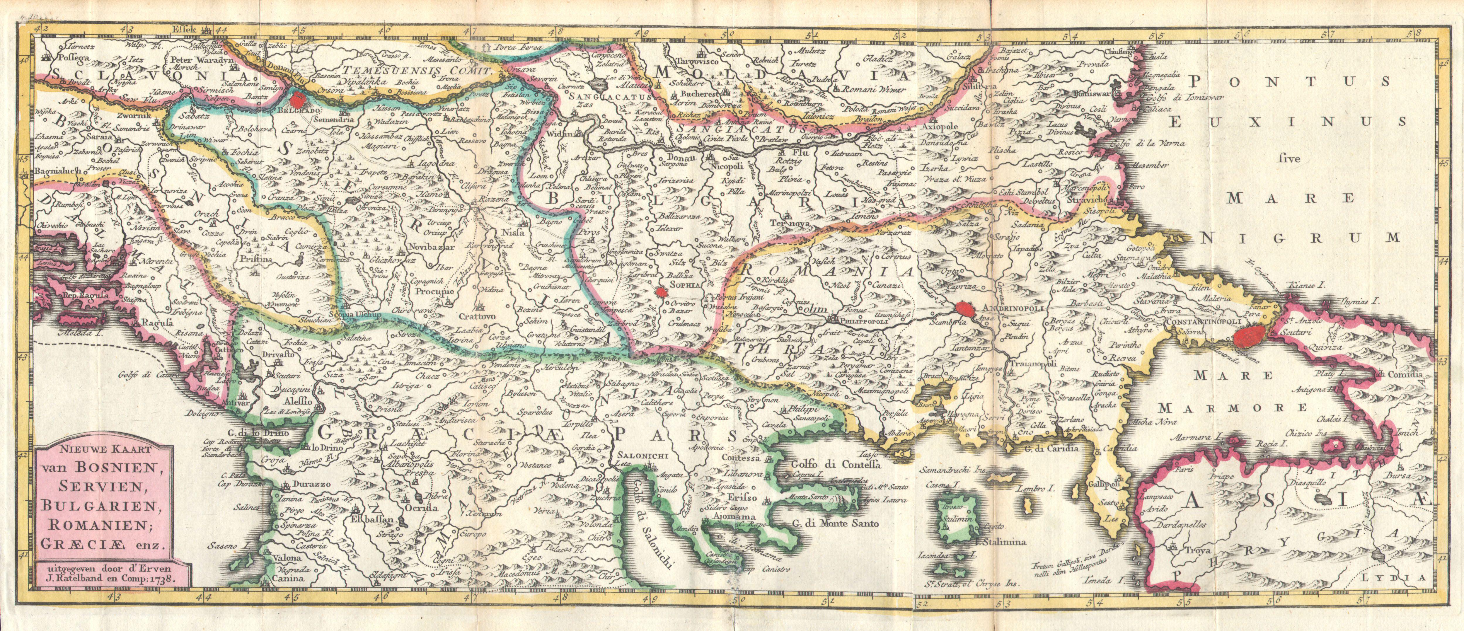
| Nieuwe Kaart van Bosnien, Servien, Bulgarien, Romanien; Graeciae enz..
( |
||||||||||||||||||||
|---|---|---|---|---|---|---|---|---|---|---|---|---|---|---|---|---|---|---|---|---|
| Artist |
|
|||||||||||||||||||
| Title |
Nieuwe Kaart van Bosnien, Servien, Bulgarien, Romanien; Graeciae enz.. |
|||||||||||||||||||
| Description |
English: This is a rare and unusual 1738 map of the Balkans by J. Ratelband. Likely revised and updated from earlier charts by the De La Feuille family. Depicts from modern day Albania (Dalmatia) eastward through Bosnia, Serbia, Bulgaria and Rumania to the Black Sea (Pontus Euxinus). Extends south as far as modern Greece and includes parts of Asia Minor in the lower right quadrant. Prominently labels the cities of Constantinople (Istanbul, Andrinopoli, Belgrade, and Sophia. Curiously the location of the ancient city of Troy is also labeled with considerable accuracy considering that it was supposedly “lost” until Heinrich Schliemann “discovered” it in 1870. Dutch title cartouche in the lower left quadrant. This map was originally prepared for inclusion as chart no. |
|||||||||||||||||||
| Date | 1738 | |||||||||||||||||||
| Dimensions | height: 7 in (17.7 cm); width: 16.2 in (41.2 cm) | |||||||||||||||||||
| Accession number |
Geographicus link: Balkans-lafeuille-1738 |
|||||||||||||||||||
| Source/Photographer |
|
|||||||||||||||||||
| Permission (Reusing this file) |
|
|||||||||||||||||||
File history
Click on a date/time to view the file as it appeared at that time.
| Date/Time | Thumbnail | Dimensions | User | Comment | |
|---|---|---|---|---|---|
| current | 03:14, 25 March 2011 | | 4,997 × 2,154 (1.99 MB) | BotMultichillT (talk | contribs) | {{subst:User:Multichill/Geographicus |link=http://www.geographicus.com/P/AntiqueMap/Balkans-lafeuille-1738 |product_name=1738 Ratelband Map of the Balkans ( Bosnia, Serbia, Bulgaria, Rumania ) |map_title=Nieuwe Kaart van Bosnien, Servien, Bulgarien, Roman |
You cannot overwrite this file.
File usage on Commons
The following page uses this file:
_-_Geographicus_-_Balkans-lafeuille-1738.jpg)
_-_Geographicus_-_Balkans-lafeuille-1738.jpg&oldid=744679722)