File:16E Sept 15 2014 1835Z (true).jpg
Jump to navigation
Jump to search
Size of this preview: 494 × 600 pixels. Other resolutions: 198 × 240 pixels | 395 × 480 pixels | 632 × 768 pixels | 843 × 1,024 pixels | 1,686 × 2,048 pixels | 2,946 × 3,578 pixels.
Original file (2,946 × 3,578 pixels, file size: 1.06 MB, MIME type: image/jpeg)
Captions
Captions
Add a one-line explanation of what this file represents
Summary
[edit]| Description |
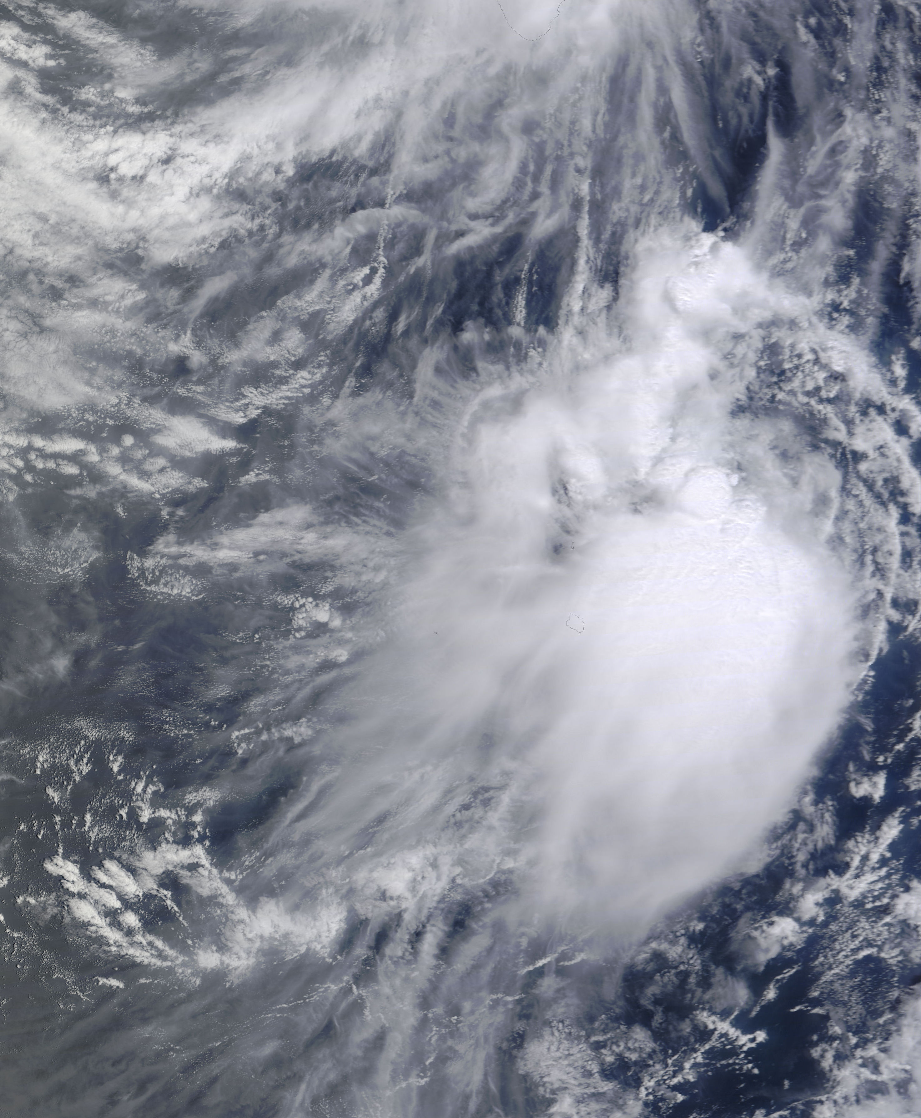
English: Tropical Depression Sixteen (16E) over Baja California |
| Date | |
| Source | http://lance-modis.eosdis.nasa.gov/cgi-bin/imagery/single.cgi?image=Odile.A2014258.1835.250m.jpg |
| Author | National Aeronautics and Space Administration, LANCE-MODIS |
| Metadata | http://lance-modis.eosdis.nasa.gov/cgi-bin/imagery/single.cgi?metadata=Odile.A2014258.1835.txt |
| Satellite | Terra |
| Camera location | | View this and other nearby images on: OpenStreetMap |
|---|
Licensing
[edit]| This file is in the public domain in the United States because it was solely created by NASA. NASA copyright policy states that "NASA material is not protected by copyright unless noted". (See Template:PD-USGov, NASA copyright policy page or JPL Image Use Policy.) | ||
 |
Warnings:
|

.jpg&action=edit§ion=1)
.jpg¶ms=025.000000_N_-113.800000_E_globe:Earth_type:camera__&language=en)
.jpg&action=edit§ion=2)
File history
Click on a date/time to view the file as it appeared at that time.
| Date/Time | Thumbnail | Dimensions | User | Comment | |
|---|---|---|---|---|---|
| current | 02:53, 14 May 2016 | | 2,946 × 3,578 (1.06 MB) | Nino Marakot (talk | contribs) | File:Odile Sept 15 2014 1835Z.jpg cropped 51 % horizontally and 54 % vertically using CropTool with precise mode. |
You cannot overwrite this file.
File usage on Commons
The following page uses this file:
.jpg&oldid=911579978)