File:1630s NorthEnd Boston byWilliamAppleton.png
Original file (811 × 715 pixels, file size: 813 KB, MIME type: image/png)
Captions
Captions
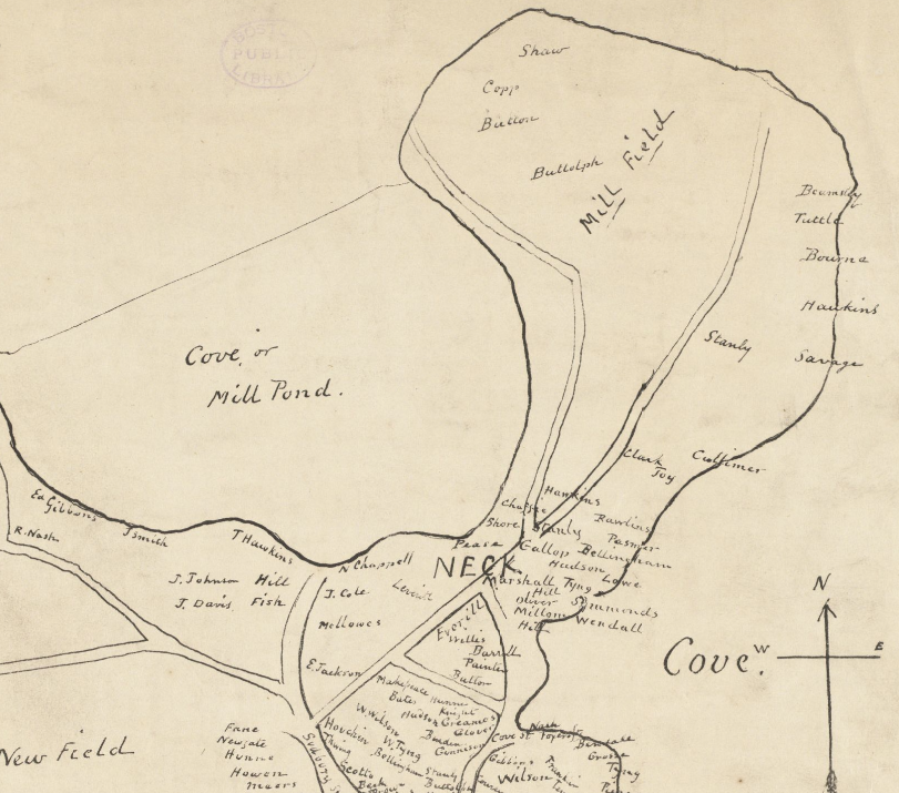
| Description |
English: Detail of map of Boston, showing North End and vicinity. |
| Date | between circa 1630 and circa 1650 |
| Source | Boston Public Library, Norman B. Leventhal Map Center. http://maps.bpl.org |
| Author | William Appleton |
|
This work is in the public domain in its country of origin and other countries and areas where the copyright term is the author's life plus 70 years or fewer.
| |
| This file has been identified as being free of known restrictions under copyright law, including all related and neighboring rights. | |
File history
Click on a date/time to view the file as it appeared at that time.
| Date/Time | Thumbnail | Dimensions | User | Comment | |
|---|---|---|---|---|---|
| current | 12:29, 19 October 2009 | | 811 × 715 (813 KB) | M2545 (talk | contribs) | {{Information |Description={{en|1=Detail of map of Boston, showing North End and vicinity.}} |Source=Boston Public Library, Norman B. Leventhal Map Center. http://maps.bpl.org |Author=William Appleton |Date=ca.1630-1650 |Permission= |other_versions= }} [ |
You cannot overwrite this file.
File usage on Commons
There are no pages that use this file.