File:15-05-09-Biosphärenreservat-Schorfheide-Chorin-Totalreservat-Plagefenn-DSCF5524-RalfR.jpg
Original file (3,264 × 4,896 pixels, file size: 4.49 MB, MIME type: image/jpeg)
Captions
Summary
[edit]Description15-05-09-Biosphärenreservat-Schorfheide-Chorin-Totalreservat-Plagefenn-DSCF5524-RalfR.jpg |
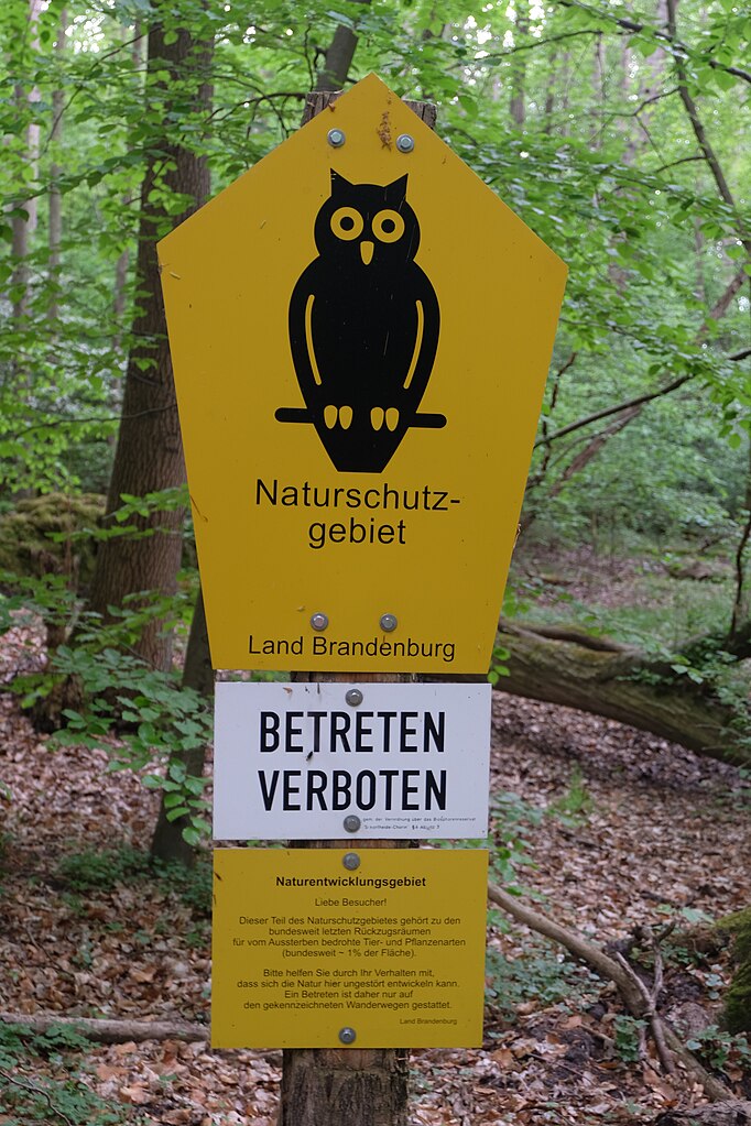
Deutsch: Naturschutzgebietsschild mit Ergänzungschild „Betreten verboten“, Totalreservat Plagefenn des Biosphärenreservates Schorfheide-Chorin |
|||||||||||||||||||||||||
Date | ||||||||||||||||||||||||||
Source | Own work | |||||||||||||||||||||||||
Author |
creator QS:P170,Q15080600
|
|||||||||||||||||||||||||
Permission (Reusing this file) |
creator QS:P170,Q15080600
|
Camera location | 52° 53′ 14.6″ N, 13° 57′ 19.53″ E | View this and other nearby images on: OpenStreetMap | 52.887389; 13.955426 |
---|
Licensing
[edit]Permission is granted to copy, distribute and/or modify this document under the terms of the GNU Free Documentation License, Version 1.2 only as published by the Free Software Foundation; with no Invariant Sections, no Front-Cover Texts, and no Back-Cover Texts. A copy of the license is included in the section entitled GNU Free Documentation License. | 1.2 onlyhttp://www.gnu.org/licenses/old-licenses/fdl-1.2.htmlGFDL 1.2GNU Free Documentation License 1.2truetrue |
This image was uploaded as part of Wiki Loves Earth 2015.
aragonés | العربية | asturianu | azərbaycanca | беларуская (тарашкевіца) | български | বাংলা | brezhoneg | català | čeština | Cymraeg | Deutsch | Ελληνικά | English | español | eesti | euskara | فارسی | français | galego | עברית | hrvatski | հայերեն | Bahasa Indonesia | italiano | 日本語 | ქართული | 한국어 | latviešu | македонски | മലയാളം | मराठी | Bahasa Melayu | norsk bokmål | नेपाली | Nederlands | norsk | polski | português | português do Brasil | русский | sicilianu | shqip | slovenščina | српски / srpski | svenska | ไทย | Türkçe | українська | اردو | 中文 | 中文(台灣) | +/− |
File history
Click on a date/time to view the file as it appeared at that time.
Date/Time | Thumbnail | Dimensions | User | Comment | |
---|---|---|---|---|---|
current | 13:42, 11 May 2015 | 3,264 × 4,896 (4.49 MB) | Ralf Roletschek (talk | contribs) |
You cannot overwrite this file.
File usage on Commons
The following 3 pages use this file:
Metadata
This file contains additional information such as Exif metadata which may have been added by the digital camera, scanner, or software program used to create or digitize it. If the file has been modified from its original state, some details such as the timestamp may not fully reflect those of the original file. The timestamp is only as accurate as the clock in the camera, and it may be completely wrong.
Camera manufacturer | FUJIFILM |
---|---|
Camera model | X-M1 |
Exposure time | 1/10 sec (0.1) |
F-number | f/5.3 |
ISO speed rating | 200 |
Date and time of data generation | 15:14, 9 May 2015 |
Lens focal length | 37.1 mm |
Latitude | 52° 53′ 14.6″ N |
Longitude | 13° 57′ 19.53″ E |
Orientation | Rotated 90° CW |
Horizontal resolution | 72 dpi |
Vertical resolution | 72 dpi |
Software used | Digital Camera X-M1 Ver1.00 |
File change date and time | 15:14, 9 May 2015 |
Y and C positioning | Co-sited |
Exposure Program | Normal program |
Exif version | 2.3 |
Date and time of digitizing | 15:14, 9 May 2015 |
Meaning of each component |
|
Image compression mode | 3.2 |
APEX shutter speed | 3.33 |
APEX aperture | 4.8 |
APEX brightness | 2.05 |
APEX exposure bias | 0 |
Maximum land aperture | 3.6 APEX (f/3.48) |
Metering mode | Average |
Light source | Unknown |
Flash | Flash did not fire, compulsory flash suppression |
Supported Flashpix version | 1 |
Color space | sRGB |
Focal plane X resolution | 2,092 |
Focal plane Y resolution | 2,092 |
Focal plane resolution unit | 3 |
Sensing method | One-chip color area sensor |
File source | Digital still camera |
Scene type | A directly photographed image |
Custom image processing | Normal process |
Exposure mode | Auto exposure |
White balance | Auto white balance |
Focal length in 35 mm film | 56 mm |
Supported Flashpix version | 1 |
Geodetic survey data used | WGS-84 |
GPS date | 15:14, 9 May 2015 |
GPS tag version | 2.2.0.0 |
Image width | 4,896 px |
Image height | 3,264 px |
Scene capture type | Standard |
Sharpness | Normal |
Subject distance range | Unknown |
Compression scheme | JPEG (old) |
Structured data
Items portrayed in this file
depicts
9 May 2015
52°53'14.60087"N, 13°57'19.53439"E
image/jpeg
2da7a6f66b0c4deff8f514b9a53140ce976a1dd4
4,703,139 byte
4,896 pixel
3,264 pixel
- Images by Ralf Roletschek/x
- Supported by Wikimedia Österreich
- Files with coordinates missing SDC location of creation
- GFDL-1.2
- Images from Wiki Loves Earth 2015
- Images from Wiki Loves Earth 2015 in Germany
- Images from Wiki Loves Earth missing SDC depicts
- Images from Wiki Loves Earth missing SDC location of creation
- Images from Wiki Loves Earth 2015, DE-BB
- Brandenburg photographs taken on 2015-05-09