File:140626 Antermoia-Hütte.jpg
Original file (4,737 × 3,158 pixels, file size: 4.49 MB, MIME type: image/jpeg)
Captions
Contents
Summary
[edit]Description140626 Antermoia-Hütte.jpg |
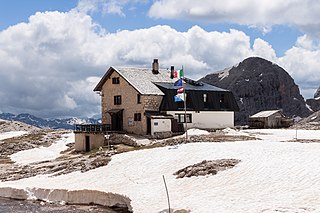
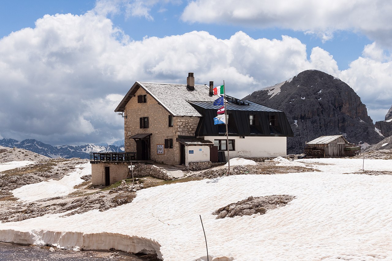
Deutsch: Die Antermoia-Schutzhütte, Blick von Westen.
English: Antermoia refuge as seen from west. Italiano: Il rifugio Antermoia visto da ovest. |
Date | |
Source | Own work |
Author | Ansgar Koreng |
Attribution (required by the license) InfoField | Ansgar Koreng / |
InfoField | Ansgar Koreng |
Object location | 46° 28′ 37.3″ N, 11° 39′ 50.2″ E | View this and other nearby images on: OpenStreetMap | 46.477029; 11.663945 |
---|
Licensing
[edit]- You are free:
- to share – to copy, distribute and transmit the work
- to remix – to adapt the work
- Under the following conditions:
- attribution – You must give appropriate credit, provide a link to the license, and indicate if changes were made. You may do so in any reasonable manner, but not in any way that suggests the licensor endorses you or your use.
- share alike – If you remix, transform, or build upon the material, you must distribute your contributions under the same or compatible license as the original.
Modifications
[edit]
Please do not upload a modified image here without consultation with the Author. The author would like to make corrections only at his own source. This ensures that the changes are preserved. |
Assessment
[edit]
This image has been assessed under the valued image criteria and is considered the most valued image on Commons within the scope: Antermoia refuge, View from West.. You can see its nomination here. |
File history
Click on a date/time to view the file as it appeared at that time.
Date/Time | Thumbnail | Dimensions | User | Comment | |
---|---|---|---|---|---|
current | 18:31, 23 November 2014 | 4,737 × 3,158 (4.49 MB) | Code (talk | contribs) | New RAW development. | |
16:35, 1 July 2014 | 4,752 × 3,168 (2.12 MB) | Code (talk | contribs) | User created page with UploadWizard |
You cannot overwrite this file.
File usage on Commons
The following 3 pages use this file:
File usage on other wikis
The following other wikis use this file:
- Usage on de.wikipedia.org
- Usage on en.wikivoyage.org
- Usage on it.wikipedia.org
Metadata
This file contains additional information such as Exif metadata which may have been added by the digital camera, scanner, or software program used to create or digitize it. If the file has been modified from its original state, some details such as the timestamp may not fully reflect those of the original file. The timestamp is only as accurate as the clock in the camera, and it may be completely wrong.
Camera manufacturer | Canon |
---|---|
Camera model | Canon EOS 500D |
Author | Ansgar Koreng |
Copyright holder |
|
Exposure time | 1/250 sec (0.004) |
F-number | f/14 |
ISO speed rating | 100 |
Date and time of data generation | 12:48, 26 June 2014 |
Lens focal length | 37 mm |
Latitude | 46° 28′ 37.31″ N |
Longitude | 11° 39′ 50.2″ E |
Image title |
|
Short title |
|
Horizontal resolution | 240 dpi |
Vertical resolution | 240 dpi |
Software used | Adobe Photoshop Lightroom 5.7 (Windows) |
File change date and time | 12:48, 26 June 2014 |
Exposure Program | Landscape mode (for landscape photos with the background in focus) |
Exif version | 2.3 |
Date and time of digitizing | 12:48, 26 June 2014 |
APEX shutter speed | 7.965784 |
APEX aperture | 7.61471 |
APEX exposure bias | 0 |
Maximum land aperture | 4.5 APEX (f/4.76) |
Subject distance | 5.82 meters |
Metering mode | Pattern |
Flash | Flash did not fire, compulsory flash suppression |
DateTimeDigitized subseconds | 38 |
Color space | sRGB |
Focal plane X resolution | 5,315.4362416107 |
Focal plane Y resolution | 5,342.3271500843 |
Focal plane resolution unit | inches |
Custom image processing | Normal process |
Exposure mode | Auto exposure |
White balance | Auto white balance |
Scene capture type | Standard |
GPS time (atomic clock) | 12:48 |
Geodetic survey data used | WGS-84 |
GPS date | 26 June 2014 |
GPS tag version | 0.0.2.2 |
Lens used | EF-S18-55mm f/3.5-5.6 IS STM |
Owner of camera | Ansgar Koreng |
Serial number of camera | 2350753186 |
Keywords |
|
Date metadata was last modified | 20:27, 23 November 2014 |
Unique ID of original document | 285A040693BC4D461AAAC4C05C204B84 |
Copyright status | Copyrighted |
IIM version | 4 |
Structured data
Items portrayed in this file
depicts
26 June 2014
46°28'37.304"N, 11°39'50.202"E
image/jpeg
4c095a766a59c19c54755541e76b054e4b59f728
4,710,014 byte
3,158 pixel
4,737 pixel
- Information field template with formatting
- Files with coordinates missing SDC location of creation
- CC-BY-SA-3.0-DE
- Self-published work
- Valued images sorted by promotion date
- Valued images promoted 2014-12
- Valued images missing SDC depicts
- Valued images by User:Code
- Valued images of Trentino-South Tyrol
- Photos by User:Code
- Pictures of South Tyrol by User:Code
- Taken with Canon EOS 500D
- Taken with Canon EF-S 18-55mm F3.5-5.6 IS STM