File:1362 LK George River (pano).jpg
Jump to navigation
Jump to search

Size of this preview: 800 × 459 pixels. Other resolutions: 320 × 184 pixels | 640 × 367 pixels | 1,024 × 588 pixels | 1,280 × 735 pixels | 2,018 × 1,158 pixels.
Original file (2,018 × 1,158 pixels, file size: 284 KB, MIME type: image/jpeg)
Captions
Captions
Add a one-line explanation of what this file represents
Summary
[edit].jpg&action=edit§ion=1)
| Description |
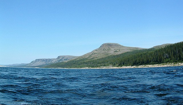
English: George River, Pyramid Peak on the right
Français : Rivière George avec le pic Pyramide à la droite dans la réserve de parc national des Monts-Pyramide |
| Date | 18 September 2008 (original upload date) |
| Source | Transferred from en.wikipedia to Commons. |
| Author | Lkovac at English Wikipedia |
| Camera location | | View this and other nearby images on: OpenStreetMap |
|---|
.jpg¶ms=057.480183_N_-065.279728_E_globe:Earth_type:camera__&language=en)
Licensing
[edit].jpg&action=edit§ion=2)
Lkovac at the English Wikipedia, the copyright holder of this work, hereby publishes it under the following license:

|
Permission is granted to copy, distribute and/or modify this document under the terms of the GNU Free Documentation License, Version 1.2 or any later version published by the Free Software Foundation; with no Invariant Sections, no Front-Cover Texts, and no Back-Cover Texts. A copy of the license is included in the section entitled GNU Free Documentation License. |
| This file is licensed under the Creative Commons Attribution-Share Alike 3.0 Unported license. | ||
| Attribution: Lkovac at the English Wikipedia | ||
| ||
| This licensing tag was added to this file as part of the GFDL licensing update. |
Original upload log
[edit].jpg&action=edit§ion=3)
The original description page was here. All following user names refer to en.wikipedia.
- 2008-09-18 13:16 Lkovac 2018×1158× (290572 bytes) {{Information|Description=George River, Pyramid Peak on the right|Source=Lester Kovac|Date=July 23,2008|Author=Lester Kovac|Permission=free documentation license|Copyright=2008 Lester Kovac}} {{coord|57|28|48.66|N|65|16|47.02|W|display=title}}
File history
Click on a date/time to view the file as it appeared at that time.
| Date/Time | Thumbnail | Dimensions | User | Comment | |
|---|---|---|---|---|---|
| current | 18:02, 2 October 2011 | | 2,018 × 1,158 (284 KB) | Fralambert (talk | contribs) | {{Information |Description={{en|''no original description''}} |Source=Transferred from [http://en.wikipedia.org en.wikipedia] |Date={{Date|2008|09|18}} (original upload date) |Author=. Original uploader was Lkovac at [http://en.wikiped |
You cannot overwrite this file.
File usage on Commons
The following 2 pages use this file:
File usage on other wikis
The following other wikis use this file:
- Usage on arz.wikipedia.org
- Usage on bg.wikipedia.org
- Usage on ca.wikimedia.org
- Usage on ceb.wikipedia.org
- Usage on en.wikipedia.org
- Usage on es.wikipedia.org
- Usage on fr.wikipedia.org
- Usage on fr.wikivoyage.org
- Usage on hy.wikipedia.org
- Usage on kk.wikipedia.org
- Usage on no.wikipedia.org
- Usage on ru.wikipedia.org
- Usage on sv.wikipedia.org
- Usage on tr.wikipedia.org
- Usage on www.wikidata.org
.jpg&oldid=743341226)