File:12-valdivia-osorno.jpg
Jump to navigation
Jump to search

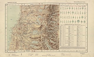
Size of this preview: 800 × 485 pixels. Other resolutions: 320 × 194 pixels | 640 × 388 pixels | 1,024 × 621 pixels | 1,280 × 776 pixels | 2,560 × 1,552 pixels | 5,502 × 3,336 pixels.
Original file (5,502 × 3,336 pixels, file size: 3.41 MB, MIME type: image/jpeg)
Captions
Captions
Add a one-line explanation of what this file represents
Summary
[edit]
| Description |
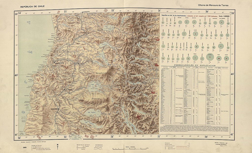
Español: Los mapas provinciales del “Atlas Centenario”, surgen de la preocupación del Presidente Pedro Montt por contar con un buen mapa de Chile. Los mapas fueron encargados a don Luis Risopatrón, director de la Oficina de Mensura de Tierras. Para la realización de este importante encargo presidencial, Risopatrón contó con la colaboración de los cartógrafos don Nicanor Boloña y Dañino y don Luis Ossandón y Cressy, quienes compilaron todos aquellos trabajos cartográficos disponibles a la fecha. El total de hojas que componen el mapa alcanza a 22 y se fueron editando entre 1908 y 1911, abarcando desde los 17° a los 57° grados de latitud sur. Su título oficial es: “Mapa de Chile. Ejecutado por orden de S.E. el Presidente de la República Excmo. Señor don Pedro Montt. Oficina de Mensura de Tierras. Edición Centenaria 1910.” |
| Date | |
| Source |
file:Risopatron-mapas-MC0073683-arica-temuco 01.pdf file:Risopatron-mapas-MC0073683-valdivia-cabo-de-hornos.pdf |
| Author | Nicanor Boloña y Dañino, Luis Ossandón y Cressy, Luis Risopatrón |
Licensing
[edit]
|
This work is in the public domain in its country of origin and other countries and areas where the copyright term is the author's life plus 70 years or fewer. This work is in the public domain in the United States because it was published (or registered with the U.S. Copyright Office) before January 1, 1929. | |
| This file has been identified as being free of known restrictions under copyright law, including all related and neighboring rights. | |
File history
Click on a date/time to view the file as it appeared at that time.
| Date/Time | Thumbnail | Dimensions | User | Comment | |
|---|---|---|---|---|---|
| current | 16:21, 6 April 2020 | | 5,502 × 3,336 (3.41 MB) | Juan Villalobos (talk | contribs) | Uploaded a work by Nicanor Boloña y Dañino, Luis Ossandón y Cressy, Luis Risopatrón from file:Risopatron-mapas-MC0073683-arica-temuco 01.pdf file:Risopatron-mapas-MC0073683-valdivia-cabo-de-hornos.pdf with UploadWizard |
You cannot overwrite this file.
File usage on Commons
There are no pages that use this file.
File usage on other wikis
The following other wikis use this file:
- Usage on es.wikipedia.org
- Lago Puyehue
- Río San Pedro (Calle-Calle)
- Lago Rupanco
- Río Calle-Calle
- Río Cruces
- Río Bueno
- Río Toltén
- Río Rahue (Bueno)
- Río Damas
- Lago Maihue
- Termas de Puyehue
- Río Pilmaiquén (Bueno)
- Lago Colico
- Río Hua-Hum
- Lago Huishue
- Termas Liquiñe
- Río Liucura
- Río Calcurrupe
- Río Hueinahue
- Río Llanquihue
- Cordillera del Mahuidanche
- Río Negro (Rahue)
- Río Coihueco
- Río Llollelhue
- Río Neltume
- Río Fuy
- Pucura
- Traitraico
- Río Liquiñe
- Río Carranco
- Río Reyehueico
- Río Cua-Cua
- Río Chanchán
- Río Lipinza
- Río Los Baños
- Río Truful
- Río Puñir
- Río Huanehue
- Río Leufucade
- Río Iñaque
- Cordillera Pelada
- Río Lingue
- Río Colún
- Río Donguil
- Río Collileufu
- Río Pichoy
- Sierra de Quinchilca
- Río Huellelhue
- Río Cholguaco
- Río Carrileufú (Pucón)
View more global usage of this file.