File:10th-century Nilakantha temple, Sunak Gujarat 404.jpg
Original file (3,300 × 4,400 pixels, file size: 8.26 MB, MIME type: image/jpeg)
Captions
Captions
Summary
[edit]
| Description |
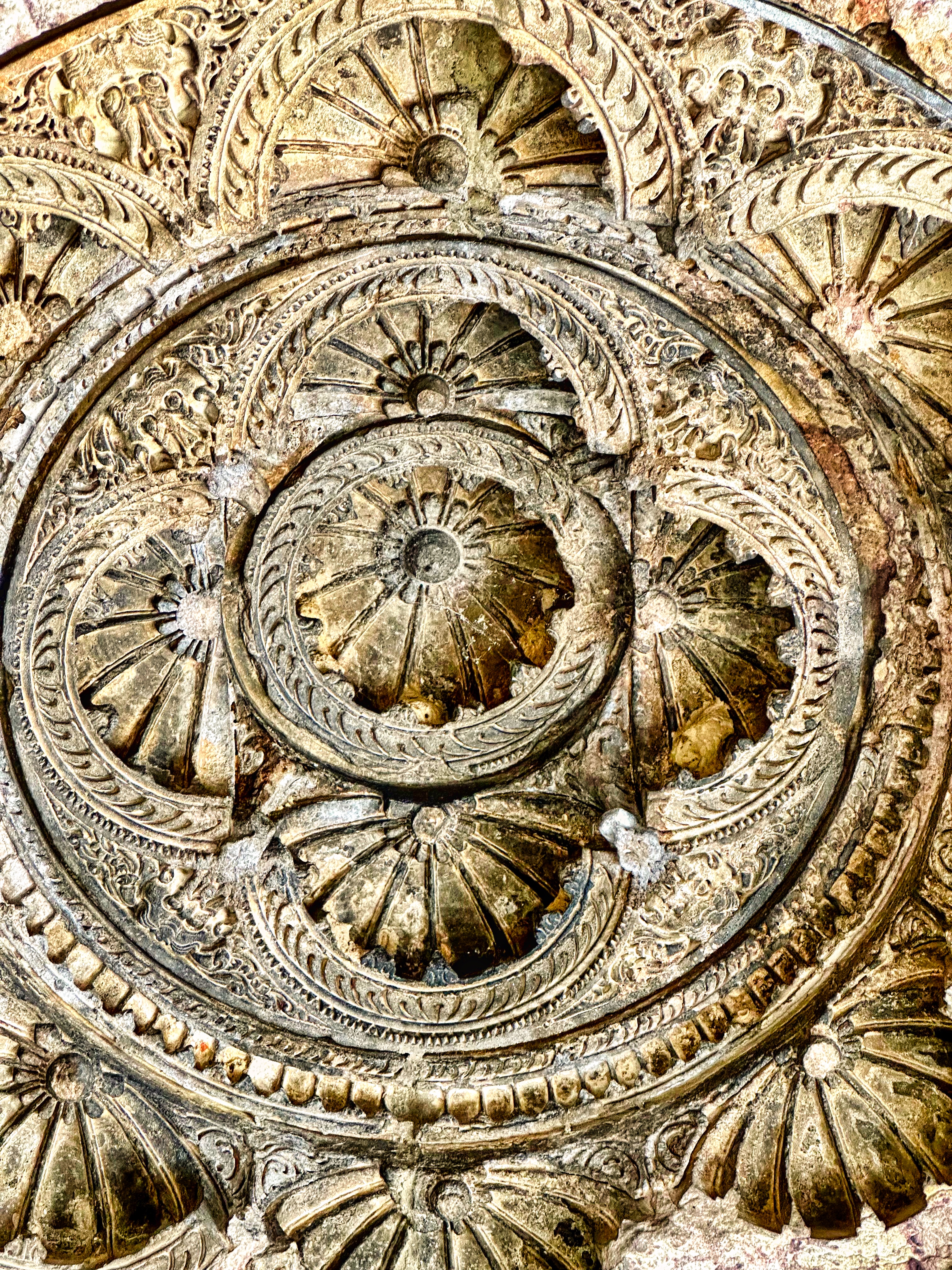
English: The Nilakantha Mahadeva temple, also called Nilkanth mandir, is a Hindu temple dedicated to Shiva in the village of Sunak, Gujarat. It is about 8 kilometers west of Unjha town in Gujarat and southwest of the historic city of Siddhapur. This temple along with the nearby Shakti temple is generally accepted by scholars to be from the 10th century, with some estimates suggesting it to be from the 11th century.
The Nilakantha temple is notable as an exemplar of the Nagara-style Hindu temple architecture with square plan. The temple faces east and consists of a mandapa, an antarala and a garbhagriya. The roof of the mandapa is supported by 16 columns with 12 forming a square, remaining flanking the north and south sides. The mandapa pillars are spaciously arranged as to let devotees gather and sit for religious ceremonies. The temple's dome is intricately carved with dedicated frame for twelve deities, of which only six mutilated Shaiva devatas art-work survive: Kali in the north, Nataraja in west, Bhairava in south being the major ones. Several inscriptions are found in the temple, but these are all from centuries after the 15th-century. This temple and its location near water tank is mentioned in an inscription found at another Hindu temple about 20 kilometers away, thereby helping it date to the 10th-century or before. Additionally, a copper plate inscription of 11th-century also mentions this temple confirming its significance to the regional Hindu community. The Nilakantha Mahadeva temple of Sunak is one of India's protected national monuments and managed by Archaeological Survey of India. |
| Date | |
| Source | Own work |
| Author | Ms Sarah Welch |
| Camera location | | View this and other nearby images on: OpenStreetMap |
|---|
Licensing
[edit]
| This file is made available under the Creative Commons CC0 1.0 Universal Public Domain Dedication. | |
| The person who associated a work with this deed has dedicated the work to the public domain by waiving all of their rights to the work worldwide under copyright law, including all related and neighboring rights, to the extent allowed by law. You can copy, modify, distribute and perform the work, even for commercial purposes, all without asking permission.
|
File history
Click on a date/time to view the file as it appeared at that time.
| Date/Time | Thumbnail | Dimensions | User | Comment | |
|---|---|---|---|---|---|
| current | 19:00, 24 May 2024 | | 3,300 × 4,400 (8.26 MB) | Ms Sarah Welch (talk | contribs) | Uploaded own work with UploadWizard |
You cannot overwrite this file.
File usage on Commons
There are no pages that use this file.