File:1-flores-1725.jpg
Jump to navigation
Jump to search

Size of this preview: 800 × 572 pixels. Other resolutions: 320 × 229 pixels | 640 × 458 pixels | 1,000 × 715 pixels.
Original file (1,000 × 715 pixels, file size: 117 KB, MIME type: image/jpeg)
Captions
Captions
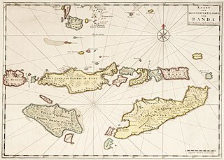
Map of the Flores Islands 1725
Summary
[edit]
| Description |
English: Map of the Flores Islands 1725. Note: Antique map of Sumba, Flores and Timor and Part of Banda, Indonesia. |
| Date | circa 1725 |
| Source | https://www.1stdibs.com/furniture/more-furniture-collectibles/collectibles-curiosities/maps/antique-map-sumba-flores-timor-part-banda-indonesia-1726/id-f_26936272/ |
| Author | Uploader Blackman Jr. |
Licensing
[edit]
|
This work is in the public domain in its country of origin and other countries and areas where the copyright term is the author's life plus 100 years or fewer. | |
| This file has been identified as being free of known restrictions under copyright law, including all related and neighboring rights. | |
File history
Click on a date/time to view the file as it appeared at that time.
| Date/Time | Thumbnail | Dimensions | User | Comment | |
|---|---|---|---|---|---|
| current | 02:10, 13 August 2022 | | 1,000 × 715 (117 KB) | Blackman Jr. (talk | contribs) | Uploaded own work with UploadWizard |
You cannot overwrite this file.
File usage on Commons
There are no pages that use this file.
File usage on other wikis
The following other wikis use this file:
- Usage on id.wikipedia.org