File:06 Buskeruds Amt 1785.png

Original file (1,280 × 1,273 pixels, file size: 4.58 MB, MIME type: image/png)
Captions
Captions
Summary
[edit]
| Description |
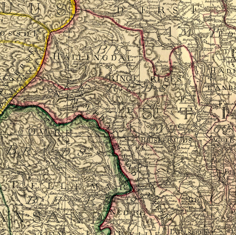
Norsk bokmål: Kartet over det sydlige Norge i 1785 tegnet av Christian Jochum Pontoppidan.
English: Map over Southern Norway in 1785 drawn by Christian Jochum Pontoppidan. |
| Date | |
| Source | http://da2.uib.no/cgi-win/WebBok.exe?slag=lesbok&bokid=pontoppidan2 |
| Author | Christian Jochum Pontoppidan |
Licensing
[edit]
|
This work is in the public domain in its country of origin and other countries and areas where the copyright term is the author's life plus 70 years or fewer.
| |
| This file has been identified as being free of known restrictions under copyright law, including all related and neighboring rights. | |
File history
Click on a date/time to view the file as it appeared at that time.
| Date/Time | Thumbnail | Dimensions | User | Comment | |
|---|---|---|---|---|---|
| current | 20:15, 12 July 2012 | | 1,280 × 1,273 (4.58 MB) | Eivindgh (talk | contribs) |
You cannot overwrite this file.
File usage on Commons
There are no pages that use this file.
File usage on other wikis
The following other wikis use this file:
- Usage on no.wikipedia.org