File:036 Carte particulière des côtes de Bretagne 1693 Neptune français.JPG
Jump to navigation
Jump to search
Size of this preview: 800 × 580 pixels. Other resolutions: 320 × 232 pixels | 640 × 464 pixels | 1,024 × 743 pixels | 1,280 × 928 pixels | 2,560 × 1,857 pixels | 2,986 × 2,166 pixels.
Original file (2,986 × 2,166 pixels, file size: 3.31 MB, MIME type: image/jpeg)
Captions
Captions
Add a one-line explanation of what this file represents
Summary
[edit]
| Description |
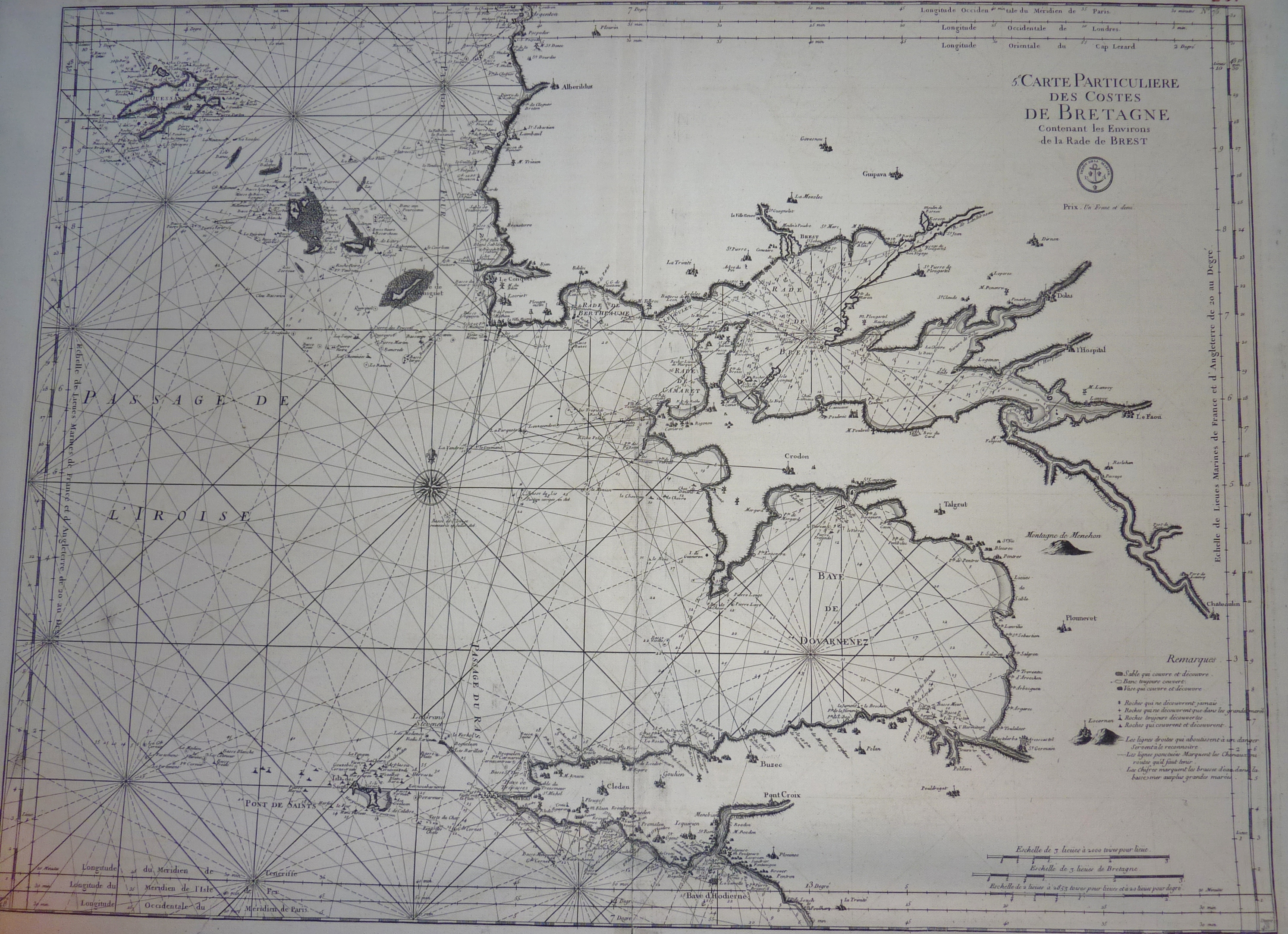
Français : Carte particulière des côtes de Bretagne parue en 1693 dans le Neptune françois, véritable atlas nautique et premier atlas officiel publié par l'Imprimerie Royale avec le financement de l'administration de la Marine. C'est une étape fondamentale dans l'évolution des documents liés à la navigation maritime. |
| Date | |
| Source | Own work |
| Author | Moreau.henri |
Licensing
[edit]
|
This is a faithful photographic reproduction of a two-dimensional, public domain work of art. The work of art itself is in the public domain for the following reason:
The official position taken by the Wikimedia Foundation is that "faithful reproductions of two-dimensional public domain works of art are public domain".
This photographic reproduction is therefore also considered to be in the public domain in the United States. In other jurisdictions, re-use of this content may be restricted; see Reuse of PD-Art photographs for details. | ||||
File history
Click on a date/time to view the file as it appeared at that time.
| Date/Time | Thumbnail | Dimensions | User | Comment | |
|---|---|---|---|---|---|
| current | 05:21, 7 December 2012 | | 2,986 × 2,166 (3.31 MB) | Moreau.henri (talk | contribs) | User created page with UploadWizard |
You cannot overwrite this file.
File usage on Commons
There are no pages that use this file.