File:02mapa02.jpg
Jump to navigation
Jump to search

Size of this preview: 412 × 600 pixels. Other resolutions: 165 × 240 pixels | 586 × 853 pixels.
Original file (586 × 853 pixels, file size: 164 KB, MIME type: image/jpeg)
Captions
Captions
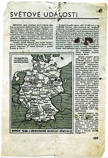
Mapa rozděleného Německa, kterou uprchlíci našli v poválečném časopisu
Summary
[edit]
| Description |
English: Mapa rozděleného Německa, kterou uprchlíci v čele s bratry Mašíny našli v poválečném časopisu |
| Date | |
| Source | Book Cesta na severozápad - Ctirad Mašín - Josef Mašín - Milan Paumer |
| Author | Městské státní zastupitelství v Praze |
Licensing
[edit]
This file is licensed under the Creative Commons Attribution-Share Alike 4.0 International license.
- You are free:
- to share – to copy, distribute and transmit the work
- to remix – to adapt the work
- Under the following conditions:
- attribution – You must give appropriate credit, provide a link to the license, and indicate if changes were made. You may do so in any reasonable manner, but not in any way that suggests the licensor endorses you or your use.
- share alike – If you remix, transform, or build upon the material, you must distribute your contributions under the same or compatible license as the original.
File history
Click on a date/time to view the file as it appeared at that time.
| Date/Time | Thumbnail | Dimensions | User | Comment | |
|---|---|---|---|---|---|
| current | 10:29, 27 October 2023 | | 586 × 853 (164 KB) | Jaroslav Krupka (talk | contribs) | Uploaded a work by Městské státní zastupitelství v Praze from Book Cesta na severozápad - Ctirad Mašín - Josef Mašín - Milan Paumer with UploadWizard |
You cannot overwrite this file.
File usage on Commons
There are no pages that use this file.