File:-OnsildHerred1900.jpg
Jump to navigation
Jump to search
Size of this preview: 800 × 428 pixels. Other resolutions: 320 × 171 pixels | 640 × 342 pixels | 1,024 × 548 pixels | 1,280 × 685 pixels | 2,024 × 1,083 pixels.
Original file (2,024 × 1,083 pixels, file size: 1.31 MB, MIME type: image/jpeg)
Captions
Captions
Add a one-line explanation of what this file represents
| Description |
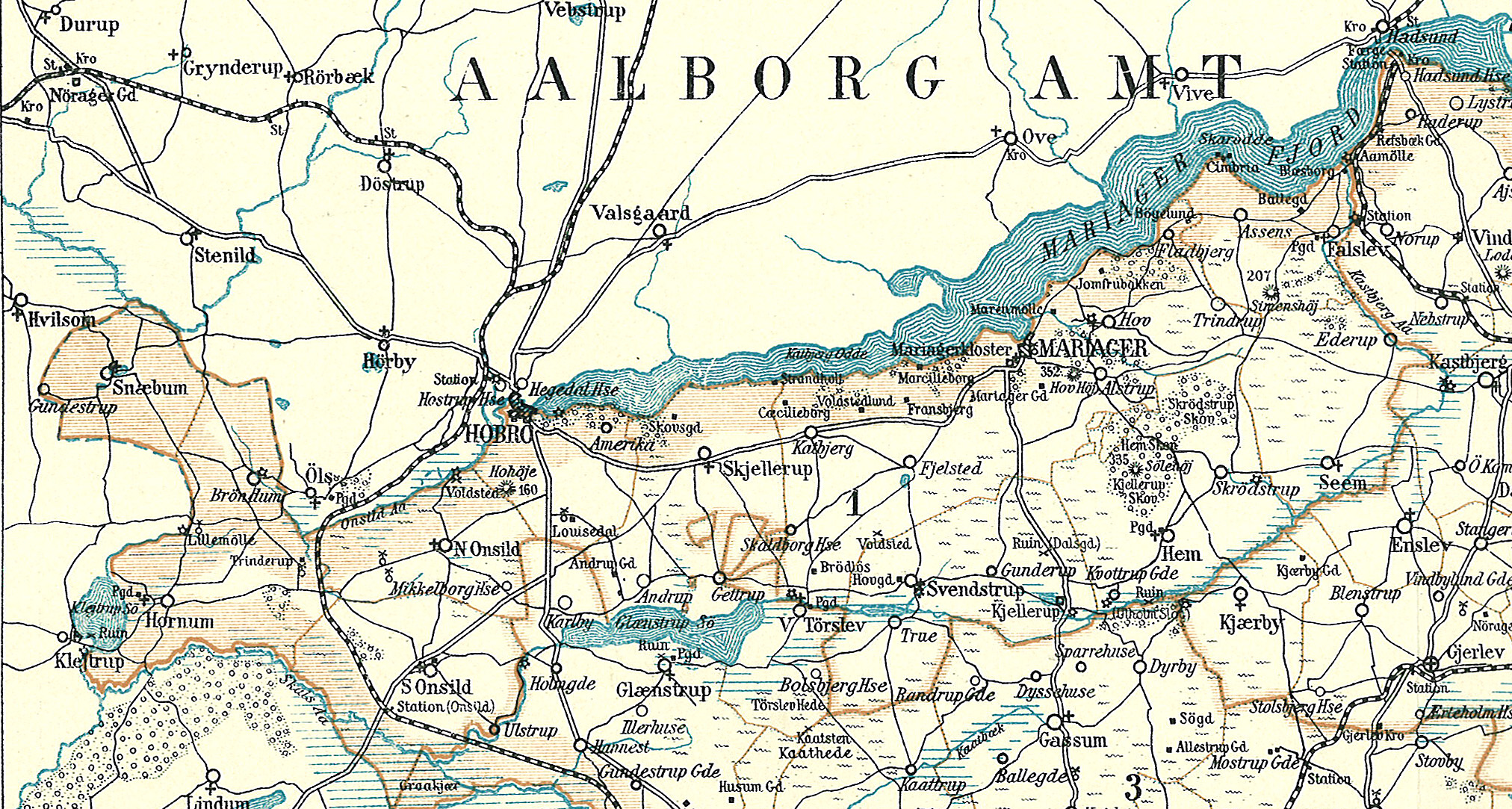
Dansk: Kort over Onsild Herred i den vestlige del af Randers Amt
English: Map of Onsild Herred in the western part of Randers County in Denmark |
||||
| Date | circa 1900 | ||||
| Source | Frems Amtskort over Danmark | ||||
| Author | Fotolitograferede i Generalstabens Topografiske Afdeling | ||||
| Permission (Reusing this file) |
|
||||
| Other versions | da:Onsild Herred | ||||
| This is a retouched picture, which means that it has been digitally altered from its original version. Modifications: Onsild Herred omkring 1900. The original can be viewed here: Randers Amt vest.jpg:
|
File history
Click on a date/time to view the file as it appeared at that time.
| Date/Time | Thumbnail | Dimensions | User | Comment | |
|---|---|---|---|---|---|
| current | 11:23, 1 February 2009 | | 2,024 × 1,083 (1.31 MB) | Cropbot (talk | contribs) | {{Information |Description=da:Kort over den vestlige del af Randers Amt<br/>en:Map of the western part of Randers County in Denmark |Source=''Frems Amtskort over Danmark'' |Date=ca. 1900 |Author= Fotolitograferede i Generalstabens Topografiske Afdeling |P |
You cannot overwrite this file.
File usage on Commons
There are no pages that use this file.
File usage on other wikis
The following other wikis use this file:
- Usage on da.wikipedia.org
- Usage on nl.wikipedia.org