File:-2021-06-24 Old railway bridge, Weavers’ Way, Aylsham, Norfolk (10).JPG
Jump to navigation
Jump to search

Size of this preview: 800 × 600 pixels. Other resolutions: 320 × 240 pixels | 640 × 480 pixels | 1,024 × 768 pixels | 1,280 × 960 pixels | 2,560 × 1,920 pixels | 5,152 × 3,864 pixels.
Original file (5,152 × 3,864 pixels, file size: 6.21 MB, MIME type: image/jpeg)
Captions
Captions
Add a one-line explanation of what this file represents
Summary
[edit]| Description |
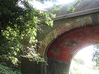
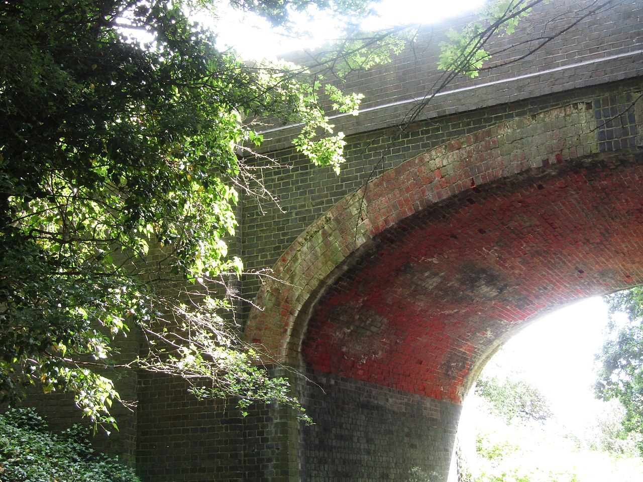
English: A bridge which carries the Cromer Road over the disused railway track bed which is now part of the weavers’ Way footpath in the parish of Aylsham, Norfolk, England. Weavers’ Way follows the dismantled railway line which was operated by the Midland and Great Northern Joint Railway line, linking the Midlands with the Norfolk Coast. Opened by the Eastern and Midlands Railway, it became the Midland and Great Northern Joint Railway, and was later converted to a joint operation of the London, Midland and Scottish Railway, with the London and North Eastern Railway taking sole operation in 1936. The line was closed in 1959. |
|
| Date |
Taken on 24 June 2021 Português: tirada a 24 de Junho de 2021 |
|
| Source | Own work | |
| Author |
This file is licensed under the Creative Commons Attribution-Share Alike 4.0 International license.
|

.JPG&action=edit§ion=1)
| Camera location | | View this and other nearby images on: OpenStreetMap |
|---|
.JPG¶ms=052.801873_N_0001.251092_E_globe:Earth_type:camera__&language=en)
| Object location | | View this and other nearby images on: OpenStreetMap |
|---|
.JPG¶ms=052.801885_N_0001.251218_E_globe:Earth_class:object_type:object__&language=en)

|
The copyright holder of this file, Kolforn (Wikimedia), allows anyone to use it for any purpose, provided that the copyright holder is properly attributed. Redistribution, derivative work, commercial use, and all other use is permitted. |
Attribution:
Kolforn (Wikimedia)
|
File history
Click on a date/time to view the file as it appeared at that time.
| Date/Time | Thumbnail | Dimensions | User | Comment | |
|---|---|---|---|---|---|
| current | 05:59, 26 June 2021 | | 5,152 × 3,864 (6.21 MB) | Kolforn (talk | contribs) | {{Information |Description= {{en|1=A bridge which carries the Cromer Road over the disused railway track bed which is now part of the weavers’ Way footpath in the parish of {{w|Aylsham}}, Norfolk, England. Weavers’ Way follows the dismantled railway line which was operated by the Midland and Great Northern Joint Railway line, linking the Midlands with the Norfolk Coast. Opened by the Eastern and Midlands Railway, it became the Midland and Great Northern Joint Railway, and was later converted... |
You cannot overwrite this file.
File usage on Commons
The following page uses this file:
.JPG&oldid=734543477)