File:-2021-04-14 Scoulton village sign, Norfolk.jpg
Jump to navigation
Jump to search
Size of this preview: 800 × 533 pixels. Other resolutions: 320 × 213 pixels | 640 × 427 pixels | 1,024 × 683 pixels | 1,280 × 853 pixels | 2,560 × 1,707 pixels | 4,608 × 3,072 pixels.
Original file (4,608 × 3,072 pixels, file size: 5.58 MB, MIME type: image/jpeg)
Captions
Captions
Add a one-line explanation of what this file represents
Summary
[edit]
| Description |
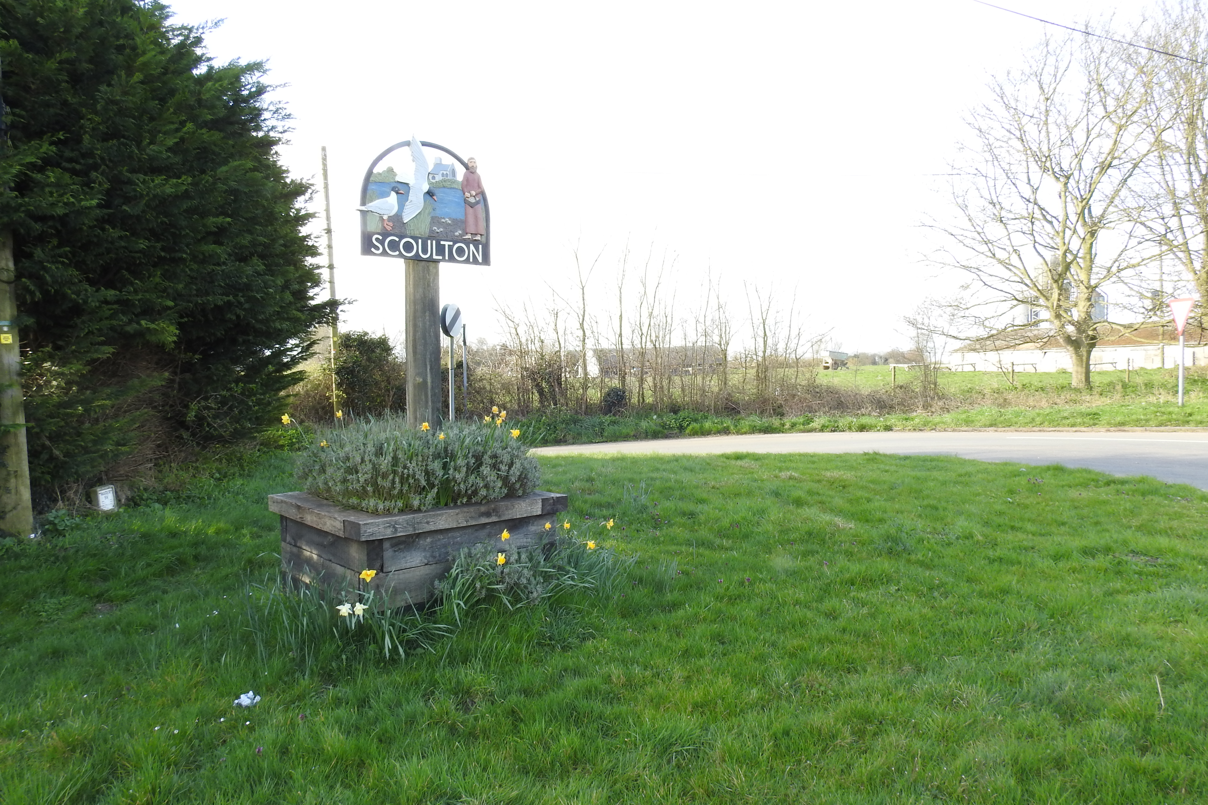
English: The Scoulton village sign is on the junction of Back lane with Norwich Road in the village of Scoulton, Norfolk, England. The sign features the church of The Holy Trinity with its octagonal top on a square tower. Scoulton mere, which was the product of extensive flint quarrying was a breeding ground of the great black-headed gull or Pallas's gull. During the Middle Ages large numbers of eggs were harvested and made into Scoulton Pie. The dish is now obsolete as the gulls moved to safer breeding grounds. This is what is depicted on the sign. |
| Date | Taken on 8 April 2021 |
| Source | From geograph.org.uk |
| Author | Adrian S Pye |
| Attribution (required by the license) | Adrian S Pye / Scoulton village sign / |
| Camera location | | View this and other nearby images on: OpenStreetMap |
|---|
| Object location | | View this and other nearby images on: OpenStreetMap |
|---|
Licensing
[edit]

|
This image was taken from the Geograph project collection. See this photograph's page on the Geograph website for the photographer's contact details. The copyright on this image is owned by Adrian S Pye and is licensed for reuse under the Creative Commons Attribution-ShareAlike 2.0 license.
|
This file is licensed under the Creative Commons Attribution-Share Alike 2.0 Generic license.
Attribution: Adrian S Pye
- You are free:
- to share – to copy, distribute and transmit the work
- to remix – to adapt the work
- Under the following conditions:
- attribution – You must give appropriate credit, provide a link to the license, and indicate if changes were made. You may do so in any reasonable manner, but not in any way that suggests the licensor endorses you or your use.
- share alike – If you remix, transform, or build upon the material, you must distribute your contributions under the same or compatible license as the original.
File history
Click on a date/time to view the file as it appeared at that time.
| Date/Time | Thumbnail | Dimensions | User | Comment | |
|---|---|---|---|---|---|
| current | 20:50, 4 July 2021 | | 4,608 × 3,072 (5.58 MB) | Geograph Update Bot (talk | contribs) | Higher-resolution version from Geograph. |
| 07:07, 18 April 2021 |  | 1,024 × 683 (259 KB) | Kolforn (talk | contribs) | {{Information |description={{en|1=The Scoulton village sign is on the junction of Back lane with Norwich Road in the village of {{w|Scoulton}}, Norfolk, England. The sign features the church of The Holy Trinity with its octagonal top on a square tower. Scoulton mere, which was the product of extensive flint quarrying was a breeding ground of the great black-headed gull or Pallas's gull. During the Middle Ages large numbers of eggs were harvested and made into Scoulton Pie. The dish is now obs... |
You cannot overwrite this file.
File usage on Commons
There are no pages that use this file.