File:-2021-02-17 Edwin Gardens, Bourne.jpg
From Wikimedia Commons, the free media repository
Jump to navigation
Jump to search
Size of this preview: 800 × 600 pixels. Other resolutions: 320 × 240 pixels | 640 × 480 pixels | 1,024 × 768 pixels | 1,280 × 960 pixels | 2,560 × 1,920 pixels | 4,032 × 3,024 pixels.
Original file (4,032 × 3,024 pixels, file size: 4.16 MB, MIME type: image/jpeg)
File information
Structured data
Captions
Summary
[edit]Description-2021-02-17 Edwin Gardens, Bourne.jpg |
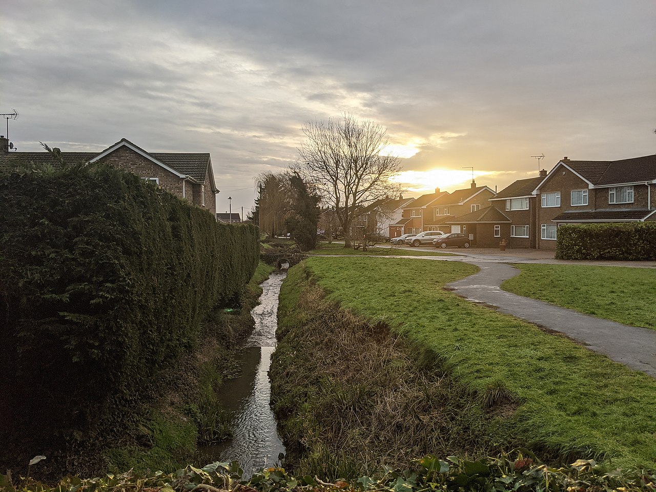
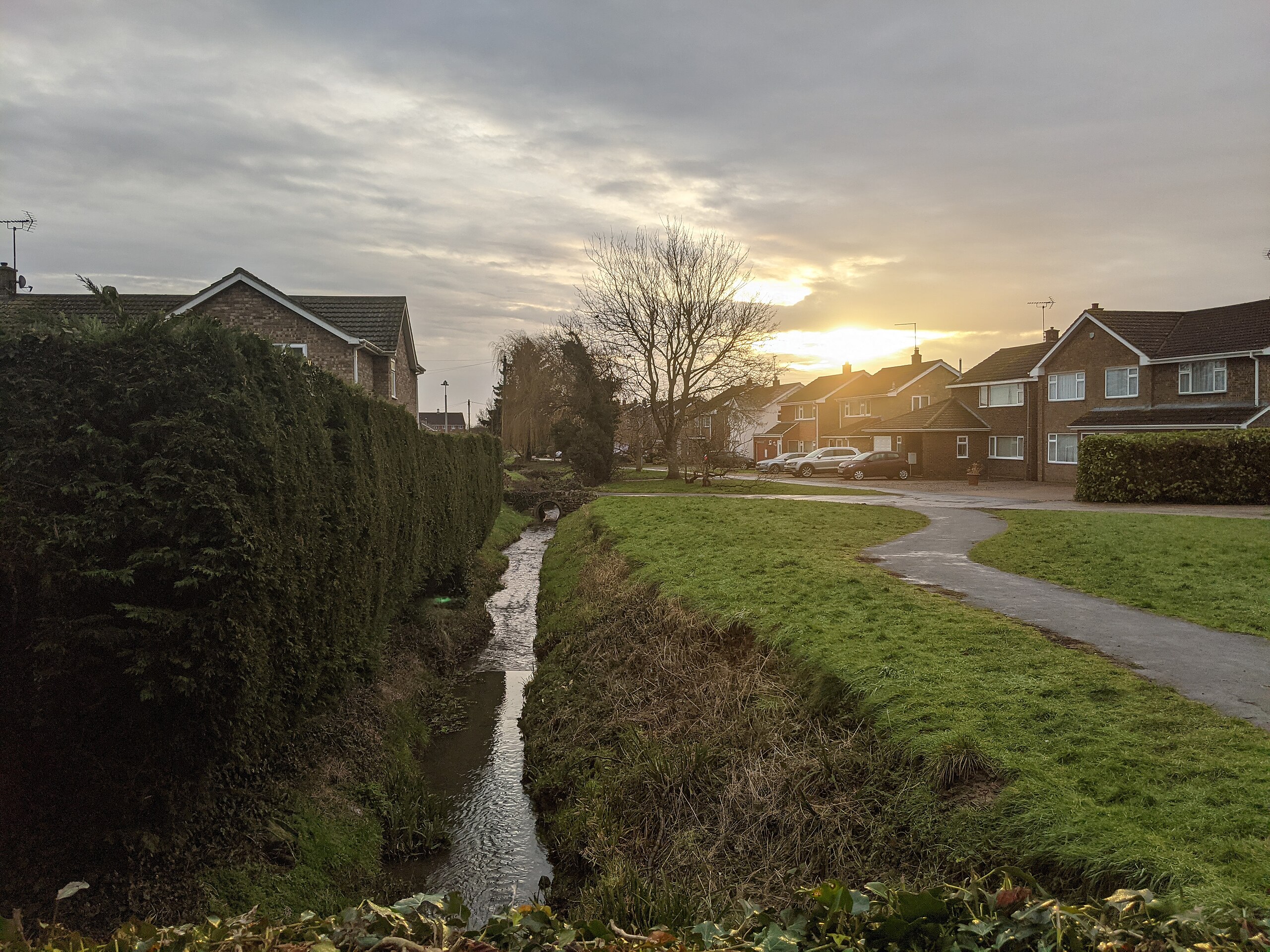
English: Looking west along Edwin Gardens in the town of Bourne, Lincolnshire, England. |
Source | From geograph.org.uk |
Author | Bob Harvey |
Attribution (required by the license) InfoField | Bob Harvey / A break in the clouds / |
InfoField | Bob Harvey / A break in the clouds |
Camera location | 52° 46′ 15.13″ N, 0° 23′ 22.91″ W | View this and other nearby images on: OpenStreetMap | 52.770870; -0.389698 |
---|
Object location | 52° 46′ 15.02″ N, 0° 23′ 17.12″ W | View this and other nearby images on: OpenStreetMap | 52.770840; -0.388089 |
---|
Licensing
[edit]This image was taken from the Geograph project collection. See this photograph's page on the Geograph website for the photographer's contact details. The copyright on this image is owned by Bob Harvey and is licensed for reuse under the Creative Commons Attribution-ShareAlike 2.0 license.
|
This file is licensed under the Creative Commons Attribution-Share Alike 2.0 Generic license.
Attribution: Bob Harvey
- You are free:
- to share – to copy, distribute and transmit the work
- to remix – to adapt the work
- Under the following conditions:
- attribution – You must give appropriate credit, provide a link to the license, and indicate if changes were made. You may do so in any reasonable manner, but not in any way that suggests the licensor endorses you or your use.
- share alike – If you remix, transform, or build upon the material, you must distribute your contributions under the same or compatible license as the original.
File history
Click on a date/time to view the file as it appeared at that time.
Date/Time | Thumbnail | Dimensions | User | Comment | |
---|---|---|---|---|---|
current | 20:00, 4 July 2021 | 4,032 × 3,024 (4.16 MB) | Geograph Update Bot (talk | contribs) | Higher-resolution version from Geograph. | |
14:17, 17 February 2021 | 1,024 × 768 (212 KB) | Kolforn (talk | contribs) | {{Information |description={{en|1=Looking west along Edwin Gardens in the town of {{w|Bourne, Lincolnshire}}, England.}} |Source=From [https://www.geograph.org.uk/photo/6755845 geograph.org.uk] |author=[https://www.geograph.org.uk/profile/8272 Bob Harvey] |permission= |other_versions= |other fields={{Credit line |Author =Bob Harvey |Other = ''A break in the clouds'' |License = CC-BY-SA-2.0 }}}} {{Location dec|52.770870|-0.389698}} {{Object location dec|52.770840|-0.388089}} == {{int:li... |
You cannot overwrite this file.
File usage on Commons
There are no pages that use this file.
Metadata
This file contains additional information such as Exif metadata which may have been added by the digital camera, scanner, or software program used to create or digitize it. If the file has been modified from its original state, some details such as the timestamp may not fully reflect those of the original file. The timestamp is only as accurate as the clock in the camera, and it may be completely wrong.
Camera manufacturer | |
---|---|
Camera model | Pixel 3 XL |
Exposure time | 2,727/1,000,000 sec (0.002727) |
F-number | f/1.8 |
ISO speed rating | 45 |
Date and time of data generation | 07:48, 17 February 2021 |
Lens focal length | 4.44 mm |
Latitude | 52° 46′ 1.87″ N |
Longitude | 0° 23′ 35.7″ W |
Altitude | 68.83 meters above sea level |
Width | 4,032 px |
Height | 3,024 px |
Orientation | Normal |
Horizontal resolution | 72 dpi |
Vertical resolution | 72 dpi |
Software used | HDR+ 1.0.352609463zd |
File change date and time | 07:48, 17 February 2021 |
Y and C positioning | Centered |
Exposure Program | Normal program |
Exif version | 2.31 |
Date and time of digitizing | 07:48, 17 February 2021 |
Meaning of each component |
|
APEX shutter speed | 8.52 |
APEX aperture | 1.7 |
APEX brightness | 6.37 |
APEX exposure bias | 0 |
Maximum land aperture | 1.7 APEX (f/1.8) |
Subject distance | 4,294,967,295 meters |
Metering mode | Center weighted average |
Flash | Flash did not fire, compulsory flash suppression |
DateTime subseconds | 134022 |
DateTimeOriginal subseconds | 134022 |
DateTimeDigitized subseconds | 134022 |
Supported Flashpix version | 1 |
Color space | sRGB |
Sensing method | One-chip color area sensor |
Scene type | A directly photographed image |
Custom image processing | Custom process |
Exposure mode | Auto exposure |
White balance | Auto white balance |
Digital zoom ratio | 0 |
Focal length in 35 mm film | 27 mm |
Scene capture type | Standard |
Contrast | Normal |
Saturation | Normal |
Sharpness | Normal |
Subject distance range | Distant view |
GPS time (atomic clock) | 07:40 |
Measurement precision | Poor (400) |
Reference for direction of image | Magnetic direction |
Direction of image | 12 |
GPS date | 17 February 2021 |
GPS tag version | 0.0.2.2 |
Structured data
Items portrayed in this file
depicts
52°46'15.132"N, 0°23'22.913"W
52°46'15.024"N, 0°23'17.120"W
0.002727 second
1.8
4.44 millimetre
image/jpeg
e08e15b23ec1c048507980d0e8d825027d36a812
4,363,734 byte
3,024 pixel
4,032 pixel
Hidden categories:
- Information field template with formatting
- Files with coordinates missing SDC location of creation (52° N, 1° W)
- CC-BY-SA-2.0
- Images from Geograph Britain and Ireland
- Images from Geograph Britain and Ireland missing SDC creator
- Images from Geograph Britain and Ireland missing SDC inception
- Images from Geograph Britain and Ireland missing SDC source of file
- United Kingdom photographs taken on 2021-02-17
- Lincolnshire images by Bob Harvey
- Taken with Fujifilm X-T30