File:(Map of the southern part of the city of Washington D.C.). LOC 88694106.jpg
Jump to navigation
Jump to search

Size of this preview: 757 × 600 pixels. Other resolutions: 303 × 240 pixels | 606 × 480 pixels | 970 × 768 pixels | 1,280 × 1,014 pixels | 2,560 × 2,027 pixels | 3,922 × 3,106 pixels.
Original file (3,922 × 3,106 pixels, file size: 1.41 MB, MIME type: image/jpeg)
Captions
Captions
Add a one-line explanation of what this file represents
Summary
[edit]| Description |
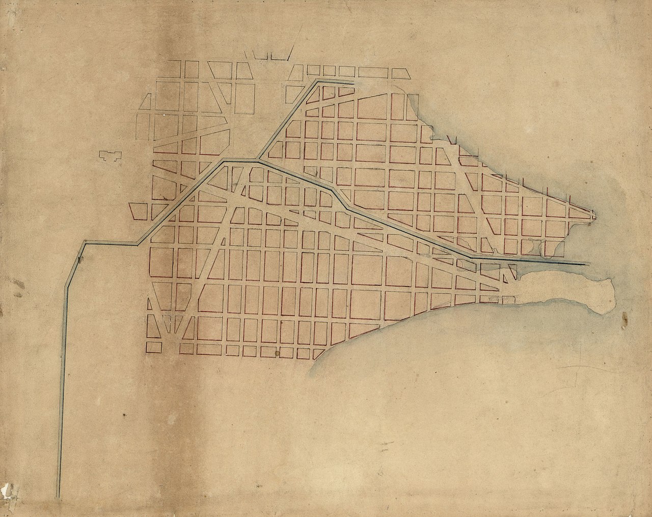
English: Covers area bounded by Anacostia River, Potomac River, S.W. 8th, S.W./S.E. B, and S.E. 3rd streets. Title devised by cataloger. Black, red, and blue inks, and red and blue washes. Soiled, edged in green cloth, and mounted on cloth backing. On cloth backing in lead pencil: From the files of the Society of Oldest Inhabitants. Deposited by Henry C. Gauss in 1920's (?). One of 12 maps. Available also through the Library of Congress Web site as a raster image. Vault DCP |
||
| Title | [Map of the southern part of the city of Washington D.C.]. | ||
| Shelf ID | G3850 18-- .M32 | ||
| Date | |||
| Source | https://www.loc.gov/item/88694106/ | ||
| Author | Gauss, Henry C.; Association Of The Oldest Inhabitants Of The District Of Columbia | ||
| Permission (Reusing this file) |
|
||
| Other versions |
|
||
| Location | United States · Washington D.C. · District Of Columbia · Washington | ||
| Part of | American Memory · Cities And Towns · Catalog · Geography And Map Division | ||
| Subject | Washington (D.C.) · Maps, Manuscript · Washington · United States · District Of Columbia · Manuscript Maps |


._LOC_88694106.jpg&action=edit§ion=1)
Licensing
[edit]._LOC_88694106.jpg&action=edit§ion=2)
|
This is a faithful photographic reproduction of a two-dimensional, public domain work of art. The work of art itself is in the public domain for the following reason:
The official position taken by the Wikimedia Foundation is that "faithful reproductions of two-dimensional public domain works of art are public domain".
This photographic reproduction is therefore also considered to be in the public domain in the United States. In other jurisdictions, re-use of this content may be restricted; see Reuse of PD-Art photographs for details. | ||||
File history
Click on a date/time to view the file as it appeared at that time.
| Date/Time | Thumbnail | Dimensions | User | Comment | |
|---|---|---|---|---|---|
| current | 01:30, 27 July 2018 | | 3,922 × 3,106 (1.41 MB) | Fæ (talk | contribs) | LOC Maps https://www.loc.gov/item/88694106/ #14681 |
You cannot overwrite this file.
File usage on Commons
The following page uses this file:
._LOC_88694106.jpg&oldid=920993228)