File:(Barb02.) Sa Talaia Freda.jpg
Jump to navigation
Jump to search

Size of this preview: 800 × 450 pixels. Other resolutions: 320 × 180 pixels | 640 × 360 pixels | 1,024 × 576 pixels | 1,280 × 720 pixels | 2,560 × 1,440 pixels | 4,128 × 2,322 pixels.
Original file (4,128 × 2,322 pixels, file size: 2.96 MB, MIME type: image/jpeg)
Captions
Captions
Add a one-line explanation of what this file represents
Summary
[edit]_Sa_Talaia_Freda.jpg&action=edit§ion=1)
| Description |
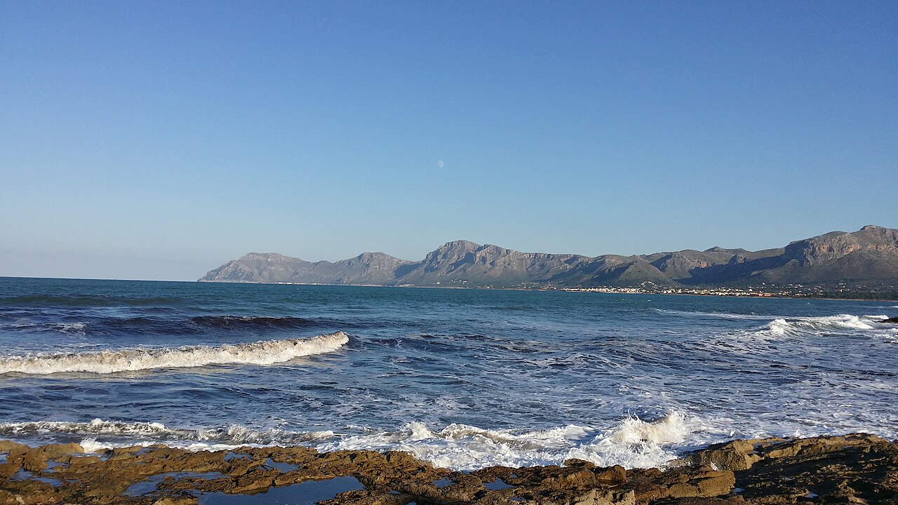
Deutsch: Sa Talaia Freda, Gemeinde Artà, Mallorca, Spanien.
Mit 561 Metern, höchster Berg des Serres de Llevant. Fotografiert aus von "es Corral des Marbres, Son Serra de Marina. Zu sehen sind von links nach rechts: Sa Talaia Morella, Puig de sa Tudossa (mit den Antennen), Sa Talaia Freda, Puig de sa Creu, Puig d'en Vermell, Puig de sa Murta (hinter Colònia de Sant Pere) sowie viele weitere Berge der "Serra Artana), Bergland von Arta. |
| Date | |
| Source | Own work |
| Author | Der Barbar |
| Camera location | | View this and other nearby images on: OpenStreetMap |
|---|
_Sa_Talaia_Freda.jpg¶ms=039.736389_N_0003.227222_E_globe:Earth_type:camera__&language=en)
Licensing
[edit]_Sa_Talaia_Freda.jpg&action=edit§ion=2)
I, the copyright holder of this work, hereby publish it under the following license:
This file is licensed under the Creative Commons Attribution-Share Alike 4.0 International license.
- You are free:
- to share – to copy, distribute and transmit the work
- to remix – to adapt the work
- Under the following conditions:
- attribution – You must give appropriate credit, provide a link to the license, and indicate if changes were made. You may do so in any reasonable manner, but not in any way that suggests the licensor endorses you or your use.
- share alike – If you remix, transform, or build upon the material, you must distribute your contributions under the same or compatible license as the original.
File history
Click on a date/time to view the file as it appeared at that time.
| Date/Time | Thumbnail | Dimensions | User | Comment | |
|---|---|---|---|---|---|
| current | 13:05, 15 February 2015 | | 4,128 × 2,322 (2.96 MB) | Der Barbar (talk | contribs) | User created page with UploadWizard |
You cannot overwrite this file.
File usage on Commons
There are no pages that use this file.
Metadata
_Sa_Talaia_Freda.jpg&oldid=896730786)
Categories:
- Sa Talaia Freda
- Remote views of Talaia Moreia
- Coasts of Artà
- Puig de sa Creu
- Puig d'en Vermell
- Sa Talaia Freda / Pictures by User:Der Barbar
- Sa Talaia Morella / Pictures by User:Der Barbar
- Puig de sa Tudossa / Pictures by User:Der Barbar
- Puig de sa Creu / Pictures by User:Der Barbar
- Puig d'en Vermell / Pictures by User:Der Barbar