File:현저동.jpg
From Wikimedia Commons, the free media repository
Jump to navigation
Jump to search
Size of this preview: 800 × 534 pixels. Other resolutions: 320 × 213 pixels | 640 × 427 pixels | 1,024 × 683 pixels | 1,280 × 854 pixels | 1,600 × 1,067 pixels.
Original file (1,600 × 1,067 pixels, file size: 943 KB, MIME type: image/jpeg)
File information
Structured data
Captions
Summary
[edit]Description현저동.jpg |
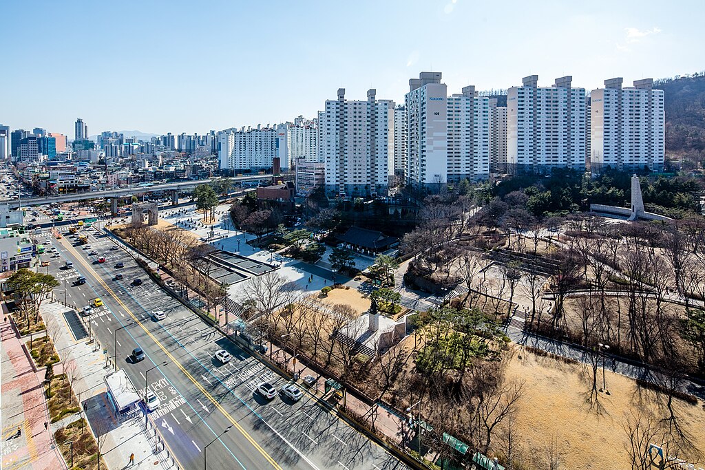
한국어: 서대문구 현저동의 모습으로, 독립문 극동아파트와 독립근린공원, 독립문이 나타나 있다. |
Date | |
Source | 서울연구원 사진으로 본 서울 > 서울 2019/2020 도시형태와 경관, 서울특별시 |
Author | 서울연구원 |
Camera location | 37° 34′ 27.38″ N, 126° 57′ 30.83″ E | View this and other nearby images on: OpenStreetMap | 37.574273; 126.958565 |
---|
Licensing
[edit]This file is licensed under the Creative Commons Attribution-Share Alike 4.0 International license.
Attribution: 서울연구원
- You are free:
- to share – to copy, distribute and transmit the work
- to remix – to adapt the work
- Under the following conditions:
- attribution – You must give appropriate credit, provide a link to the license, and indicate if changes were made. You may do so in any reasonable manner, but not in any way that suggests the licensor endorses you or your use.
- share alike – If you remix, transform, or build upon the material, you must distribute your contributions under the same or compatible license as the original.
File history
Click on a date/time to view the file as it appeared at that time.
Date/Time | Thumbnail | Dimensions | User | Comment | |
---|---|---|---|---|---|
current | 13:24, 14 November 2023 | 1,600 × 1,067 (943 KB) | SCMBD (talk | contribs) | Uploaded a work by 서울연구원 from [https://data.si.re.kr/node/60347 서울연구원 사진으로 본 서울] with UploadWizard |
You cannot overwrite this file.
File usage on Commons
There are no pages that use this file.
File usage on other wikis
The following other wikis use this file:
- Usage on ko.wikipedia.org
- Usage on www.wikidata.org
Metadata
This file contains additional information such as Exif metadata which may have been added by the digital camera, scanner, or software program used to create or digitize it. If the file has been modified from its original state, some details such as the timestamp may not fully reflect those of the original file. The timestamp is only as accurate as the clock in the camera, and it may be completely wrong.
Camera manufacturer | Canon |
---|---|
Camera model | Canon EOS 5DS R |
Author | chaisoook.chaicom_01052173514 |
Exposure time | 1/80 sec (0.0125) |
F-number | f/11 |
ISO speed rating | 100 |
Date and time of data generation | 15:54, 11 March 2020 |
Lens focal length | 17 mm |
Latitude | 37° 34′ 27.38″ N |
Longitude | 126° 57′ 30.83″ E |
Altitude | 101.8 meters above sea level |
URL for copyright license | https://creativecommons.org/licenses/by/2.0/kr/ |
JPEG file comment | 2020 ¼¿ï°æ°ü±â·ÏÈ»ç¾÷, The Project of Documenting the Landscape of Seoul |
Horizontal resolution | 300 dpi |
Vertical resolution | 300 dpi |
Software used | Adobe Photoshop Lightroom 6.8 (Windows) |
File change date and time | 20:17, 12 March 2020 |
Exposure Program | Manual |
Exif version | 2.3 |
Date and time of digitizing | 15:54, 11 March 2020 |
APEX shutter speed | 6.321928 |
APEX aperture | 6.918863 |
APEX exposure bias | 0 |
Maximum land aperture | 4 APEX (f/4) |
Metering mode | Center weighted average |
Flash | Flash did not fire |
DateTimeOriginal subseconds | 88 |
DateTimeDigitized subseconds | 88 |
Color space | sRGB |
Focal plane X resolution | 2,413.3333435059 |
Focal plane Y resolution | 2,413.3333435059 |
Focal plane resolution unit | 3 |
Custom image processing | Normal process |
Exposure mode | Manual exposure |
White balance | Auto white balance |
Scene capture type | Standard |
GPS time (atomic clock) | 05:54:17.779 |
Satellites used for measurement | 10 |
Receiver status | Measurement in progress |
Measurement mode | 2-dimensional measurement |
Measurement precision | Moderate (0.9) |
Reference for direction of image | Magnetic direction |
Direction of image | 234 |
Geodetic survey data used | WGS-84 |
GPS date | 11 March 2020 |
GPS tag version | 0.0.3.2 |
IIM version | 4 |
Keywords | Seoul 2019/2020 Urban Form and Landscape, http://data.si.re.kr |
Lens used | TS-E17mm f/4L |
Serial number of camera | 078022002669 |
Date metadata was last modified | 05:17, 13 March 2020 |
Unique ID of original document | 95F2F5DA32CD2480AFBFBE46BBCFA247 |