File:진섭산 안내판.jpg
Jump to navigation
Jump to search

Size of this preview: 800 × 600 pixels. Other resolutions: 320 × 240 pixels | 640 × 480 pixels | 1,024 × 768 pixels | 1,280 × 960 pixels | 2,560 × 1,920 pixels | 4,624 × 3,468 pixels.
Original file (4,624 × 3,468 pixels, file size: 6.27 MB, MIME type: image/jpeg)
Captions
Captions
Add a one-line explanation of what this file represents
Summary
[edit]
| Description |
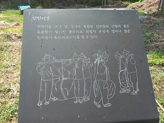
한국어: 진섭산은 일명 신털이봉 안내판에는 "의림지를 조성할 당시에 동원된 인부들의 신발에 묻은 흙을 털어 쌓아진 봉우리로 의림지 조성에 얼마나 많은 인부들이 동원되었는지를 알 수 있다."라고 쓰였다. |
| Date | |
| Source | Own work |
| Author | 류금열 |
| Camera location | | View this and other nearby images on: OpenStreetMap |
|---|
Licensing
[edit]
I, the copyright holder of this work, hereby publish it under the following license:
| This file is made available under the Creative Commons CC0 1.0 Universal Public Domain Dedication. | |
| The person who associated a work with this deed has dedicated the work to the public domain by waiving all of their rights to the work worldwide under copyright law, including all related and neighboring rights, to the extent allowed by law. You can copy, modify, distribute and perform the work, even for commercial purposes, all without asking permission.
|
File history
Click on a date/time to view the file as it appeared at that time.
| Date/Time | Thumbnail | Dimensions | User | Comment | |
|---|---|---|---|---|---|
| current | 04:39, 6 December 2023 | | 4,624 × 3,468 (6.27 MB) | 류금열 (talk | contribs) | Uploaded own work with UploadWizard |
You cannot overwrite this file.
File usage on Commons
There are no pages that use this file.
File usage on other wikis
The following other wikis use this file:
- Usage on ko.wikipedia.org