File:자수궁 터.jpg
Jump to navigation
Jump to search

Size of this preview: 692 × 600 pixels. Other resolutions: 277 × 240 pixels | 554 × 480 pixels | 886 × 768 pixels | 1,182 × 1,024 pixels | 2,364 × 2,048 pixels | 2,614 × 2,265 pixels.
Original file (2,614 × 2,265 pixels, file size: 1.37 MB, MIME type: image/jpeg)
Captions
Captions
Add a one-line explanation of what this file represents
Summary
[edit]
| Description |
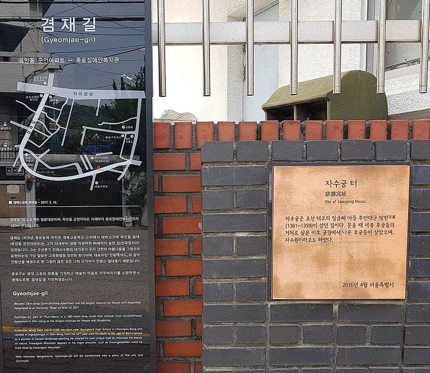
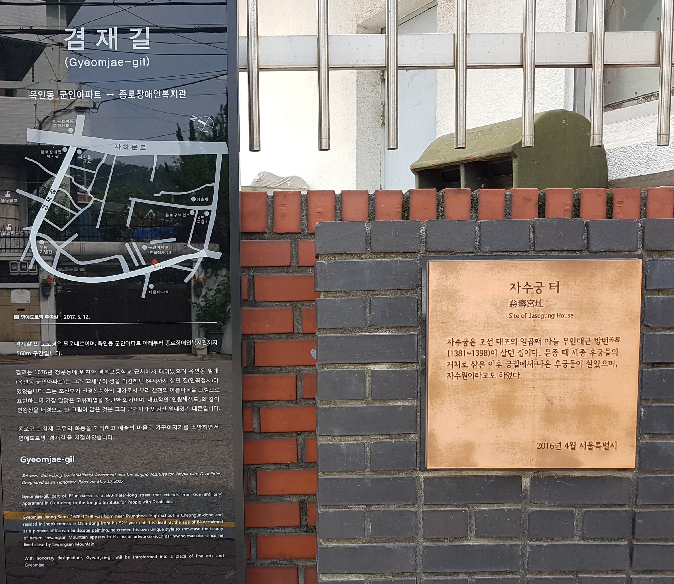
한국어: 자수궁(慈壽宮)터 부근에 소세양의 청심당(淸心堂·風泉閣·水雲軒)터가 있었는데, 신교(新橋),자수교(慈壽橋)중간쯤 인왕동을 건너면 있었다고 한다. |
| Date | |
| Source | Own work |
| Author | Osidaj |
| Camera location | | View this and other nearby images on: OpenStreetMap |
|---|
Licensing
[edit]
I, the copyright holder of this work, hereby publish it under the following license:
This file is licensed under the Creative Commons Attribution-Share Alike 4.0 International license.
- You are free:
- to share – to copy, distribute and transmit the work
- to remix – to adapt the work
- Under the following conditions:
- attribution – You must give appropriate credit, provide a link to the license, and indicate if changes were made. You may do so in any reasonable manner, but not in any way that suggests the licensor endorses you or your use.
- share alike – If you remix, transform, or build upon the material, you must distribute your contributions under the same or compatible license as the original.
File history
Click on a date/time to view the file as it appeared at that time.
| Date/Time | Thumbnail | Dimensions | User | Comment | |
|---|---|---|---|---|---|
| current | 08:10, 29 July 2018 | | 2,614 × 2,265 (1.37 MB) | Osidaj (talk | contribs) | User created page with UploadWizard |
You cannot overwrite this file.
File usage on Commons
There are no pages that use this file.
File usage on other wikis
The following other wikis use this file:
- Usage on ko.wikipedia.org